Longwood Medical and Academic Area


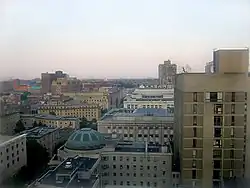
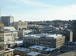
The Longwood Medical and Academic Area (also known as Longwood Medical Area, LMA, or simply Longwood) is a medical campus in Boston, Massachusetts. Flanking Longwood Avenue, LMA is adjacent to the Fenway–Kenmore, Audubon Circle, and Mission Hill neighborhoods, as well as the town of Brookline.[1]
It is most strongly associated with Harvard Medical School, the Harvard T.H. Chan School of Public Health, the Harvard School of Dental Medicine, and other medical facilities such as Harvard's teaching hospitals, but prominent non-Harvard institutions are located there as well. Long known as a global center of research, institutions in the Longwood Medical Area secured over $1.2 billion in NIH funds alone, in FY 2018 which exceeds funding received by 44 states.
Hospitals and research institutions
- Beth Israel Deaconess Medical Center
- Boston Children's Hospital
- Brigham and Women's Hospital
- Dana–Farber Cancer Institute
- Joslin Diabetes Center
- Massachusetts Mental Health Center
- New England Baptist Hospital
- Wyss Institute for Biologically Inspired Engineering
Schools and colleges
- Boston Latin School
- Emmanuel College
- Harvard Medical School
- Harvard School of Dental Medicine
- Harvard T.H. Chan School of Public Health
- Massachusetts College of Art and Design
- Massachusetts College of Pharmacy and Health Sciences
- Simmons University
- Wentworth Institute of Technology
- Boston University Wheelock College of Education & Human Development
- Winsor School
Transportation
LMA is served by two subway stations at opposite ends of Longwood Avenue: "Longwood" (on the MBTA Green Line's "D" branch) and "Longwood Medical Area" (on the "E" branch). Several public bus routes serve the area and commuter rail service is available at nearby Ruggles Station. MASCO offers shuttle buses (generally for affiliated personnel only) around the Longwood Medical Area and between Harvard's Cambridge Campus and the Medical Campus (M2). The M2 shuttle is free for passengers holding a Harvard ID.
Energy
LMA receives electrical power, cooling, and heating from a trigeneration (CCHP) facility, the Medical Area Total Energy Plant (MATEP).[2][3]
References
- ↑ "Longwood Medical and Academic Area (LMA) Fact Sheet" (PDF). MASCO Area Planning and Development. December 2012. Retrieved 1 December 2014.
- ↑ Veolia (18 November 2014). "Medical Area Total Energy Plant (MATEP)". Veolia North America. Retrieved 19 April 2018.
- ↑ "Harvard's Unknown Medical Power Plant - News - The Harvard Crimson". www.thecrimson.com. Retrieved 19 April 2018.
External links
| Wikimedia Commons has media related to Longwood Medical Area. |
- Medical Academic and Scientific Community Organization
- The Diaries of John Hull, Mint-master and Treasurer of the Colony of Massachusetts Bay
Coordinates: 42°20′18″N 71°06′22″W / 42.3382°N 71.1060°W
