Çamalan
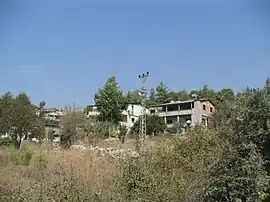
Çamalan is a neighbourhood in the municipality and district of Tarsus, Mersin Province, Turkey.[1] Its population is 266 (2022).[2] It is in the Taurus Mountains and to the west of Turkish state highway D.400. The village is inhabited by Tahtacı.[3]
Çamalan | |
|---|---|
 | |
 Çamalan Location in Turkey | |
| Coordinates: 37°12′00″N 34°48′19″E | |
| Country | Turkey |
| Province | Mersin |
| District | Tarsus |
| Elevation | 750 m (2,460 ft) |
| Population (2022) | 266 |
| Time zone | TRT (UTC+3) |
| Area code | 0324 |
There is a German cemetery from World War I in the village, which is 40 kilometres (25 mi) to Tarsus and 67 kilometres (42 mi) to Mersin. The village was founded in the 16th century by Turkmens of the Alevi sect. They escaped from the harsh treatment of the Ottoman sultan Selim I to the forests of the mountainous area for concealment. Their main economic activity was forestry, and they were called tahtacı ("woodman"). Nowadays, however, the majority of the village population is retired people from the cities in the Çukurova plains (Cilicia of the antiquity).
References
- Mahalle, Turkey Civil Administration Departments Inventory. Retrieved 12 July 2023.
- "Address-based population registration system (ADNKS) results dated 31 December 2022, Favorite Reports" (XLS). TÜİK. Retrieved 12 July 2023.
- Çıblak Coşkun, Nilgün (2013). "Tahtacılar ve Tahtacı Ocaklarına Bağlı Oymakların Yerleşim Alanları". Türk Kültürü ve Hacı Bektaş Veli Araştırma Dergisi (in Turkish) (68): 34–54. Retrieved 22 September 2023.