1990 Manjil–Rudbar earthquake
The 1990 Manjil–Rudbar earthquake occurred on Thursday, June 21, 1990 at 00:30:14 local time in the Caspian Sea region of northern Iran. The shock had a moment magnitude of 7.4 and a Mercalli Intensity of X (Extreme).
_-_1990_Manjil_Roudbar_Earthquake.jpg.webp) Collapsed unreinforced masonry buildings | |
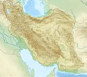 Tehran | |
| UTC time | 1990-06-20 21:00:14 |
|---|---|
| ISC event | 366754 |
| USGS-ANSS | ComCat |
| Local date | June 21, 1990 |
| Local time | 00:30:14 IRST |
| Magnitude | 7.4 Mw [1] |
| Depth | 15 km (9 mi) [1] |
| Epicenter | 37.07°N 49.28°E [1] |
| Type | Strike-slip[2] |
| Areas affected | Iran |
| Total damage | $8 billion [3] |
| Max. intensity | X (Extreme) [4] |
| Casualties | 35,000–45,000 killed [3] 60,000–105,000 injured [3] 105,000–400,000 displaced [3] |
Geology
Iran is one of the most seismically active regions in the world. In northwestern Iran, the Arabian and Eurasian plates are converging in a northeasterly direction, resulting in infrequent strike-slip earthquakes. The dominant style of faulting in the Albortz Mountains are reverse. The focal mechanism of the earthquake indicate that the event corresponded with right-lateral strike-slip faulting with an epicenter in Gilan province.[5]
On 22 July 1983, a Mw 5.5 earthquake struck Mazandaran province, killing 30 people. That earthquake although situated just southwest of the 1990 earthquake's epicenter, is unlikely a foreshock to the 1990 event. The coulomb stress transfer from the 1983 source fault to the 1990 earthquake source fault was insufficient. Stress modelling showed the 1983 earthquake had decreased crustal stress in the epicenter area of the 1990 earthquake rather than increasing it.[6]
Damage and casualties

Widespread damage occurred to the northwest of the capital city of Tehran, including the cities of Rudbar and Manjil. The total area of devastation was measured to be 20,000 square kilometers.[7] The National Geophysical Data Center estimated that $8 billion in damage occurred in the affected area. Other earthquake catalogs presented estimates of the loss of life in the range of 35,000–50,000, with a further 60,000–105,000 that were injured and 400,000 homeless. The earthquake struck 30 minutes after midnight when most people were sleeping in their uncomplicated mud homes, a major factor contributing to the large death toll.
The morning after the mainshock, a 6.5 magnitude aftershock hit the city of Rasht, causing a dam to break and creating a large flood and landslide, flooding and wiping out huge swaths of farmland. Other landslides also made many roads unusable, with one landslide next to Rudbar moving up to 20 million cubic meters of land.[8] There were at least 223 landslides recorded within a 11.3 km2 (4.4 sq mi) area with a total volume of 380 million cubic meters.[9] The earthquake was one of the strongest recorded in the densely populated region of the Alborz mountains.[10]
Damage was extreme in the cities of Manjil, and Rudbar; Khalkhal and Nowshahr also recorded significant damage. In Tehran, the damage was slight.[11] Soil liquefaction also caused extensive damage in an area of about 80 kilometers to the northeast of the earthquake's epicenter, ruining irrigation canals, pipelines, and splitting pavements apart. Water wells were also filled with boiled sand.[12]In some of the smaller, hard-to-reach towns in the Alborz mountains, there were no survivors and no house was left standing.[13]
Most all of the buildings destroyed were unreinforced masonry buildings, or UMBs, buildings made out of unsupported brick, cinderblock or other masonry elements which will collapse during strong earthquakes like the Iran earthquake.[14]
Tsunami
The earthquake was accompanied by a small, localized tsunami in the Caspian Sea. The waves were reported to reach 2 meters (6.5 ft) and inundated up to 1 kilometer (0.6 miles) inland. Presumably, an underwater landslide contributed to the notable tsunami, taking place on the steep shores of the continental shelf in the area. Although there were no reported casualties or severe damage in the wake of the tsunami, it reaffirmed the existence of a tsunami in the Caspian Sea and suggested that an underwater landslide that could be caused by an earthquake near the area could cause a life-threatening and potent tsunami.[15]
Aftermath and relief efforts
The earthquake took place as Iran was recovering from the Iran-Iraq war that ended just two years prior. Due to anti-American sentiment in Iran at the time, with the earthquake taking place just 10 years after the Iranian Revolution, Iranians initially did not want to accept help from the United States and other western countries, but they were not in a position to launch an extensive relief effort on their own.[16] The Iranian government and the governments that responded to the earthquake issued over 2,900 tents for the unhoused and camps for hundreds of thousands of people affected by the disaster. 170,000 blankets were also sent in to protect Iranians from the cold. [17][18]
An unusual outbreak of acute renal failure (ARF) occurred in the aftermath of the earthquake, with the number of victims demanding dialysis support rising to 156, with a mortality rate of 14 percent. Patients with ARF were more severely injured and usually had nerve damage, elevated muscle enzymes, and abnormal urinalysis.[19]
Use in media
Acclaimed Iranian director Abbas Kiarostami has fictionally incorporated the earthquake and its effects on northern Iran into multiple films of his. In And Life Goes On (1992), a director and his son search for child actors from a previous Kiarostami film; Where Is the Friend's Home? (1986), which was shot in a city that, by the time of the second film's production, is recovering from the earthquake. Kiarostami's next film Through the Olive Trees (1994) follows a film crew as they shoot scenes from Life, and Nothing More...; in one of these scenes a man discusses his marriage having taken place a day after the earthquake. Critics and scholars often refer to these three films as the Koker trilogy, and rank them among the director's finest works.[20]
References
- ISC (19 January 2015), ISC-GEM Global Instrumental Earthquake Catalogue (1900–2009), Version 2.0, International Seismological Centre
- Berberian et al. 1992, pp. 1752, 1753
- USGS (4 September 2009), PAGER-CAT Earthquake Catalog, Version 2008_06.1, United States Geological Survey
- Berberian et al. 1992, p. 1731
- Gao, Liping; Wallace, Terry C. (1995). "The 1990 Rudbar‐Tarom Iranian earthquake sequence: Evidence for slip partitioning". Journal of Geophysical Research: Solid Earth. 100 (B8): 15317–15332. doi:10.1029/95jb00320.
- Sarkarinejad, Khalil; Ansari, Shoja (2015). "Did the 1983 Charazeh earthquake trigger the destructive 1990 Rudbar earthquake?". International Journal of Earth Sciences. 104: 309–319. doi:10.1007/s00531-014-1072-z.
- This day. 1990 earthquake devastates Iranhistory.com Archived 1 June 2023 at the Wayback Machine
- "Earthquake devastates Iran | June 21, 1990". HISTORY. Retrieved 30 September 2023.
- Vanani, Ali Asghar Ghaedi; Shoaei, Gholamreza; Zare, Mehdi (2021). "Statistical analyses of landslide size and spatial distribution triggered by 1990 Rudbar-Manjil (Mw 7.3) earthquake, northern Iran: revised inventory, and controlling factors". Bulletin of Engineering Geology and the Environment. 80: 3381–3403. doi:10.1007/s10064-021-02106-8.
- Berberian, Manuel; Walker, Richard (2010). "The Rudbār Mw 7.3 earthquake of 1990 June 20; seismotectonics, coseismic and geomorphic displacements, and historic earthquakes of the western 'High-Alborz', Iran". Geophysical Journal International. 182 (3): 1577–1602. doi:10.1111/j.1365-246x.2010.04705.x.
- "Today in Earthquake History". earthquake.usgs.gov. Retrieved 30 September 2023.
- Nateghi, F. (20 June 1990). "June 20, 1990 Earthquake of Northern Iran: An Overview". Scholars' Mine. Retrieved 30 September 2023.
- https://historycollection.com/today-history-earthquake-killed-thousands-iran-1990/%7CThis Day In History; An Earthquake Killed Thousands In Iran (1990)
- https://www.buffalo.edu/mceer/catalog.host.html/content/shared/www/mceer/publications/NCEER-90-0017.detail.html%7CReconnaissance Report on the Northern Iran Earthquake of June 21, 1990
- https://academic.oup.com/gji/article/201/2/621/573760?login=false%7CField survey and modelling of the Caspian Sea tsunami of 1990 June 20
- "Earthquake shakes Iran's view of its enemies". The Washington Post. 2 July 1990. Archived from the original on 11 March 2023. Retrieved 30 September 2023.
- https://historycollection.com/today-history-earthquake-killed-thousands-iran-1990/
- UN Department of Humanitarian Affairs (21 June 1990). Medical supplies and equipment sent to Iranian earthquake survivors (Report). ReliefWeb. Retrieved 1 October 2023.
- Atef, M. R.; Nadjatfi, I.; Boroumand, B.; Rastegar, A. (1994). "Acute renal failure in earthquake victims in Iran: epidemiology and management". Quarterly Journal of Medicine. 87 (1): 35-40.
- http://www.sensesofcinema.com/2003/abbas-kiarostami/kiarostami_rural_space_and_place/%7CDays in the Country: Representations of Rural Space and Place in Abbas Kiarostami’s Life and Nothing More, Through the Olive Trees and The Wind Will Carry Us
Sources
- Berberian, M.; Qorashi, M.; Jackson, J. A.; Priestley, K.; Wallace, T. (1992), "The Rudbar-Tarom earthquake of 20 June 1990 in NW Persia: Preliminary field and seismological observations, and its tectonic significance", Bulletin of the Seismological Society of America, 82 (4): 1726–1755
Further reading
- Berberian, M.; Walker, R. (2010), "The Rudbar Mw 7.3 earthquake of 1990 June 20; seismotectonics, coseismic and geomorphic displacements, and historic earthquakes of the western 'High-Alborz', Iran" (PDF), Geophysical Journal International, 182 (3): 1577–1602, Bibcode:2010GeoJI.182.1577B, doi:10.1111/j.1365-246x.2010.04705.x
- Redmond, A. D.; Watson, S.; Nightingale, P. (1991), "The South Manchester Accident Rescue Team and the Earthquake in Iran, June 1990", BMJ: British Medical Journal, 302 (6791): 1521–1523, doi:10.1136/bmj.302.6791.1521, JSTOR 29712007, PMC 1670205, PMID 1855026
External links
- 7.4 - northern Iran – United States Geological Survey
- The International Seismological Centre has a bibliography and/or authoritative data for this event.