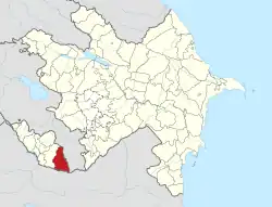
Ağrı, Azerbaijan
Ağrı (also, Aghry) is a village in the Ordubad District of Nakhchivan, Azerbaijan. It is part of the municipality of the Vənənd village. The village is located in the right side of the Ordubad-Unus highway, 15 km away from the district center, on the left banks of the Venendchay river. Its population mainly is busy with gardening, vegetable-growing, silkworm breeding and animal husbandry. There are secondary school, club and a medical center in the village. It has a population of 291.[1]
Ağrı | |
|---|---|
Municipality | |
 Ağrı | |
| Coordinates: 38°55′N 45°56′E | |
| Country | |
| Autonomous republic | Nakhchivan |
| District | Ordubad |
| Population (2005) | |
| • Total | 291 |
| Time zone | UTC+4 (AZT) |
Etymology
The village took its name from the Ağrıdağ (Aghrydagh) Mount located in the east of the Turkey. In the Turkic languages the word of ağrı / ağru means "high, height".[2]
References
This article is issued from Wikipedia. The text is licensed under Creative Commons - Attribution - Sharealike. Additional terms may apply for the media files.
