Roads in Jamaica
The roads in Jamaica allow people and goods to traverse the island of Jamaica, which is the third largest in the Caribbean. As of 2011, Jamaica has road network 22,121 kilometres in length.[1]
Road network
According to the National Works Agency, in 2007 Jamaica had 844 km of arterial roads, 717 km of secondary roads, 3225 km of tertiary roads, 282 km of urban roads, and 10326 km of parochial roads.[2] Using data from 2011, the CIA World Factbook claimed Jamaica has a total road network of 22121 km, 5973 km of which was unpaved and 16148 km of which was paved.[1]
Governing legislation
Various pieces of legislation govern the construction, maintenance, classification, and operation of roads in Jamaica. They include the Road Traffic Act, the Toll Road Act, the Parochial Roads Act, and the Main Roads Act. Government agencies with various responsibilities relating to roads in Jamaica include the Island Traffic Authority, the Toll Authority of Jamaica, and the National Works Agency.[3][4]

Motorways
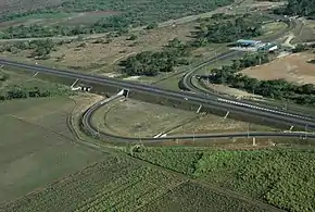
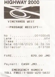
Starting in the late 1990s the Jamaican Government (in cooperation with private investors) embarked on the Highway 2000 project to create a system of motorways, the first such access-controlled roads of their kind on the island. The project seeks ultimately to link the two main cities (Kingston and Montego Bay) and the north coast. It is being undertaken as a series of phases:[5]
- Phase 1a was the 33-kilometre (21 mi) Kingston-Bushy Park Highway (in actuality, from the Mandela Highway at Caymanas Park to Sandy Bay) which was completed in 2003, and the upgrade of the Portmore Causeway, completed June 2006.
- Phase 1B Sandy Bay to Four Paths which was completed on 15 August 2012 and opened as the T1 Toll Road. There is an exit for traffic to/from the A1 Spanish Town Bypass between 9.7 km (6 mi) and 11.2 km (7 mi) from the eastern end of the T1, then to Old Harbour at 26.5 km (16.5 mi), to Freetown at 30.9 km (19.2 mi), to Sandy Bay at 42.3 km (26.3 mi), and concludes at a junction with the A2 at 45 km (28 mi), about 400 m (440 yd) east of the junction with Glenmuir Rd providing access to May Pen. Work on the section from Four Paths to Williamsfield was completed in September 2023. This phase will be a total of 37.7 km (23.4 mi) when completed.
- Phase 2a Caymanas Park-Ocho Rios. The section from Linstead By-Pass to Moneague opened as the T3 on 5 August 2014, 19.1 km (11.9 mi). The link to the A1 Moneague to Mount Diablo Road at 16.5 km (10.3 mi) from Linstead remains closed at this time. This exit allows northbound traffic to exit to the A1 and southbound traffic to join the T3.
- Phase 2b Mandeville-Montego Bay. General Alignment in progress
On 2009-09-15 Jamaica's prime minister, Bruce Golding, announced to Parliament that Highway 2000 was to be renamed in honour of Usain Bolt.[6] Those intentions were sidelined following a news paper article claiming Bolt had rejected the proposal.

Northern Coastal Highway
1998, the Government of Jamaica and the European Commission signed the financing agreement for the third segment of the Northern Coastal Highway Improvement Project in the amount of €80 million. The Project involves the reconstruction and re-habilitation of approximately 96 km (60 mi) of road between Ocho Rios; St. Ann; and Port Antonio, Portland. Total cost of the project is €105.0 million with the GOJ contributing €25 million for land acquisition and re-settlement as well as the construction of three bridges along the segment.
The entire project consists of approximately 287 km (178 mi) of roadway and is divided into three segments. · Segment 1 – Negril to Montego Bay (approx. 71 km [44 mi]) · Segment 2 – Montego Bay to Ocho Rios (approx. 97 km [60 mi]) · Segment 3 – Ocho Rios to Fair Prospect (approx. 119 km [74 mi]) [7]
Southern Coastal Highway
Approval has been given by Cabinet for the execution of a contract between the government and China Harbour Engineering Company Ltd. for the design, improvement and construction of Sections 1A and 1B of the Southern Coastal Highway Improvement Project. This will involve work from Harbour View to Morant Bay as part of the overall Segment from Harbour View to Port Antonio.
The existing main road along this southern coastal section of the island has been in generally poor condition. The alignment, surface condition, drainage are in need of major improvement.
The Harbour View to Morant Bay section covers some 43 km (27 mi), with Morant Bay to Port Antonio approximately 65 km (40 mi). The work on the Harbour View to Morant Bay leg is estimated to cost approximately US$385 million.
Among the improvement works will be a re alignment of the White Horses Bypass to the south of the town along the sea coast rather than to the north and modification of the Morant Bay Bypass at the western and eastern ends.
A section of the highway will also be constructed to accommodate four lanes and major structures are to be built including 16 bridges, one flyover, and one subway, along with new pipe and box culverts.
Financing for the project is through the China Exim Bank. It is being accommodated in the 5-year Public Sector Investment Programmes covering the period from 2016 to 2021. [8]
Toll Motorways
| Designation | From | To | Via | Comments | Length |
|---|---|---|---|---|---|
| Kingston | Montego Bay (Future) | Portmore - Spanish Town - Old Harbour - May Pen - Toll Gate - Williamsfield | East-West leg of Highway 2000 | 84 kilometres (52 mi) | |
| Kingston | Portmore | Port Kingston Causeway | Also known as Portmore Causeway | 6 kilometres (3.7 mi) | |
| Caymanas | Saint Ann's Bay | Spanish Town - Angels - Linstead - Moneague - Ocho Rios | North-South leg of Highway 2000 | 67 kilometres (42 mi) |
A Roads
| Designation | From | To | Via | Comments | Length |
|---|---|---|---|---|---|
| Kingston | Lucea | Spanish Town - Bog Walk - Linstead - Ewarton - Moneague - Claremont - Saint Ann's Bay - Falmouth - Montego Bay | 243 kilometres (151 mi) | ||
| Spanish Town | Savanna-la-Mar | Old Harbour - May Pen - Porus - Mandeville - Santa Cruz - Black River | 154 kilometres (96 mi) | ||
| Kingston | Saint Ann's Bay | Castleton - A4 junction west of Annotto Bay - Port Maria - Oracabessa - Ocho Rios | 101 kilometres (63 mi) | ||
| Kingston | A3 junction west of Annotto Bay | Morant Bay - Port Morant - Golden Grove - Hectors River - Manchioneal - Boston Bay - Port Antonio - Hope Bay - Buff Bay | Eastern Jamaica coast road. | 168 kilometres (104 mi) |
B Roads
| Designation | From | To | Via | Comments | Length |
|---|---|---|---|---|---|
| B1 | Cross Roads | Buff Bay | Newcastle | ||
| B2 | Bog Walk | White Hall | Riversdale - Troja - Richmond - Highgate | 37 kilometres (23 mi)[9] | |
| B3 | May Pen | Runaway Bay | 85 kilometres (53 mi)[9] | ||
| B4 | Trout Hall | Walderston | Frankfield | 26 kilometres (16 mi)[9] | |
| B5 | Shooters Hill | Jackson Town | Christiana - Albert Town | 71 kilometres (44 mi)[9] | |
| B6 | Montpelier | Shooters Hill | Balaclava - Maggotty - Y.S. River | 87 kilometres (54 mi)[9] | |
| B7 | Shettlewood | Baptist (A2 N of Black River) | Happy Grove - Newmarket - Struie | 39 kilometres (24 mi)[9] | |
| B8 | Ferris Cross (A2 E of Savanna-la-Mar) | Reading (A1 W of Montego Bay) | Whithorn - Shettlewood - Montpelier | 35 kilometres (22 mi)[9] | |
| B9 | Lucea | Savanna-la-Mar | Frome | 32 kilometres (20 mi)[9] | |
| B10 | Oxford | Duncans | Clark's Town | ||
| B11 | Falmouth | Green Park (old A1 3.2 kilometres (2 mi) north of Claremont) | Clark's Town - Jackson Town - Stewart Town - Brown's Town | 68 kilometres (42 mi)[10] | |
| B12 | Freetown (A2 E of May Pen) | Toll Gate (A2 W of May Pen) | Lionel Town | Forms a rough semi circle S of May Pen, predominantly near the coast. | |
| B13 | Linstead | Oracabessa | Guy's Hill - Gayle | ||
| B15[11] | Montego Bay | Falmouth | Adelphi - Wakefield - Martha Brae |
See also
References
- "Jamaica". CIA World Factbook. 2023. Retrieved 25 October 2023.
- "National Transport Policy" (PDF). Organisation of American States. Ministry of Transport and Works. October 2007. Archived from the original (PDF) on 24 October 2020. Retrieved 25 October 2023.
- "That $4 Roads Act penalty". Jamaica Observer. 30 July 2023. Retrieved 25 October 2023.
- "St. Ann PC warns against road encroachments". Jamaica Information Service. 15 July 2011. Retrieved 25 October 2023.
- Highway 2000: Project Schedule Retrieved 25 March 2007.
- "Usain Bolt gets OJ - Highway 2000 renamed in sprint star's honour". Jamaica Weekly Gleaner. Kingston, Jamaica: Gleaner Company. 3, 022. 20 September 2009.
- "Archived copy". www.mhtww.gov.jm. Archived from the original on 14 February 2017. Retrieved 13 January 2022.
{{cite web}}: CS1 maint: archived copy as title (link) - "Jamaica House Media Briefing | Office of the Prime Minister". opm.gov.jm. Archived from the original on 21 December 2015. Retrieved 13 January 2022.
- "Jamaica Road Trips".
- Jamaica road map, Texaco, 1972.
- UK Directorate of Overseas Surveys 1:50,000 map of Jamaica sheet C, 1959.