Acquasanta Terme
Acquasanta Terme (Latin: Ad Aquas)[4] is a comune (municipality) in the Province of Ascoli Piceno in the Italian region Marche, located about 90 kilometres (56 mi) south of Ancona and about 15 kilometres (9 mi) southwest of Ascoli Piceno. It is located in the Gran Sasso e Monti della Laga National Park.
Acquasanta Terme | |
|---|---|
| Comune di Acquasanta Terme | |
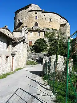
 Castel di Luco. | |
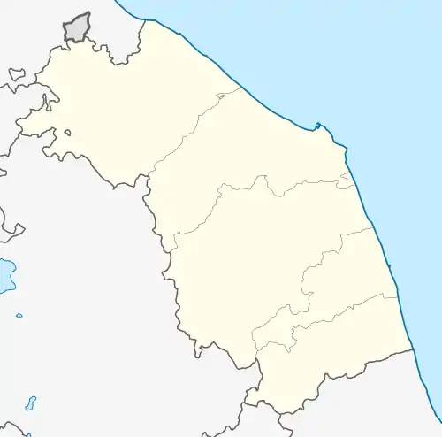
Location of Acquasanta Terme | |
 Acquasanta Terme Location of Acquasanta Terme in Italy  Acquasanta Terme Acquasanta Terme (Marche) | |
| Coordinates: 42°46′N 13°25′E | |
| Country | Italy |
| Region | Marche |
| Province | Ascoli Piceno (AP) |
| Frazioni | Arli, Arola, Cagnano, Campeglia, Capodirigo, Case Rotili, Centrale, Colle Falciano, Colle Frattale, Corneto, Farno, Favalanciata, Fleno, Forcella, Matera, Novele, Paggese, Peracchia, Piandelloro, Piedicava, Pito, Pomaro, Ponte d'Arli, Pozza, Quintodecimo, Rocca di Montecalvo, Rocchetta, San Gregorio, San Martino, Santa Maria, San Paolo, San Vito, Tallacano, Torre Santa Lucia, Umito, Vallecchia, Valle d'Acqua, Venamartello |
| Government | |
| • Mayor | Sante Stangoni |
| Area | |
| • Total | 138.39 km2 (53.43 sq mi) |
| Elevation | 388 m (1,273 ft) |
| Population | |
| • Total | 2,829 |
| • Density | 20/km2 (53/sq mi) |
| Demonym | Acquasantani |
| Time zone | UTC+1 (CET) |
| • Summer (DST) | UTC+2 (CEST) |
| Postal code | 63041 |
| Dialing code | 0736 |
| Website | Official website |
History
In June 1883, a coin hoard was discovered by chance in S. Maria del Paggese, within the municipality of Acquasanta Terme, today S. Maria di Acquasanta Terme. The hoard was in a terracotta pot and contained c. 275 denarii dated between the second half of the 1st century and the beginning of the 3rd century AD. A brief announcement of the discovery was made by the Inspector of Excavations and Monuments in Ascoli Piceno, Giulio Gabrielli, and published in the local newspaper Corriere Piceno.[5]
Main sights
- Medieval castle Castel di Luco (14th century), characterized by an unusual elliptical plan.
- Ponte di Quintodecimo and Ponte Romano, Roman bridges crossing which were part of the Via Salaria.
References
- "Superficie di Comuni Province e Regioni italiane al 9 ottobre 2011". Italian National Institute of Statistics. Retrieved 16 March 2019.
- All demographics and other statistics: Italian statistical institute Istat.
- "Popolazione Residente al 1° Gennaio 2018". Italian National Institute of Statistics. Retrieved 16 March 2019.
- Richard J.A. Talbert, ed. (2000). Barrington Atlas of the Greek and Roman World: Map-By-Map Directory. Vol. I. Princeton, NJ and Oxford, UK: Princeton University Press. p. 606. ISBN 0691049459.
- Giulia D'Angelo; Alberto Martín Esquivel (2021). "A Hoard of Imperial Denarii from S. Maria del Paggese (Acquasanta Terme, Ascoli Piceno)". The Numismatic Chronicle. 181: 364–380.