Acton Regional County Municipality
Acton Regional County Municipality is a regional county municipality located in the Montérégie region of Quebec. The seat is Acton Vale.[2]
Acton | |
|---|---|
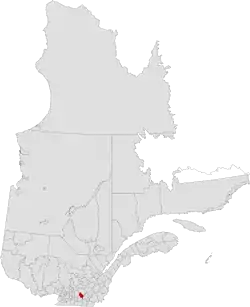 | |
| Coordinates: 45°39′N 72°34′W[1] | |
| Country | |
| Province | |
| Region | Montérégie |
| Effective | January 1, 1982 |
| County seat | Acton Vale |
| Communities | List
|
| Government | |
| • Type | Prefecture |
| • Prefect | Jean-Marie Laplante |
| Area | |
| • Total | 583.00 km2 (225.10 sq mi) |
| • Land | 579.80 km2 (223.86 sq mi) |
| Population (2016)[3] | |
| • Total | 15,594 |
| • Density | 26.9/km2 (70/sq mi) |
| • Change 2011-2016 | |
| • Dwellings | 7,101 |
| Time zone | UTC−5 (EST) |
| • Summer (DST) | UTC−4 (EDT) |
| Area codes | 450 and 579 |
| Website | www |
| [4] | |
Founded in 1982, the Acton Regional County Municipality is made up of eight smaller municipalities containing a little fewer than 16,000 people. The average population density is 26.9 per square kilometre. About half of the population is concentrated in the town of Acton Vale.[5]
Subdivisions
There are 8 subdivisions within the RCM:[2]
|
|
|
|
|
Demographics
Mother tongue from Canada 2016 Census[3]
| Language | Population | Pct (%) |
|---|---|---|
| French only | 14,925 | 95.7% |
| English only | 160 | 1.0% |
| Both English and French | 55 | 0.4% |
| Other languages | 455 | 2.9% |
Transportation
Attractions and Other Areas
La Campagnarde Trail
References
- "Reference number 141124 in Banque de noms de lieux du Québec". toponymie.gouv.qc.ca (in French). Commission de toponymie du Québec.
- "Geographic code 480 in the official Répertoire des municipalités". www.mamh.gouv.qc.ca (in French). Ministère des Affaires municipales et de l'Habitation.
- "Census Profile, 2016 Census Acton, Municipalité régionale de comté [Census division], Quebec". Statistics Canada. Retrieved November 25, 2019.
- "Acton Regional County Municipality (Code 2448) Census Profile". 2011 census. Government of Canada - Statistics Canada.
- Acton RCM Archived March 24, 2009, at the Wayback Machine
- Official Transport Quebec Road Map
External links
Adjacent Counties & Equivalent Territories | |
|---|---|
This article is issued from Wikipedia. The text is licensed under Creative Commons - Attribution - Sharealike. Additional terms may apply for the media files.