Saint-Basile-le-Grand
Saint-Basile-le-Grand is a city located in La Vallée-du-Richelieu Regional County Municipality in southwestern Quebec, Canada. The population as of the 2021 Canadian Census was 17,053.
Saint-Basile-le-Grand | |
|---|---|
 | |
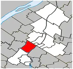
 Située dans La Vallée-du-Richelieu RCM. | |
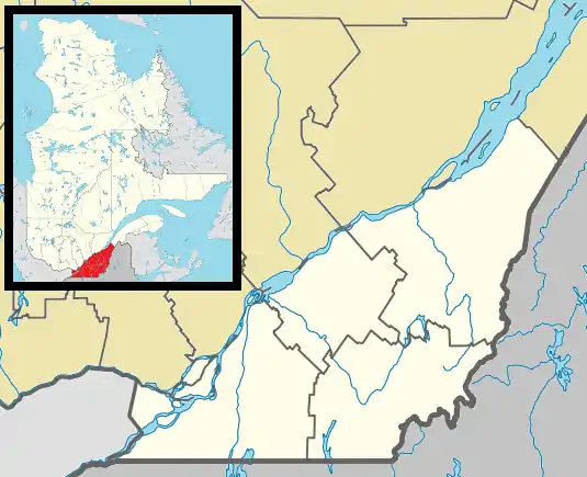
 Saint-Basile-le-Grand Située dans le sud du Québec. | |
| Coordinates: 45°32′N 73°17′W[1] | |
| Country | Canada |
| Province | Quebec |
| Region | Montérégie |
| RCM | La Vallée-du-Richelieu |
| Constituted | June 15, 1871 |
| Government | |
| • Mayor | Yves Lessard |
| • Federal riding | Montarville |
| • Prov. riding | Chambly |
| Area | |
| • Total | 36.90 km2 (14.25 sq mi) |
| • Land | 35.84 km2 (13.84 sq mi) |
| Population (2021)[4] | |
| • Total | 17,053 |
| • Density | 475.8/km2 (1,232/sq mi) |
| • Pop 2016-2021 | |
| • Dwellings | 6,635 |
| Time zone | UTC−05:00 (EST) |
| • Summer (DST) | UTC−04:00 (EDT) |
| Postal code(s) | |
| Area code(s) | 450 and 579 |
| Highways | |
| Website | www.ville.saint- basile-le-grand.qc.ca |
History
On June 15, 1871, Saint-Basile-le-Grand was created from territories coming from Saint-Bruno-de-Montarville and Saint-Joseph-de-Chambly. On June 7, 1969, the municipality obtained its status as a city. Its territory, the majority of which is still agricultural, occupies an area of 35.84 km2 between the Richelieu River and Mont Saint-Bruno.
On August 23, 1988, the city suffered an arson attack on a PCBs warehouse.
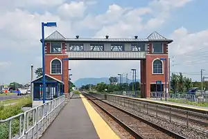
For several years now, the citizens of Saint-Basile-le-Grand are able to take advantage of the commuter train. The station located at the corner of boulevard du Millénaire and boulevard Sir-Wilfrid-Laurier (Route 116) also led, in 2004, to the construction of a small shopping center called “Place de la gare”. This construction is today, partly composed of an IGA, a McDonald's, a gas station, a dentist, a pet store, a florist, a Sushi Shop , an SAQ, a Caisse Desjardins.
The Church
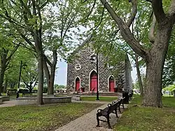
The church was finished at the beginning of January 1877, after a little less than a year of work. The church was built on land donated by Basile Daigneault.
Here is a quote from Mr. Moreau who went to the stone house of Basile Daigneault to hold his meeting:
“Built [the house] on the land with Mr. Basile Daigneault as a neighbor on both sides, on Rang des Vingt-Quatre, /…/, it was found that the majority of the freeholder inhabitants wanted to buy it. Consequently, the meeting, considering that Mr. Basile Daigneault, owner of the land on which the said house is located, land which he offered free of charge to the deputy of Monsignor of Montreal to build the church, presbytery and other dependencies of the said parish , without including, however, the said stone house which is built there, asks to sell the said house, before making the contracts of the said land, so that, later, it will serve as a presbytery. ».
The "Bunker"
Saint-Basile-le-Grand also has its place of choice in the history of organized crime. Indeed, a fortified square was erected there in the 1990s, at 28 rue Alvarès. The property belonged to a satellite club of the Hells Angels, the Evil Ones. This was in the sights of the municipality in the early 2000s, when a regulation prohibiting fortifications (bulletproof glass, maximum exterior cameras and limitation of the height of fences) was adopted by the city council.
The bunker will finally be seized during the roundup of Operation South in February 2004 to finally be destroyed in January 2006.
Demographics
In the 2021 Census of Population conducted by Statistics Canada, Saint-Basile-le-Grand had a population of 17,053 living in 6,561 of its 6,635 total private dwellings, a change of -0% from its 2016 population of 17,059. With a land area of 35.84 km2 (13.84 sq mi), it had a population density of 475.8/km2 (1,232.3/sq mi) in 2021.[5]
|
Population trend:[6]
|
Mother tongue language (2021)[7]
|
Infrastructure

Saint-Basile-le-Grand is served by the Saint-Basile-le-Grand, a commuter rail station on the Exo's Mont-Saint-Hilaire line. Local bus service is provided by the Exo de la Vallée du Richelieu sector.
Education
The South Shore Protestant Regional School Board previously served the municipality.[8]
See also
References
- "Reference number 55722 in Banque de noms de lieux du Québec". toponymie.gouv.qc.ca (in French). Commission de toponymie du Québec.
- Ministère des Affaires municipales, des Régions et de l'Occupation du territoire: Saint-Basile-le-Grand
- Parliament of Canada Federal Riding History: CHAMBLY--BORDUAS (Quebec)
- 2021 Statistics Canada Census Profile: Saint-Basile-le-Grand, Quebec
- "Population and dwelling counts: Canada, provinces and territories, and census subdivisions (municipalities), Quebec". Statistics Canada. February 9, 2022. Retrieved August 29, 2022.
- Statistics Canada: 1996, 2001, 2006, 2011 census
- 2021 Statistics Canada Community Profile: Saint-Basile-le-Grand, Quebec
- King, M.J. (Chairperson of the board). "South Shore Protestant Regional School Board" (St. Johns, PQ). The News and Eastern Townships Advocate. Volume 119, No. 5. Thursday December 16, 1965. p. 2. Retrieved from Google News on November 23, 2014.