Adorp
Adorp (Dutch pronunciation: [ˈaːdɔr(ə)p]; Gronings: Oadörp [ˈʊːdœːp]) is a village in the municipality of Het Hogeland, Netherlands. It is located about 6 km north of Groningen. Until 1990, Adorp was a separate municipality, however the seat was in Sauwerd.[3]
Adorp | |
|---|---|
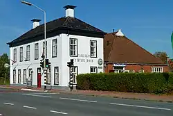 Bar restaurant 't Witte Hoes | |
 Flag  Seal | |
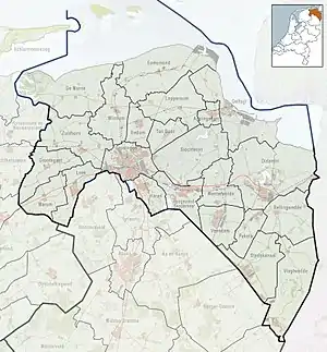 Adorp Location of Adorp in the province of Groningen  Adorp Adorp (Netherlands) | |
| Coordinates: 53°16′29″N 6°32′4″E | |
| Country | Netherlands |
| Province | Groningen |
| Municipality | Het Hogeland |
| Area | |
| • Total | 0.46 km2 (0.18 sq mi) |
| Elevation | 1 m (3 ft) |
| Population (2021)[1] | |
| • Total | 525 |
| • Density | 1,100/km2 (3,000/sq mi) |
| Time zone | UTC+1 (CET) |
| • Summer (DST) | UTC+2 (CEST) |
| Postal code | 9774 |
| Dialing code | 050 |
| Website | adorp.com |
History
Adorp started in the middle ages as a settlement in a bend in the River Hunze. Later, the river moved westwards.[4] It was first mentioned as Artharpe in 1371. The origin of the name is unclear, it seems to read river (A) village (dorp), however the earliest names started with Ar.[5] The church dates from 1667.[4] In 1840, it was home to 1,030 people.[3]
Gallery
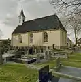 Protestant church
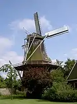 Windmill Aeolus
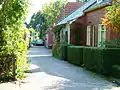 Little street in Adorp
References
- "Kerncijfers wijken en buurten 2021". Central Bureau of Statistics. Retrieved 8 March 2022.
- "Postcodetool for 9774PA". Actueel Hoogtebestand Nederland (in Dutch). Het Waterschapshuis. Retrieved 8 March 2022.
- "Adorp". Plaatsengids (in Dutch). Retrieved 8 March 2022.
- Redmer Alma (1998). Adorp (in Dutch). Zwolle: Waanders Uitgevers. p. 175. ISBN 90 400 9258 3. Retrieved 8 March 2022.
- "Adorp - (geografische naam)". Etymologiebank (in Dutch). Retrieved 8 March 2022.
This article is issued from Wikipedia. The text is licensed under Creative Commons - Attribution - Sharealike. Additional terms may apply for the media files.