Ahtiala
Ahtiala is the 13th district of the city of Lahti, in the region of Päijät-Häme, Finland. It borders the districts of Viuha and Seesta in the north, Kunnas in the east, Koiskala in the southeast, Myllypohja in the south and Kytölä in the west.[1]
Ahtiala | |
|---|---|
District of Lahti | |
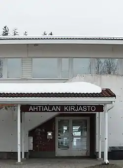
 The public library of Ahtiala | |
| Coordinates: 61°0′12″N 25°46′17″E | |
| Country | |
| Region | Päijät-Häme |
| Municipality | Lahti |
| Population (2019) | |
| • Total | 5,379 |
| (approximate) | |
| Postal codes | 15300, 15320 |
| District number | 13 |
The population of the statistical district of Ahtiala was 5,379 in 2019.[2]
History
The area now known as Ahtiala has been populated since the Iron Age, as per radiocarbon dating performed on the hill of Paakkolanmäki. Agriculture had been established by the 1400s, and midway through the 1500s, the village of Ahtiala consisted of 24 estates, being the largest in all of the parish of Nastola. It was entirely destroyed in a fire in 1740, after which some of the newly rebuilt estates were moved away from the former centre of the village.[3]
By a governmental decree made on 29 October 1954, Ahtiala was annexed to Lahti from Nastola on 1 January 1956.[4]
References
- "Lahti map service: Quarters of Lahti City". City of Lahti. Retrieved 31 January 2021.
- "Statistics service of the City of Lahti" (in Finnish). Archived from the original on 6 July 2008. Retrieved 31 January 2021. (under Tilastokanta → Lahti → Väestö → Väkiluku ja ikärakenne → Lahden väkiluku ja ikärakenne alueittain 1999-)
- Kivilä, Hannu (2007). Lahtelaisen lukukirja (in Finnish). Lahti: Lahti City Museum, Lahti-seura. pp. 12–14. ISBN 978-951-849-618-5.
- Kivilä, Hannu (1997). Markalla Möysään: Seitsemän vuosikymmentä Lahden seudun paikallista linja-autoliikennettä. Lahti: Suomen Linja-autohistoriallinen Seura r.y. p. 82. ISBN 951-96869-1-6.