Ahuroa
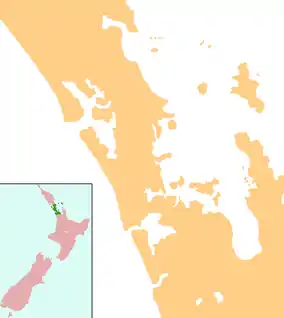
Ahuroa is a locality in the north of Auckland, New Zealand. Ahuroa is located in the Rodney Local Board area of the city, within the Warkworth subdivision. Puhoi is to the south-east, Warkworth to the north-east, and Kaipara Flats to the north.[1] The North Auckland railway line passes through the area.[2][3]
Ahuroa | |
|---|---|
 Ahuroa | |
| Coordinates: 36°28′35″S 174°33′19″E | |
| Country | New Zealand |
| Region | Auckland Region |
| District | Rodney District |
| Population (2013) | |
| • Total | 132 |
.jpg.webp)
Ahuroa and its surrounds in Meshblock 0146600 had a population of 132 people in 48 households in the 2013 New Zealand census.[4]
The New Zealand Ministry for Culture and Heritage gives a translation of "Long Mound" for Ahuroa.[5]
The North Auckland Line reached Ahuroa from Kaukapakapa in 1905, allowing exploitation of the local forests.[6] Because it had a railway station, the road between Ahuroa and Glorit on the western coast was chosen to be a highway in the late 1920s, and metalled.[7]
Ahuroa is also the site of King's College's Venture Camp. The school owns land and forests there and runs camps such as the 8 days stay as part of the 26 days Year 10 Adventure Challenge at Kings College and the Ahuroa venture camp hosts the Year 12 Leadership camp, preparing them to become prefects in Year 13, as well as leasing out the facility to many corporations from New Zealand.
Education
Ahuroa School is a coeducational full primary (years 1–8) school[8] with a roll of 64 as of April 2023.[9]
Economy
The economy of Ahuroa is primarily based on agriculture, with farming and livestock production serving as the main industries in the region. Tourism is also an important industry in the region, with visitors drawn to the area's stunning natural beauty and rural charm.[10]
Notes
- (PDF) https://www.aucklandcouncil.govt.nz/about-auckland-council/how-auckland-council-works/local-boards/all-local-boards/rodney-local-board/Documents/rodney-local-board-mapbook.pdf.
{{cite web}}: Missing or empty|title=(help) - Peter Dowling, ed. (2004). Reed New Zealand Atlas. Reed Books. pp. map 11. ISBN 0-7900-0952-8.
- Roger Smith, GeographX (2005). The Geographic Atlas of New Zealand. Robbie Burton. pp. map 35. ISBN 1-877333-20-4.
- "2013 Census map – QuickStats about a place". archive.stats.govt.nz. Archived from the original on 9 August 2019. Retrieved 24 August 2019.
- "1000 Māori place names". New Zealand Ministry for Culture and Heritage. 6 August 2019.
- Ryburn, Wayne (1999). Tall Spars, Steamers & Gum. p. 84. ISBN 0-473-06176-7.
- Ryburn, p 189
- Education Counts: Ahuroa School
- "New Zealand Schools Directory". New Zealand Ministry of Education. Retrieved 12 December 2022.
- "Ahuroa, Auckland - Everything You Need to Know : New Zealand Govt".