Kaukapakapa
Kaukapakapa is a town in the North Island of New Zealand. It is situated in the Rodney ward of the Auckland Region and is around 50 kilometres (31 miles) northwest of Auckland city. State Highway 16 passes through the town, connecting it to Helensville about 12 km (7.5 miles) to the south-west, and Araparera about 14 km to the north. The North Auckland Line also passes through Kaukapakapa. The Kaukapakapa River flows from the town to the Kaipara Harbour to the west.[3][4]
Kaukapakapa | |
|---|---|
 Kaukapakapa sign | |
| Coordinates: 36°36′58″S 174°29′29″E | |
| Country | New Zealand |
| Region | Auckland Region |
| Ward | Rodney ward |
| Community board | Rodney Local Board |
| Electorates | |
| Government | |
| • Territorial Authority | Auckland Council |
| Area | |
| • Total | 5.26 km2 (2.03 sq mi) |
| Population (June 2023)[2] | |
| • Total | 1,080 |
| • Density | 210/km2 (530/sq mi) |
"Kaukapakapa" is a Māori name meaning "to swim with much splashing".[5] The town is commonly known to the locals in its shortened form "Kaukap".[6]
History
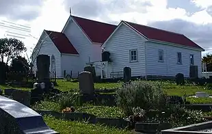
European settlement of the area began in 1860, when the Government bought land from local Māori.[7] A small number of settlers arrived from England and Scotland, and a Methodist church was built in 1872. A monthly boat service operated between Kaukapakapa and the northern Kaipara from 1863.[8] The population of the area was 311 in 1881. The town developed split between the northern and southern banks of the river. Although roads connected the town to Riverhead, Tauhoa and Helensville by the early 1880s, they were of poor quality, and most access was by the river.[9] The roads were still mostly unmetalled in 1920.[10]
The kauri timber industry was responsible for developing the area, with logs floated down the Kaukapakapa River to the Kaipara Harbour, where they were loaded onto ships for export. Kauri gum digging (beginning in 1873-74 and continuing until at least 1914)[11] and flax processing (in the 1880s)[12] were also significant early industries. A shipyard operated from 1864 and into the 1880s.[13]
The North Auckland railway line reached Kaukapakapa in 1889.[14] A creamery was built next to the railway station to service the developing dairy industry.[15][16]
In 2008 Genesis Energy proposed building a gas-fired power station called Rodney Power Station near Kaukapakapa. Despite local opposition,[17] the project was granted resource consent in 2009.[18] The project was abandoned in 2015.[19]
Demographics
Statistics New Zealand describes Kaukapakapa as a rural settlement, which covers 5.26 km2 (2.03 sq mi)[1] and had an estimated population of 1,080 as of June 2023,[2] with a population density of 205 people per km2. The settlement is part of the larger Te Kuru statistical area.
| Year | Pop. | ±% p.a. |
|---|---|---|
| 2006 | 540 | — |
| 2013 | 609 | +1.73% |
| 2018 | 873 | +7.47% |
| Source: [20] | ||

Kaukapakapa had a population of 873 at the 2018 New Zealand census, an increase of 264 people (43.3%) since the 2013 census, and an increase of 333 people (61.7%) since the 2006 census. There were 270 households, comprising 426 males and 444 females, giving a sex ratio of 0.96 males per female, with 228 people (26.1%) aged under 15 years, 150 (17.2%) aged 15 to 29, 435 (49.8%) aged 30 to 64, and 69 (7.9%) aged 65 or older.
Ethnicities were 93.1% European/Pākehā, 11.7% Māori, 2.4% Pacific peoples, 3.1% Asian, and 2.4% other ethnicities. People may identify with more than one ethnicity.
Although some people chose not to answer the census's question about religious affiliation, 60.8% had no religion, 30.9% were Christian, 1.0% had Māori religious beliefs, 0.3% were Buddhist and 1.7% had other religions.
Of those at least 15 years old, 120 (18.6%) people had a bachelor's or higher degree, and 75 (11.6%) people had no formal qualifications. 195 people (30.2%) earned over $70,000 compared to 17.2% nationally. The employment status of those at least 15 was that 399 (61.9%) people were employed full-time, 93 (14.4%) were part-time, and 21 (3.3%) were unemployed.[20]
Te Kuru statistical area
Te Kuru statistical area covers 80.93 km2 (31.25 sq mi)[1] and had an estimated population of 2,880 as of June 2022,[21] with a population density of 36 people per km2.
| Year | Pop. | ±% p.a. |
|---|---|---|
| 2006 | 1,695 | — |
| 2013 | 2,010 | +2.46% |
| 2018 | 2,484 | +4.33% |
| Source: [22] | ||

Te Kuru had a population of 2,484 at the 2018 New Zealand census, an increase of 474 people (23.6%) since the 2013 census, and an increase of 789 people (46.5%) since the 2006 census. There were 792 households, comprising 1,233 males and 1,251 females, giving a sex ratio of 0.99 males per female. The median age was 38.8 years (compared with 37.4 years nationally), with 561 people (22.6%) aged under 15 years, 414 (16.7%) aged 15 to 29, 1,254 (50.5%) aged 30 to 64, and 255 (10.3%) aged 65 or older.
Ethnicities were 93.4% European/Pākehā, 11.2% Māori, 2.4% Pacific peoples, 2.7% Asian, and 2.3% other ethnicities. People may identify with more than one ethnicity.
The percentage of people born overseas was 21.1, compared with 27.1% nationally.
Although some people chose not to answer the census's question about religious affiliation, 61.2% had no religion, 27.7% were Christian, 0.5% had Māori religious beliefs, 0.2% were Hindu, 0.7% were Buddhist and 1.9% had other religions.
Of those at least 15 years old, 348 (18.1%) people had a bachelor's or higher degree, and 255 (13.3%) people had no formal qualifications. The median income was $42,400, compared with $31,800 nationally. 513 people (26.7%) earned over $70,000 compared to 17.2% nationally. The employment status of those at least 15 was that 1,122 (58.3%) people were employed full-time, 327 (17.0%) were part-time, and 45 (2.3%) were unemployed.[22]
Governance
Kaukapakapa is part of the local government Rodney Ward of Auckland Council and is part of the Kumeu subdivision of the Rodney Local Board.
Kaukapakapa is in the Kaipara ki Mahurangi parliamentary electorate.
Economy
The township is in the North West Country Inc business improvement district zone. The business association which represents businesses from Kaukapakapa to Riverhead.
Education

Kaukapakapa School is a coeducational full primary school (years 1-8), with a roll of 296 students as of April 2023.[23][24] The school celebrated its 125th reunion in 1998.[25]
Kaukapakapa also has two early learning institutions: The Kaukapakapa Pre-School, located near the primary school, and a Playcentre located in Macky Road. (Established in 1976) [26]
Publications
Kaukapakapa's only local publication dedicated to Kaukapakapa news and events is the Kaukapakapa Kourier, a free newsletter delivered to local residents by post and also available online in PDF format.[27]
Notable people
- Alan Gibbs - businessman and art collector.
- Tony Woodcock – former All Black rugby player
Amenities
The Omeru Scenic Reserve is located north of Kaukapakapa, at the confluence of the Omeru Stream and Waitangi Stream. The reserve was gifted to Auckland by Basil Orr in 1971, and features a number of waterfalls, including the Omeru Falls and Waitangi Falls.[28][29][30] The site of the Omeru pā can be found within the reserve.[30]
References
- "ArcGIS Web Application". statsnz.maps.arcgis.com. Retrieved 21 May 2022.
- "Subnational population estimates (RC, SA2), by age and sex, at 30 June 1996-2023 (2023 boundaries)". Statistics New Zealand. Retrieved 25 October 2023. (regional councils); "Subnational population estimates (TA, SA2), by age and sex, at 30 June 1996-2023 (2023 boundaries)". Statistics New Zealand. Retrieved 25 October 2023. (territorial authorities); "Subnational population estimates (urban rural), by age and sex, at 30 June 1996-2023 (2023 boundaries)". Statistics New Zealand. Retrieved 25 October 2023. (urban areas)
- Peter Dowling, ed. (2004). Reed New Zealand Atlas. Reed Books. map 11. ISBN 0-7900-0952-8.
- Roger Smith, GeographX (2005). The Geographic Atlas of New Zealand. Robbie Burton. map 34. ISBN 1-877333-20-4.
- Reed, A.W. (1996) The Reed Dictionary of Mǎori Place Names: Te Papakupu Ingoa Wǎhi Mǎori a Reed (3rd ed.). Reed Books: Auckland, New Zealand
- "Kaukapakapa Travel Guide". Jasons Travel Media.
- Ryburn, Wayne (1999). Tall Spars, Steamers & Gum. Auckland, N.Z.: Kaipara Publications. p. 25. ISBN 0-473-06176-7.
- Ryburn, p. 30.
- Ryburn, pp. 49-50, 86-87, 89.
- Ryburn, pp. 187-188.
- Ryburn, pp. 42, 201.
- Ryburn, p. 139.
- Ryburn, pp. 43-44, 138.
- Ryburn, pp. 83-84.
- Ryburn, p. 62.
- "Kaukapakapa". Helensville Museum. Retrieved 6 September 2008.
- Thompson, Wayne (22 August 2008). "Parties warming up on power station hearing". The New Zealand Herald.
- "Moving closer to Rodney power station". Stuff. 27 March 2009.
- "Genesis axes Rodney power station plan". RNZ. 8 July 2015. Retrieved 1 July 2021.
- "Statistical area 1 dataset for 2018 Census". Statistics New Zealand. March 2020. 7001377–7001378 and 7001380–7001382.
- "Population estimate tables - NZ.Stat". Statistics New Zealand. Retrieved 25 October 2022.
- "Statistical area 1 dataset for 2018 Census". Statistics New Zealand. March 2020. Te Kuru (111600). 2018 Census place summary: Te Kuru
- "New Zealand Schools Directory". New Zealand Ministry of Education. Retrieved 12 December 2022.
- Education Counts: Kaukapakapa School
- "Jubilees & reunions - Kaukapakapa School". Education Gazette New Zealand. 77 (13). 3 August 1998.
- "Playcentre Details Kaukapakapa". Archived from the original on 26 January 2015.
- "Kaukapakapa Kourier". Archived from the original on 5 September 2013.
- "Omeru Falls". New Zealand Gazetteer. Land Information New Zealand. Retrieved 8 May 2023.
- "Waitangi Falls". New Zealand Gazetteer. Land Information New Zealand. Retrieved 8 May 2023.
- Janssen, Peter (January 2021). Greater Auckland Walks. New Holland Publishers. p. 36-37. ISBN 978-1-86966-516-6. Wikidata Q118136068.