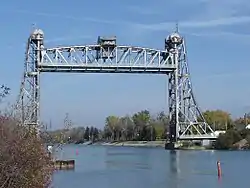
Air draft
Air draft (or air draught) is the distance from the surface of the water to the highest point on a vessel. This is similar to the "deep draft" of a vessel which is measured from the surface of the water to the deepest part of the hull below the surface, but air draft is expressed as a height, not a depth.[1][2]

Clearance below
The vessel's clearance is the distance in excess of the air draft which allows a vessel to pass safely under a bridge or obstacle such as power lines, etc. A bridge's "clearance below" is most often noted on charts as measured from the surface of the water to the under side of the bridge at the chart datum Mean High Water (MHW),[3][4] a less restrictive clearance than Mean Higher High Water (MHHW).
In 2014, the United States Coast Guard reported that 1.2% of the collisions that it investigated in the recent past were caused by vessels attempting to pass under structures with insufficient clearance resulting in bridge strikes.[1]
Examples

The Bridge of the Americas in Panama limits which ships can traverse the Panama Canal due to its height at 61.3 m (201 ft) above the water. The world's largest cruise ships, Oasis of the Seas, Allure of the Seas and the Harmony of the Seas will fit within the canal's new widened locks, but they are too tall to pass under the bridge, even at low tide (the two first ships are 72 m (236 ft), but do have lowerable funnels, enabling them to pass the 65-metre (213 ft) Great Belt Bridge in Denmark). New vessels are rarely built not clearing 65 m (213 ft), a height which accommodates all but the largest cruise and container ships.
The Suez Canal Bridge has a 70-metre (230 ft) clearance over the canal.
The Bayonne Bridge, an arch bridge connecting New Jersey with New York City, undertook a $1.7 billion modification to raise its roadbed to 66 m (217 ft).[5]
See also
References
- "Marine Safety Alert 090-14: AIR DRAFT IS CRITICAL!" (PDF) (Press release). United States Coast Guard Inspections and Compliance Directorate. 2014-09-09. Archived (PDF) from the original on 2022-05-16. Retrieved 2023-09-05.
- 2104 Connecticut Boater's Guide (PDF). State of Connecticut Department of Energy and Environmental Protection. p. 60. Retrieved 2015-02-15.
- See: NOAA Navigation Chart #12335, Hudson and East Rivers, Governors Island to 67th Street, Revised October 1, 2019, "HEIGHTS: Heights in feet above Mean High Water"
- See: U.S. Coast Pilot 5, Chapter 8, p. 354, Structures across the Inner Harbor Navigation Canal, New Orleans, 15 December, 2019, "Vertical clearance measured at Mean High Water"
- Bayonne Bridge rededication ceremony marks end of $1.7 billion project