Alford, Florida
Alford is a town in Jackson County, Florida, United States. It is located in the Florida Panhandle near Marianna. The population was 489 at the 2010 census.[4]
Alford, Florida | |
|---|---|
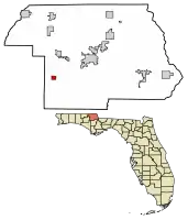 Location of Alford in Jackson County, Florida. | |
| Coordinates: 30°41′41″N 85°23′35″W | |
| Country | |
| State | |
| County | Jackson |
| Area | |
| • Total | 1.07 sq mi (2.78 km2) |
| • Land | 1.05 sq mi (2.73 km2) |
| • Water | 0.02 sq mi (0.05 km2) |
| Elevation | 148 ft (45 m) |
| Population (2020) | |
| • Total | 484 |
| • Density | 458.77/sq mi (177.19/km2) |
| Time zone | UTC-6 (Central (CST)) |
| • Summer (DST) | UTC-5 (CDT) |
| ZIP code | 32420 |
| Area code | 850 |
| FIPS code | 12-00625[2] |
| GNIS feature ID | 0277741[3] |
Geography
Alford is located at 30°41′41″N 85°23′35″W (30.694794, –85.393119).[5]
The town is located along U.S. Route 231 approximately 4 mi (6.4 km) south of its intersection with Interstate 10. Via US 231, Cottondale is 7 mi (11 km) north, and Panama City is 44 mi (71 km) south-southwest.
According to the United States Census Bureau, the town has a total area of 1.3 square miles (3.4 km2), of which 1.3 square miles (3.4 km2) is land and 0.04 square miles (0.10 km2) (1.53%) is water.
Demographics
| Census | Pop. | Note | %± |
|---|---|---|---|
| 1920 | 207 | — | |
| 1930 | 221 | 6.8% | |
| 1940 | 283 | 28.1% | |
| 1950 | 375 | 32.5% | |
| 1960 | 380 | 1.3% | |
| 1970 | 402 | 5.8% | |
| 1980 | 548 | 36.3% | |
| 1990 | 472 | −13.9% | |
| 2000 | 466 | −1.3% | |
| 2010 | 489 | 4.9% | |
| 2020 | 484 | −1.0% | |
| U.S. Decennial Census[6] | |||
2020 census
| Race | Number | Percentage |
|---|---|---|
| White (NH) | 411 | 84.92% |
| Black or African American (NH) | 13 | 2.69% |
| Native American or Alaska Native (NH) | 3 | 0.62% |
| Asian (NH) | 2 | 0.41% |
| Some Other Race (NH) | 1 | 0.21% |
| Mixed/Multi-Racial (NH) | 27 | 5.58% |
| Hispanic or Latino | 27 | 5.58% |
| Total | 484 |
As of the 2020 United States census, there were 484 people, 250 households, and 159 families residing in the town.
2010 census
As of the census of 2010, there were 489 people and 202 households in the town.
The population was 48 percent male and 52 percent female. Twenty percent of the population was under 18 and 15.5 percent 65 or over. Ninety-three percent of the population was white and 4 percent Hispanic or Latino.
References
- "2020 U.S. Gazetteer Files". United States Census Bureau. Retrieved October 31, 2021.
- "U.S. Census website". United States Census Bureau. Retrieved January 31, 2008.
- "US Board on Geographic Names". United States Geological Survey. October 25, 2007. Retrieved January 31, 2008.
- "2010 Census Interactive Population Search". Archived from the original on September 1, 2012. Retrieved March 26, 2012.
- "US Gazetteer files: 2010, 2000, and 1990". United States Census Bureau. February 12, 2011. Retrieved April 23, 2011.
- "Census of Population and Housing". Census.gov. Retrieved June 4, 2015.
- "Explore Census Data". data.census.gov. Retrieved March 5, 2022.
Municipalities and communities of Jackson County, Florida, United States | ||
|---|---|---|
| Cities | 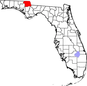 | |
| Towns | ||
| Unincorporated communities | ||
| Ghost town | ||