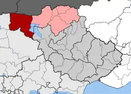
Anatoli, Serres
Anatoli (Greek: Ανατολή) is a village in the municipality of Sintiki, within the regional section of Serres, at the border with the neighbouring regional section of Kilkis. It was known as Anatolou (Ανατολού) prior to 1927. As a result of the Kallikratis plan of 2010, it belongs to the Anatoli community of the municipality of Sintiki. Prior to this date, it had been in the sub municipality of Kerkini. According to the 2011 census, it has a population of 132 inhabitants, the majority of whom have roots in the Greek disapora who came from areas of Pontus.[2] According to the 1928 census, Anatolia is a purely refugee village with 31 refugee families of 108 people.[3]
Anatoli
Ανατολή | |
|---|---|
 Anatoli village sign | |
 Anatoli Location within the regional unit  | |
| Coordinates: 41.2626°N 22.9304°E | |
| Country | Greece |
| Administrative region | Central Macedonia |
| Regional unit | Serres |
| Municipality | Sintiki |
| Elevation | 140 m (460 ft) |
| Community | |
| • Population | 132 (2011) |
| Time zone | UTC+2 (EET) |
| • Summer (DST) | UTC+3 (EEST) |
| Postal code | 620 53 |
| Area code(s) | +30 23270 |
| Vehicle registration | EP |

A small river flows from the entrance of the village. The existing school is no longer operating. The Central Church of the village is dedicated to the Prophet Elias.
The village is famous for its beautiful square with tall plane trees . Also near the village there is a chapel dedicated to Saint Paisios of Mount Athos.[4][5]
The village is located in the Serres Plain (Ο κάμπος των Σερρών) about 55 kilometers northwest of the town of Serres, northwest of Lake Kerkini.
References
- "Απογραφή Πληθυσμού - Κατοικιών 2011. ΜΟΝΙΜΟΣ Πληθυσμός" (in Greek). Hellenic Statistical Authority.
- DigiServices/Twinnet 2013-2015. "EG | Anatolí (Chorió) [SERRES, SINTIKI]". www.exploring-greece.gr (in Greek). Retrieved 2020-09-11.
- Κατάλογος των προσφυγικών συνοικισμών της Μακεδονίας σύμφωνα με τα στοιχεία της Επιτροπής Αποκαταστάσεως Προσφύγων (ΕΑΠ) έτος 1928, archived from the original on 2012-06-30, retrieved 2012-06-30
- "Sérres : Parekklísi tou Osíou Païsíou themelíose stin Anatolí o Sidirokástrou Makários (FOTO)". Epilogés (in Greek). 2018-07-13. Archived from the original on 2021-06-25. Retrieved 2020-09-10.
- "I eortí tou Agíou Païsíou stin I.M. Sidirokástrou (FOTO)". ROMFEA (in Greek). Retrieved 2020-09-12.