Antananabo
Antananabo is a rural municipality in Vohipeno District, Fitovinany, Madagascar. As of the year 2018, there are 4,688 inhabitants within its borders.[1]
Antananabo | |
|---|---|
Rural municipality | |
 Antananabo | |
| Coordinates: 22°25′28″S 47°43′34″E | |
| Country | |
| Region | Fitovinany |
| District | Vohipeno |
| Elevation | 24 m (79 ft) |
| Population (2018) | |
| • Total | 4,688 |
| Time zone | UTC+3 (EAT) |
| Postal code | 321 |
Geography
Antananabo is situated near the regional border with Atsimo-Atsinanana, about 43 kilometers southwest of the regional capital Manakara, and 14 kilometers southwest of the district capital Vohipeno. Its average elevation is at 24 meters above the sea level.[2]
Demographics
According to the 2018 census, Antananabo has a total of 846 households, with a 5.5 average household size. Out of the total 4,688 inhabitants, 2,332 are male and 2,356 are female.
See also
References
- Troisieme Recensement General de la Population et de l'Habitation (RGPH-3) [Third General Population and Housing Census (RGPH-3)] (PDF) (in French). Vol. 2. pp. 56, 122, 187. Archived from the original (PDF) on 2023-03-26.
- "Antananabo topographic map, elevation, terrain". Topographic maps. Retrieved 2023-03-26.
Capital: Manakara | ||
| Ikongo (17) - 310 | 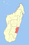 | |
| Manakara (42) - 316 |
| |
| Vohipeno (19) - 321 | ||
3 districts; 78 communes | ||
This article is issued from Wikipedia. The text is licensed under Creative Commons - Attribution - Sharealike. Additional terms may apply for the media files.