Marofarihy
Marofarihy is a rural municipality in Madagascar. It belongs to the district of Manakara-Atsimo_(district), which is a part of Fitovinany. The population of the commune was estimated to be approximately 7,000 in 2001 commune census.[2]
Marofarihy | |
|---|---|
 Marofarihy Location in Madagascar | |
| Coordinates: 22°2′S 48°0′E | |
| Country | |
| Region | Fitovinany |
| District | Manakara |
| Area | |
| • Total | 75 km2 (29 sq mi) |
| Elevation | 4 m (13 ft) |
| Population (2001)[2] | |
| • Total | 7,000 |
| Time zone | UTC3 (EAT) |
| Postal code | 316 |
Geography
The municipality is situated at 15 km North of Manakara.[3] It is crossed by the National Road 12 and the Fianarantsoa-Côte Est railway.
5 Fokontany (villages) belong to this municipality: Marofarihy, Ambotaka, Mideboka, Alakamisy Anivosoa and Ambohimandroso.
Only primary schooling is available. Farming and raising livestock provides employment for 46.5% and 46.5% of the working population. The most important crop is rice, while other important products are coffee, sugarcane and lychee. Industry and services provide employment for 3% and 4% of the population, respectively.[2]
Rivers
- The Managnano river.
References
- Estimated based on DEM data from Shuttle Radar Topography Mission
- "ILO census data". Cornell University. 2002. Retrieved 2008-05-03.
- LES ACTIVITES APICOLES A MANAKARAET SES ENVIRONS
Capital: Manakara | ||
| Ikongo (17) - 310 | 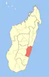 | |
| Manakara (42) - 316 |
| |
| Vohipeno (19) - 321 | ||
3 districts; 78 communes | ||