Antarctica
Antarctica (/ænˈtɑːrktɪkə/ ⓘ)[note 1] is Earth's southernmost and least-populated continent. Situated almost entirely south of the Antarctic Circle and surrounded by the Southern Ocean (also known as the Antarctic Ocean), it contains the geographic South Pole. Antarctica is the fifth-largest continent, being about 40% larger than Europe, and has an area of 14,200,000 km2 (5,500,000 sq mi). Most of Antarctica is covered by the Antarctic ice sheet, with an average thickness of 1.9 km (1.2 mi).
.svg.png.webp) | |
| Area | 14,200,000 km2 5,500,000 sq mi[1] |
|---|---|
| Population | 1,300 to 5,100 (seasonal) |
| Population density | 0.00009/km² to 0.00036/km² (seasonal) |
| Countries | 7 territorial claims |
| Time zones | All time zones |
| Internet TLD | .aq |
| Largest settlements | |
| UN M49 code | 010 |
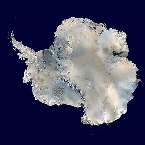
Antarctica is, on average, the coldest, driest, and windiest of the continents, and it has the highest average elevation. It is mainly a polar desert, with annual precipitation of over 200 mm (8 in) along the coast and far less inland. About 70% of the world's freshwater reserves are frozen in Antarctica, which, if melted, would raise global sea levels by almost 60 metres (200 ft). Antarctica holds the record for the lowest measured temperature on Earth, −89.2 °C (−128.6 °F). The coastal regions can reach temperatures over 10 °C (50 °F) in summer. Native species of animals include mites, nematodes, penguins, seals and tardigrades. Where vegetation occurs, it is mostly in the form of lichen or moss.
The ice shelves of Antarctica were probably first seen in 1820, during a Russian expedition led by Fabian Gottlieb von Bellingshausen and Mikhail Lazarev. The decades that followed saw further exploration by French, American, and British expeditions. The first confirmed landing was by a Norwegian team in 1895. In the early 20th century, there were a few expeditions into the interior of the continent. British explorers were the first to reach the magnetic South Pole in 1909, and the geographic South Pole was first reached in 1911 by Norwegian explorers.
Antarctica is governed by about 30 countries, all of which are parties of the 1959 Antarctic Treaty System. According to the terms of the treaty, military activity, mining, nuclear explosions, and nuclear waste disposal are all prohibited in Antarctica. Tourism, fishing and research are the main human activities in and around Antarctica. During the summer months, about 5,000 people reside at research stations, a figure that drops to around 1,000 in the winter. Despite its remoteness, human activity has a significant impact on the continent via pollution, ozone depletion, and climate change.
Etymology
The name given to the continent originates from the word antarctic, which comes from Middle French antartique or antarctique ('opposite to the Arctic') and, in turn, the Latin antarcticus ('opposite to the north'). Antarcticus is derived from the Greek ἀντι- ('anti-') and ἀρκτικός ('of the Bear', 'northern').[4] The Greek philosopher Aristotle wrote in Meteorology about an "Antarctic region" in c. 350 BCE.[5] The Greek geographer Marinus of Tyre reportedly used the name in his world map from the second century CE, now lost. The Roman authors Gaius Julius Hyginus and Apuleius used for the South Pole the romanised Greek name polus antarcticus,[6] from which derived the Old French pole antartike (modern pôle antarctique) attested in 1270, and from there the Middle English pol antartik, found first in a treatise written by the English author Geoffrey Chaucer.[4]
Belief by Europeans in the existence of a Terra Australis—a vast continent in the far south of the globe to balance the northern lands of Europe, Asia, and North Africa—had existed as an intellectual concept since classical antiquity. The belief in such a land lasted until the European discovery of Australia.[7]
During the early 19th century, explorer Matthew Flinders doubted the existence of a detached continent south of Australia (then called New Holland) and thus advocated for the "Terra Australis" name to be used for Australia instead.[8][9] In 1824, the colonial authorities in Sydney officially renamed the continent of New Holland to Australia, leaving the term "Terra Australis" unavailable as a reference to Antarctica. Over the following decades, geographers used phrases such as "the Antarctic Continent". They searched for a more poetic replacement, suggesting names such as Ultima and Antipodea.[10] Antarctica was adopted in the 1890s, with the first use of the name being attributed to the Scottish cartographer John George Bartholomew.[11]
Geography
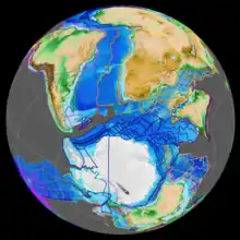
Positioned asymmetrically around the South Pole and largely south of the Antarctic Circle (one of the five major circles of latitude that mark maps of the world), Antarctica is surrounded by the Southern Ocean.[note 2] Rivers exist in Antarctica, the longest is the Onyx. Antarctica covers more than 14.2 million km2 (5,500,000 sq mi), making it the fifth-largest continent, slightly less than 1.5 times the area of the United States. Its coastline is almost 18,000 km (11,200 mi) long:[1] as of 1983, of the four coastal types, 44% of the coast is floating ice in the form of an ice shelf, 38% consists of ice walls that rest on rock, 13% is ice streams or the edge of glaciers, and the remaining 5% is exposed rock.[13]
The lakes that lie at the base of the continental ice sheet occur mainly in the McMurdo Dry Valleys or various oases.[14] Lake Vostok, discovered beneath Russia's Vostok Station, is the largest subglacial lake globally and one of the largest lakes in the world. It was once believed that the lake had been sealed off for millions of years, but scientists now estimate its water is replaced by the slow melting and freezing of ice caps every 13,000 years.[15] During the summer, the ice at the edges of the lakes can melt, and liquid moats temporarily form. Antarctica has both saline and freshwater lakes.[14]
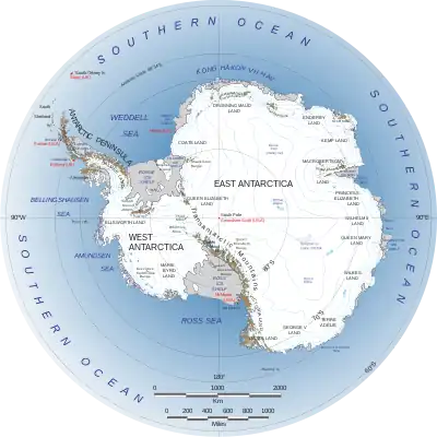
Antarctica is divided into West Antarctica and East Antarctica by the Transantarctic Mountains, which stretch from Victoria Land to the Ross Sea.[16][17] The vast majority of Antarctica is covered by the Antarctic ice sheet, which averages 1.9 km (1.2 mi) in thickness.[18] The ice sheet extends to all but a few oases, which, with the exception of the McMurdo Dry Valleys, are located in coastal areas.[19] Several Antarctic ice streams flow to one of the many Antarctic ice shelves, a process described by ice-sheet dynamics.[20]
.jpg.webp)
East Antarctica comprises Coats Land, Queen Maud Land, Enderby Land, Mac. Robertson Land, Wilkes Land, and Victoria Land. All but a small portion of the region lies within the Eastern Hemisphere. East Antarctica is largely covered by the East Antarctic Ice Sheet.[21] There are numerous islands surrounding Antarctica, most of which are volcanic and very young by geological standards.[22] The most prominent exceptions to this are the islands of the Kerguelen Plateau, the earliest of which formed around 40 Ma.[22][23]
Vinson Massif, in the Ellsworth Mountains, is the highest peak in Antarctica at 4,892 m (16,050 ft).[24] Mount Erebus on Ross Island is the world's southernmost active volcano and erupts around 10 times each day. Ash from eruptions has been found 300 kilometres (190 mi) from the volcanic crater.[25] There is evidence of a large number of volcanoes under the ice, which could pose a risk to the ice sheet if activity levels were to rise.[26] The ice dome known as Dome Argus in East Antarctica is the highest Antarctic ice feature, at 4,091 metres (13,422 ft). It is one of the world's coldest and driest places—temperatures there may reach as low as −90 °C (−130 °F), and the annual precipitation is 1–3 cm (0.39–1.18 in).[27]
Geologic history
From the end of the Neoproterozoic era to the Cretaceous, Antarctica was part of the supercontinent Gondwana.[28] Modern Antarctica was formed as Gondwana gradually broke apart beginning around 183 Ma.[29] For a large proportion of the Phanerozoic, Antarctica had a tropical or temperate climate, and it was covered in forests.[30]
Palaeozoic era (540–250 Ma)
_(Permian%253B_Antarctica)_1_(49063572172)_(cropped).jpg.webp)
During the Cambrian period, Gondwana had a mild climate.[31] West Antarctica was partially in the Northern Hemisphere, and during the time, large amounts of sandstones, limestones, and shales were deposited. East Antarctica was at the equator, where seafloor invertebrates and trilobites flourished in the tropical seas. By the start of the Devonian period (416 Ma), Gondwana was in more southern latitudes, and the climate was cooler, though fossils of land plants are known from then. Sand and silts were laid down in what is now the Ellsworth, Horlick and Pensacola Mountains.
Antarctica became glaciated during the Late Paleozoic icehouse beginning at the end of the Devonian period (360 Ma), though glaciation would substantially increase during the late Carboniferous. It drifted closer to the South Pole, and the climate cooled, though flora remained.[32] After deglaciation during the latter half of the Early Permian, the land became dominated by glossopterids (an extinct group of seed plants with no close living relatives), most prominently Glossopteris, a tree interpreted as growing in waterlogged soils, which formed extensive coal deposits. Other plants found in Antarctica during the Permian include Cordaitales, sphenopsids, ferns, and lycophytes.[33] At the end of the Permian, the climate became drier and hotter over much of Gondwana, and the glossopterid forest ecosystems collapsed, as part of the End-Permian mass extinction.[33][34] There is no evidence of any tetrapods having lived in Antarctica during the Paleozoic.[35]
Mesozoic era (250–66 Ma)
The continued warming dried out much of Gondwana. During the Triassic, Antarctica was dominated by seed ferns (pteridosperms) belonging to the genus Dicroidium, which grew as trees. Other associated Triassic flora included ginkgophytes, cycadophytes, conifers, and sphenopsids.[36] Tetrapods first appeared in Antarctica during the early Triassic, with the earliest known fossils found in the Fremouw Formation of the Transantarctic Mountains.[35] Synapsids (also known as "mammal-like reptiles") included species such as Lystrosaurus, and were common during the Early Triassic.[37]
The Antarctic Peninsula began to form during the Jurassic period (206 to 146 million years ago).[38] Ginkgo trees, conifers, Bennettitales, horsetails, ferns and cycads were plentiful during the time.[39] In West Antarctica, coniferous forests dominated throughout the Cretaceous period (146–66 Ma), though southern beech trees (Nothofagus) became prominent towards the end of the Cretaceous.[40][41] Ammonites were common in the seas around Antarctica, and dinosaurs were also present, though only a few Antarctic dinosaur genera (Cryolophosaurus and Glacialisaurus, from the Early Jurassic Hanson Formation of the Transantarctic Mountains,[42] and Antarctopelta, Trinisaura, Morrosaurus and Imperobator from Late Cretaceous of the Antarctic Peninsula) have been described.[43][44][45][46]
Gondwana breakup (160–15 Ma)
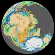

Africa separated from Antarctica in the Jurassic around 160 Ma, followed by the Indian subcontinent in the early Cretaceous (about 125 Ma).[47] During the early Paleogene, Antarctica remained connected to South America as well as to southeastern Australia. Fauna from the La Meseta Formation in the Antarctic Peninsula, dating to the Eocene, is very similar to equivalent South American faunas; with marsupials, xenarthrans, litoptern, and astrapotherian ungulates, as well as gondwanatheres and possibly meridiolestidans.[48][49] Marsupials are thought to have dispersed into Australia via Antarctica by the early Eocene.[50]
Around 53 Ma, Australia-New Guinea separated from Antarctica, opening the Tasmanian Passage.[51] The Drake Passage opened between Antarctica and South America around 30 Ma, resulting in the creation of the Antarctic Circumpolar Current that completely isolated the continent.[52] Models of Antarctic geography suggest that this current, as well as a feedback loop caused by lowering CO2 levels, caused the creation of small yet permanent polar ice caps. As CO2 levels declined further the ice began to spread rapidly, replacing the forests that until then had covered Antarctica.[53] Tundra ecosystems continued to exist on Antarctica until around 14-10 million years ago, when further cooling lead to their extermination.[54]
Present day

The geology of Antarctica, largely obscured by the continental ice sheet,[55] is being revealed by techniques such as remote sensing, ground-penetrating radar, and satellite imagery.[56] Geologically, West Antarctica closely resembles the South American Andes.[57] The Antarctic Peninsula was formed by geologic uplift and the transformation of sea bed sediments into metamorphic rocks.[58]
West Antarctica was formed by the merging of several continental plates, which created a number of mountain ranges in the region, the most prominent being the Ellsworth Mountains. The presence of the West Antarctic Rift System has resulted in volcanism along the border between West and East Antarctica, as well as the creation of the Transantarctic Mountains.[59]
East Antarctica is geologically varied. Its formation began during the Archean Eon (4,000 Ma–2,500 Ma), and stopped during the Cambrian Period.[60] It is built on a craton of rock, which is the basis of the Precambrian Shield.[61] On top of the base are coal and sandstones, limestones, and shales that were laid down during the Devonian and Jurassic periods to form the Transantarctic Mountains.[62] In coastal areas such as the Shackleton Range and Victoria Land, some faulting has occurred.[63][64]
Coal was first recorded in Antarctica near the Beardmore Glacier by Frank Wild on the Nimrod Expedition in 1907, and low-grade coal is known to exist across many parts of the Transantarctic Mountains.[65] The Prince Charles Mountains contain deposits of iron ore.[66] There are oil and natural gas fields in the Ross Sea.[67]
Climate

Antarctica is the coldest, windiest, and driest of Earth's continents.[1] The lowest natural air temperature ever recorded on Earth was −89.2 °C (−128.6 °F) at the Russian Vostok Station in Antarctica on 21 July 1983.[68] A lower air temperature of −94.7 °C (−138.5 °F) was recorded in 2010 by satellite—however, it may have been influenced by ground temperatures and was not recorded at a height of 2 m (7 ft) above the surface as required for official air temperature records.[69] Average temperatures can reach a minimum of between −80 °C (−112 °F) in the interior of the continent during winter and a maximum of over 10 °C (50 °F) near the coast in summer.[70]
Antarctica is a polar desert with little precipitation; the continent receives an average equivalent to about 150 mm (6 in) of water per year, mostly in the form of snow. The interior is dryer and receives less than 50 mm (2 in) per year, whereas the coastal regions typically receive more than 200 mm (8 in).[71] In a few blue-ice areas, the wind and sublimation remove more snow than is accumulated by precipitation.[72] In the dry valleys, the same effect occurs over a rock base, leading to a barren and desiccated landscape.[73] Antarctica is colder than the Arctic region, as much of Antarctica is over 3,000 m (9,800 ft) above sea level, where air temperatures are colder. The relative warmth of the Arctic Ocean is transferred through the Arctic sea ice and moderates temperatures in the Arctic region.[74]
Regional differences
East Antarctica is colder than its western counterpart because of its higher elevation. Weather fronts rarely penetrate far into the continent, leaving the centre cold and dry, with moderate wind speeds. Heavy snowfalls are common on the coastal portion of Antarctica, where snowfalls of up to 1.22 m (48 in) in 48 hours have been recorded. At the continent's edge, strong katabatic winds off of the polar plateau often blow at storm force. During the summer, more solar radiation reaches the surface at the South Pole than at the equator because of the 24 hours of sunlight received there each day.[1]
Climate change
Over the second half of the 20th century, the Antarctic Peninsula was the fastest-warming place on Earth, closely followed by West Antarctica, but temperatures rose less rapidly during the early 21st century.[75] Conversely, the South Pole, located in East Antarctica, barely warmed during much of the 20th century, but temperatures rose three times the global average between 1990 and 2020.[76] In February 2020, the continent recorded its highest temperature of 18.3 °C (64.9 °F), which was 0.8 °C (1.4 °F) higher than the previous record attained in March 2015.[77]
A main component of climate variability in Antarctica is the Southern Annular Mode (a low-frequency mode of atmospheric variability of the Southern Hemisphere), which showed strengthened winds around Antarctica in the summer of the later decades of the 20th century, associated with cooler temperatures over the continent. The trend was at a scale unprecedented over the last 600 years; the most dominant driver of the mode of variability is likely the depletion of ozone above the continent.[78]
Glaciers and floating ice
Precipitation in Antarctica occurs in the form of snow, which accumulates and forms the giant ice sheet that covers the continent.[79] Under the force of gravity, the ice flows towards the coast. The ice then moves into the ocean, often forming vast floating ice shelves. These shelves can melt or form icebergs that eventually disintegrate when they reach warmer ocean waters.[80]
Sea ice and ice shelves
Sea ice extent expands annually during the Antarctic winter, but most of it melts in the summer.[81] The ice is formed from the ocean, and does not contribute to changes in sea level.[82] The average extent of sea ice around Antarctica has changed little since satellites began to observe the Earth's surface in 1978; which is in contrast with the Arctic, where there has been rapid sea ice loss. A possible explanation is that thermohaline circulation transports warmed water to deeper layers in the Southern Ocean so that the surface remains relatively cool.[83]
The melting of the ice shelves does not contribute much to sea level rise, as the floating ice displaces its own mass of water, but the ice shelves act to stabilize the land ice. They are vulnerable to warming water, which has caused large ice shelves to collapse into the ocean.[84] The loss of ice shelf "buttressing" has been identified as the major cause of ice loss on the West Antarctic ice sheet, but has also been observed around the East Antarctic ice sheet.[85]
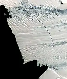
In 2002 the Antarctic Peninsula's Larsen-B ice shelf collapsed.[86] In early 2008, about 570 km2 (220 sq mi) of ice from the Wilkins Ice Shelf on the southwest part of the peninsula collapsed, putting the remaining 15,000 km2 (5,800 sq mi) of the ice shelf at risk. The ice was being held back by a "thread" of ice about 6 km (4 mi) wide,[87][88] prior to its collapse in 2009.[89] As of 2022, the two most rapidly thinning ice shelves are those in front of the Pine Island and Thwaites glaciers. Both ice shelves act to stabilise the glaciers that feed into them.[90]
Ice sheet loss and sea level rise
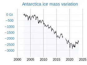
Antarctica contains about 90% of the world's ice. If all of this ice were melted, global sea levels would rise about 58 m (190 ft).[91] In addition, Antarctica stores around 70% of global freshwater as ice.[92] The continent is losing mass due to the increased flow of its glaciers toward the ocean.[93] The loss of mass from Antarctica's ice sheets is partially offset by additional snow falling back onto it.[94] A 2018 systematic review study estimated that ice loss across the entire continent was 43 gigatonnes (Gt) per year on average during the period from 1992 to 2002, but accelerated to an average of 220 Gt per year during the five years from 2012 to 2017.[95] Antarctica's total contribution to sea level rise has been estimated to be 8 to 14 mm (0.31 to 0.55 in).[94][93]
Most of the ice loss has taken place on the Antarctic Peninsula and West Antarctica.[96] Estimates of the mass balance of the East Antarctic Ice Sheet as a whole range from slightly positive to slightly negative.[93][97] Increased ice outflow has been observed in some regions of East Antarctica, particularly at Wilkes Land.[93]
Future projections of ice loss depend on the speed of climate change mitigation and are uncertain. When a certain threshold warming is reached, some parts of the ice sheet may start melting at a significantly faster rate, and become committed to disappearing in the future. If average temperatures were to begin to fall, the ice would not immediately be restored.[98] Some research (2020) suggests that once warming commits the Antarctic ice sheet to a certain level of ice loss, the only way to prevent that loss from happening is through lowering the global temperature to 1 °C (1.8 °F) below the preindustrial level: that is, 2 °C (3.6 °F) below the temperature of 2020.[99] A study published in 2023 projected that ocean warming at about triple the historical rate is likely unavoidable in the 21st century, with no significant difference between mid-range emissions scenarios versus achieving the most ambitious targets of the Paris Agreement—suggesting that greenhouse gas mitigation has limited ability to prevent collapse of the West Antarctic Ice Sheet.[100]
Such warming-dependent, likely to be effectively irreversible changes are examples of tipping points in the climate system: in 2022, a major review had identified 16 likely tipping points, including three in Antarctica. The West Antarctic ice sheet is the most vulnerable of the three, as the review found that it would likely be committed to complete collapse (adding about 3.3 m (10 ft) to sea level rise[102]) at around 1.5 °C (2.7 °F). At best, its collapse may not become inevitable until 3 °C (5.4 °F), but at worst, it may have been already triggered after the warming passed 0.8 °C (1.4 °F) globally. Once triggered, its collapse would unfold over a period of about 2000 years, with the absolute minimum of 500 years, and a potential maximum of 13,000 years.[103][104]
In East Antarctica, the most vulnerable areas of the ice sheet are the so-called subglacial basins, such as Wilkes Basin, which are likely to become committed to collapse around 3 °C (5.4 °F) of global warming: at best, their full collapse may require 6 °C (11 °F), yet at worst, 2 °C (3.6 °F) might be sufficient. Once the warming level is sufficient to commit these subglacial basins to collapse, it could take between 500 and 10,000 years for them to disappear, with the most likely timeline of 2000 years.[103][104] Total ice loss from losing the West Antarctic ice sheet and the East Antarctic subglacial basins would lead to around 6 to 12 meters (20 to 39 feet) of sea level rise.[105] Finally, only very high warming will commit the entire East Antartic ice sheet to collapse: the most likely level is 7.5 °C (13.5 °F), with a range between 5 °C (9.0 °F) and 10 °C (18 °F)), and it would take at least 10,000 years to disappear entirely.[103][104] Another estimate suggested that the loss of two-thirds of its volume may require at least 6 °C (11 °F) of warming.[99]
Ozone depletion
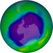
Scientists have studied the ozone layer in the atmosphere above Antarctica since the 1970s. In 1985, British scientists, working on data they had gathered at Halley Research Station on the Brunt Ice Shelf, discovered a large area of low ozone concentration over Antarctica.[106][107] The 'ozone hole' covers almost the whole continent and was at its largest in September 2006;[108] the longest-lasting event occurred in 2020.[109] The depletion is caused by the emission of chlorofluorocarbons and halons into the atmosphere, which causes ozone to break down into other gases.[110] The extreme cold conditions of Antarctica allow polar stratospheric clouds to form. The clouds act as catalysts for chemical reactions, which eventually lead to the destruction of ozone.[111] The 1987 Montreal Protocol has restricted the emissions of ozone-depleting substances. The ozone hole above Antarctica is predicted to slowly disappear; by the 2060s, levels of ozone are expected to have returned to values last recorded in the 1980s.[112]
The ozone depletion can cause a cooling of around 6 °C (11 °F) in the stratosphere. The cooling strengthens the polar vortex and so prevents the outflow of the cold air near the South Pole, which in turn cools the continental mass of the East Antarctic ice sheet. The peripheral areas of Antarctica, especially the Antarctic Peninsula, are then subjected to higher temperatures, which accelerate the melting of the ice.[107] Models suggest that ozone depletion and the enhanced polar vortex effect may also account for the period of increasing sea ice extent, lasting from when observation started in the late 1970s until 2014. Since then, the coverage of Antarctic sea ice has decreased rapidly.[113][114]
Biodiversity
Most species in Antarctica seem to be the descendants of species that lived there millions of years ago. As such, they must have survived multiple glacial cycles. The species survived the periods of extremely cold climate in isolated warmer areas, such as those with geothermal heat or areas that remained ice-free throughout the colder climate.[115]
Animals
Invertebrate life of Antarctica includes species of microscopic mites such as Alaskozetes antarcticus, lice, nematodes, tardigrades, rotifers, krill and springtails. The few terrestrial invertebrates are limited to the sub-Antarctic islands.[116] The flightless midge Belgica antarctica, the largest purely terrestrial animal in Antarctica, reaches 6 mm (1⁄4 in) in size.[117]
Antarctic krill, which congregates in large schools, is the keystone species of the ecosystem of the Southern Ocean, being an important food organism for whales, seals, leopard seals, fur seals, squid, icefish, and many bird species, such as penguins and albatrosses.[118] Some species of marine animals exist and rely, directly or indirectly, on phytoplankton. Antarctic sea life includes penguins, blue whales, orcas, colossal squids and fur seals.[119] The Antarctic fur seal was very heavily hunted in the 18th and 19th centuries for its pelt by seal hunters from the United States and the United Kingdom.[120] Leopard seals are apex predators in the Antarctic ecosystem and migrate across the Southern Ocean in search of food.[121]
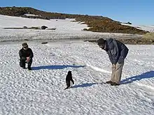
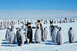
There are approximately 40 bird species that breed on or close to Antarctica, including species of petrels, penguins, cormorants, and gulls. Various other bird species visit the ocean around Antarctica, including some that normally reside in the Arctic.[122] The emperor penguin is the only penguin that breeds during the winter in Antarctica; it and the Adélie penguin breed farther south than any other penguin.[119]
A Census of Marine Life by some 500 researchers during the International Polar Year was released in 2010. The research found that more than 235 marine organisms live in both polar regions, having bridged the gap of 12,000 km (7,456 mi). Large animals such as some cetaceans and birds make the round trip annually. Smaller forms of life, such as sea cucumbers and free-swimming snails also found in both polar oceans. Factors that may aid in their distribution include temperature differences between the deep ocean at the poles and the equator of no more than 5 °C (9 °F) and the major current systems or marine conveyor belts which are able to transport eggs and larva.[123]
Fungi
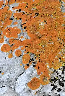
About 1,150 species of fungi have been recorded in the Antarctic region, of which about 750 are non-lichen-forming.[124][125] Some of the species, having evolved under extreme conditions, have colonized structural cavities within porous rocks and have contributed to shaping the rock formations of the McMurdo Dry Valleys and surrounding mountain ridges.[126]
The simplified morphology of such fungi, along with their similar biological structures, metabolism systems capable of remaining active at very low temperatures, and reduced life cycles, make them well suited to such environments. Their thick-walled and strongly melanised cells make them resistant to UV radiation.[126] An Antarctic endemic species, the crust-like lichen Buellia frigida, has been used as a model organism in astrobiology research.[127]
The same features can be observed in algae and cyanobacteria, suggesting that they are adaptations to the conditions prevailing in Antarctica. This has led to speculation that life on Mars might have been similar to Antarctic fungi, such as Cryomyces antarcticus and Cryomyces minteri.[126] Some of the species of fungi, which are apparently endemic to Antarctica, live in bird dung, and have evolved so they can grow inside extremely cold dung, but can also pass through the intestines of warm-blooded animals.[128][129]
Plants
Throughout its history, Antarctica has seen a wide variety of plant life. In the Cretaceous, it was dominated by a fern-conifer ecosystem, which changed into a temperate rainforest by the end of that period. During the colder Neogene (17–2.5 Ma), a tundra ecosystem replaced the rainforests. The climate of present-day Antarctica does not allow extensive vegetation to form.[130] A combination of freezing temperatures, poor soil quality, and a lack of moisture and sunlight inhibit plant growth, causing low species diversity and limited distribution. The flora largely consists of bryophytes (25 species of liverworts and 100 species of mosses). There are three species of flowering plants, all of which are found in the Antarctic Peninsula: Deschampsia antarctica (Antarctic hair grass), Colobanthus quitensis (Antarctic pearlwort) and the non-native Poa annua (annual bluegrass).[131]
Other organisms
Of the 700 species of algae in Antarctica, around half are marine phytoplankton. Multicoloured snow algae are especially abundant in the coastal regions during the summer.[132] Bacteria have been found as deep as 800 m (0.50 mi) under the ice.[133] It is thought to be likely that there exists a native bacterial community within the subterranean water body of Lake Vostok.[134] The existence of life there is thought to strengthen the argument for the possibility of life on Jupiter's moon Europa, which may have water beneath its water-ice crust.[135] There exists a community of extremophile bacteria in the highly alkaline waters of Lake Untersee.[136][137] The prevalence of highly resilient creatures in such inhospitable areas could further bolster the argument for extraterrestrial life in cold, methane-rich environments.[138]
Conservation and environmental protection
.jpg.webp)
The first international agreement to protect Antarctica's biodiversity was adopted in 1964.[139] The overfishing of krill (an animal that plays a large role in the Antarctic ecosystem) led officials to enact regulations on fishing. The Convention for the Conservation of Antarctic Marine Living Resources, an international treaty that came into force in 1980, regulates fisheries, aiming to preserve ecological relationships.[1] Despite these regulations, illegal fishing—particularly of the highly prized Patagonian toothfish which is marketed as Chilean sea bass in the U.S.—remains a problem.[140]
In analogy to the 1980 treaty on sustainable fishing, countries led by New Zealand and the United States negotiated a treaty on mining. This Convention on the Regulation of Antarctic Mineral Resource Activities was adopted in 1988. After a strong campaign from environmental organisations, first Australia and then France decided not to ratify the treaty.[141] Instead, countries adopted the Protocol on Environmental Protection to the Antarctic Treaty (the Madrid Protocol), which entered into force in 1998.[142] The Madrid Protocol bans all mining, designating the continent as a "natural reserve devoted to peace and science".[143]
The pressure group Greenpeace established a base on Ross Island from 1987 to 1992 as part of its attempt to establish the continent as a World Park.[144] The Southern Ocean Whale Sanctuary was established in 1994 by the International Whaling Commission. It covers 50 million km2 (19 million sq mi) and completely surrounds the Antarctic continent. All commercial whaling is banned in the zone, though Japan has continued to hunt whales in the area, ostensibly for research purposes.[145]
Despite these protections, the biodiversity in Antarctica is still at risk from human activities. Specially protected areas cover less than 2% of the area and provide better protection for animals with popular appeal than for less visible animals.[139] There are more terrestrial protected areas than marine protected areas.[146] Ecosystems are impacted by local and global threats, notably pollution, the invasion of non-native species, and the various effects of climate change.[139]
History of exploration
Captain James Cook's ships, HMS Resolution and Adventure, crossed the Antarctic Circle on 17 January 1773, in December 1773, and again in January 1774.[147] Cook came within about 120 km (75 mi) of the Antarctic coast before retreating in the face of field ice in January 1773.[148] In 1775, he called the existence of a polar continent "probable," and in another copy of his journal he wrote: "[I] firmly believe it and it's more than probable that we have seen a part of it".[149]
19th century

Sealers were among the earliest to go closer to the Antarctic landmass, perhaps in the earlier part of the 19th century. The oldest known human remains in the Antarctic region was a skull, dated from 1819 to 1825, that belonged to a young woman on Yamana Beach at the South Shetland Islands. The woman, who was likely to have been part of a sealing expedition, was found in 1985.[150]
The first person to see Antarctica or its ice shelf was long thought to have been the British sailor Edward Bransfield, a captain in the Royal Navy, who discovered the tip of the Antarctic peninsula on 30 January 1820. However, a captain in the Imperial Russian Navy, Fabian Gottlieb von Bellingshausen, recorded seeing an ice shelf on 27 January.[151] The American sealer Nathaniel Palmer, whose sealing ship was in the region at this time, may also have been the first to sight the Antarctic Peninsula.[152]
The First Russian Antarctic Expedition, led by Bellingshausen and Mikhail Lazarev on the 985-ton sloop-of-war Vostok and the 530-ton support vessel Mirny, reached a point within 32 km (20 mi) of Queen Maud Land and recorded sighting an ice shelf at 69°21′28″S 2°14′50″W,[153] on 27 January 1820.[154][note 4] The sighting happened three days before Bransfield sighted the land of the Trinity Peninsula of Antarctica, as opposed to the ice of an ice shelf, and 10 months before Palmer did so in November 1820. The first documented landing on Antarctica was by the American sealer John Davis, apparently at Hughes Bay on 7 February 1821, although some historians dispute this claim, as there is no evidence Davis landed on the Antarctic continent rather than an offshore island.[155][156]
On 22 January 1840, two days after the discovery of the coast west of the Balleny Islands, some members of the crew of the 1837–1840 expedition of the French explorer Jules Dumont d'Urville disembarked on the Dumoulin Islands, off the coast of Adélie Land, where they took some mineral, algae, and animal samples erected the French flag and claimed French sovereignty over the territory.[157] The American captain Charles Wilkes led an expedition in 1838–1839 and was the first to claim he had discovered the continent.[158] The British naval officer James Clark Ross failed to realise that what he referred to as "the various patches of land recently discovered by the American, French and English navigators on the verge of the Antarctic Circle" were connected to form a single continent.[159][160][161][note 5] The American explorer Mercator Cooper landed on East Antarctica on 26 January 1853.[164]
The first confirmed landing on the continental mass of Antarctica occurred in 1895 when the Norwegian-Swedish whaling ship Antarctic reached Cape Adare.[165]
20th century
.jpg.webp)
During the Nimrod Expedition led by the British explorer Ernest Shackleton in 1907, parties led by Edgeworth David became the first to climb Mount Erebus and to reach the south magnetic pole. Douglas Mawson, who assumed the leadership of the Magnetic Pole party on their perilous return, retired in 1931.[166] Between December 1908 and February 1909: Shackleton and three members of his expedition became the first humans to traverse the Ross Ice Shelf, the first to cross the Transantarctic Mountains (via the Beardmore Glacier), and the first to set foot on the south Polar Plateau. On 14 December 1911, an expedition led by Norwegian explorer Roald Amundsen from the ship Fram became the first to reach the geographic South Pole, using a route from the Bay of Whales and up the Axel Heiberg Glacier.[167] One month later, the doomed Terra Nova Expedition reached the pole.[168]
The American explorer Richard E. Byrd led four expeditions to Antarctica during the 1920s, 1930s, and 1940s, using the first mechanised tractors. His expeditions conducted extensive geographical and scientific research, and he is credited with surveying a larger region of the continent than any other explorer.[169] In 1937, Ingrid Christensen became the first woman to step onto the Antarctic mainland.[170] Caroline Mikkelsen had landed on an island of Antarctica, earlier in 1935.[171]
The South Pole was next reached on 31 October 1956, when a U.S. Navy group led by Rear Admiral George J. Dufek successfully landed an aircraft there.[172] Six women were flown to the South Pole as a publicity stunt in 1969.[173][note 6] In the summer of 1996–1997, Norwegian explorer Børge Ousland became the first person to cross Antarctica alone from coast to coast, helped by a kite on parts of the journey.[174] Ousland holds the record for the fastest unsupported journey to the South Pole, taking 34 days.[175]
Population
The first semi-permanent inhabitants of regions near Antarctica (areas situated south of the Antarctic Convergence) were British and American sealers who used to spend a year or more on South Georgia, from 1786 onward. During the whaling era, which lasted until 1966, the population of the island varied from over 1,000 in the summer (over 2,000 in some years) to some 200 in the winter. Most of the whalers were Norwegian, with an increasing proportion from Britain.[176][note 7]
Antarctica's population consists mostly of the staff of research stations in Antarctica (which are continuously maintained despite the population decline in the winter), although there are 2 all-civilian bases in Antarctica: the Esperanza Base and the Villa Las Estrellas base.[177] The number of people conducting and supporting scientific research and other work on the continent and its nearby islands varies from about 1,200 in winter to about 4,800 in the summer, with an additional 136 people in the winter to 266 people in the summer from the 2 civilian bases (as of 2017). Some of the research stations are staffed year-round, the winter-over personnel typically arriving from their home countries for a one-year assignment. The Russian Orthodox Holy Trinity Church at the Bellingshausen Station on King George Island opened in 2004; it is manned year-round by one or two priests, who are similarly rotated every year.[178][179]
The first child born in the southern polar region was a Norwegian girl, Solveig Gunbjørg Jacobsen, born in Grytviken on 8 October 1913.[180] Emilio Marcos Palma was the first person born south of the 60th parallel south and the first to be born on the Antarctic mainland at the Esperanza Base of the Argentine Army.[181]
The Antarctic Treaty prohibits any military activity in Antarctica, including the establishment of military bases and fortifications, military manoeuvres, and weapons testing. Military personnel or equipment are permitted only for scientific research or other peaceful purposes.[182] Operation 90 by the Argentine military in 1965 was conducted to strengthen Argentina's claim in Antarctica.[183]
Politics
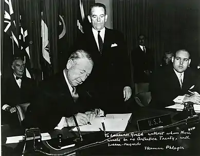
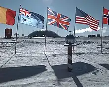
Antarctica's status is regulated by the 1959 Antarctic Treaty and other related agreements, collectively called the Antarctic Treaty System. Antarctica is defined as all land and ice shelves south of 60° S for the purposes of the Treaty System.[1] The treaty was signed by twelve countries, including the Soviet Union, the United Kingdom, Argentina, Chile, Australia, and the United States. Since 1959, a further 42 countries have acceded to the treaty. Countries can participate in decision-making if they can demonstrate that they do significant research on Antarctica; as of 2022, 29 countries have this 'consultative status'.[184] Decisions are based on consensus, instead of a vote. The treaty set aside Antarctica as a scientific preserve and established freedom of scientific investigation and environmental protection.[185]
Territorial claims
%252C_Spain.svg.png.webp)
In 1539, the King of Spain, Charles V, created the Governorate of Terra Australis, which encompassed lands south of the Strait of Magellan and thus theoretically Antarctica,[186] granting this Governorate to Pedro Sancho de la Hoz,[187][188] who in 1540 transferred the title to the conquistador Pedro de Valdivia.[189] Spain claimed all the territories to the south of the Strait of Magellan until the South Pole, with eastern and western borders to these claims specified in the Treaty of Tordesillas and Zaragoza respectively. In 1555 the claim was incorporated to Chile.[190]
In the present, sovereignty over regions of Antarctica is claimed by seven countries.[1] While a few of these countries have mutually recognised each other's claims,[191] the validity of the claims is not recognised universally.[1] New claims on Antarctica have been suspended since 1959, although in 2015, Norway formally defined Queen Maud Land as including the unclaimed area between it and the South Pole.[192]
The Argentine, British, and Chilean claims overlap and have caused friction. In 2012, after the British Foreign & Commonwealth Office designated a previously unnamed area Queen Elizabeth Land in tribute to Queen Elizabeth II's Diamond Jubilee,[193] the Argentine government protested against the claim.[194] The UK passed some of the areas it claimed to Australia and New Zealand after they achieved independence. The claims by Britain, Australia, New Zealand, France, and Norway do not overlap and are recognised by each other.[191] Other member nations of the Antarctic Treaty do not recognize any claim, yet have shown some form of territorial interest in the past.[195]
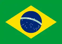 Brazil has a designated 'zone of interest' that is not an actual claim.[196]
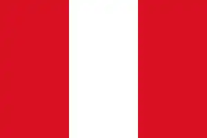 Peru formally reserved its right to make a claim.[195]
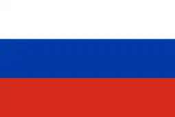 Russia inherited the Soviet Union's right to claim territory under the original Antarctic Treaty.[197]
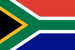 South Africa formally reserved its right to make a claim.[195]
 The United States reserved its right to make a claim in the original Antarctic Treaty.[197]
| Date | Claimant | Territory | Claim limits | Map |
|---|---|---|---|---|
| 1840 | 142°2′E to 136°11′E |  | ||
| 1908 | 80°0′W to 20°0′W
|
 | ||
| 1923 | 160°0′E to 150°0′W |  | ||
| 1931 | 68°50′S 90°35′W | .svg.png.webp) | ||
| 1933 | 44°38′E to 136°11′E, and 142°2′E to 160°00′E | 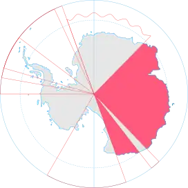 | ||
| 1939 | 20°00′W to 44°38′E | .svg.png.webp) | ||
| 1940 | 90°0′W to 53°0′W
|
 | ||
| 1943 | 74°0′W to 25°0′W
|
 | ||
| – | (Unclaimed territory) | 150°0′W to 90°0′W (except Peter I Island) |
 |
Human activity
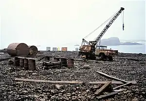
Economic activity and tourism
.jpg.webp)
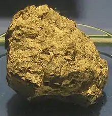
Deposits of coal, hydrocarbons, iron ore, platinum, copper, chromium, nickel, gold, and other minerals have been found in Antarctica, but not in large enough quantities to extract.[198] The Protocol on Environmental Protection to the Antarctic Treaty, which came into effect in 1998 and is due to be reviewed in 2048, restricts the exploitation of Antarctic resources, including minerals.[199]
Tourists have been visiting Antarctica since 1957.[200] Tourism is subject to the provisions of the Antarctic Treaty and Environmental Protocol;[201] the self-regulatory body for the industry is the International Association of Antarctica Tour Operators.[202] Tourists arrive by small or medium ship at specific scenic locations with accessible concentrations of iconic wildlife.[200] Over 74,000 tourists visited the region during the 2019–2020 season, of which 18,500 travelled on cruise ships but did not leave them to explore on land.[203] The numbers of tourists fell rapidly after the start of the COVID-19 pandemic. Some nature conservation groups have expressed concern over the potential adverse effects caused by the influx of visitors and have called for limits on the size of visiting cruise ships and a tourism quota.[204] The primary response by Antarctic Treaty parties has been to develop guidelines that set landing limits and closed or restricted zones on the more frequently visited sites.[205]
Overland sightseeing flights operated out of Australia and New Zealand until the Mount Erebus disaster in 1979, when an Air New Zealand plane crashed into Mount Erebus, killing all of the 257 people on board. Qantas resumed commercial overflights to Antarctica from Australia in the mid-1990s.[206] There are many airports in Antarctica.
Research
.jpg.webp)
In 2017, there were more than 4,400 scientists undertaking research in Antarctica, a number that fell to just over 1,100 in the winter.[1] There are over 70 permanent and seasonal research stations on the continent; the largest, United States' McMurdo Station, is capable of housing more than 1,000 people.[207][208] The British Antarctic Survey has five major research stations on Antarctica, one of which is completely portable. The Belgian Princess Elisabeth station is one of the most modern stations and the first to be carbon-neutral.[209] Argentina, Australia, Chile, and Russia also have a large scientific presence on Antarctica.[1]
Geologists primarily study plate tectonics, meteorites, and the breakup of Gondwana. Glaciologists study the history and dynamics of floating ice, seasonal snow, glaciers, and ice sheets. Biologists, in addition to researching wildlife, are interested in how low temperatures and the presence of humans affect adaptation and survival strategies in organisms.[210] Biomedical scientists have made discoveries concerning the spreading of viruses and the body's response to extreme seasonal temperatures.[211]
The high elevation of the interior, the low temperatures, and the length of polar nights during the winter months all allow for better astronomical observations at Antarctica than anywhere else on Earth. The view of space from Earth is improved by a thinner atmosphere at higher elevations and a lack of water vapour in the atmosphere caused by freezing temperatures.[212] Astrophysicists at the Amundsen–Scott South Pole Station study cosmic microwave background radiation and neutrinos from space.[213] The largest neutrino detector in the world, the IceCube Neutrino Observatory, is at the Amundsen-Scott Station. It consists of around 5,500 digital optical modules, some of which reach a depth of 2,450 m (8,040 ft), that are held in 1 km3 (0.24 cu mi) of ice.[214]
Antarctica provides a unique environment for the study of meteorites: the dry polar desert preserves them well, and meteorites older than a million years have been found. They are relatively easy to find, as the dark stone meteorites stand out in a landscape of ice and snow, and the flow of ice accumulates them in certain areas. The Adelie Land meteorite, discovered in 1912, was the first to be found. Meteorites contain clues about the composition of the Solar System and its early development.[215] Most meteorites come from asteroids, but a few meteorites found in Antarctica came from the Moon and Mars.[216][note 8]
See also
Notes
- The word was originally pronounced with the first c silent in English, but the spelling pronunciation has become common and is often considered more correct. However, the pronunciation with a silent c, and even with the first t silent as well, is widespread and typical of many similar English words.[2] The c had ceased to be pronounced in Medieval Latin and was dropped from the spelling in Old French, but it was added back for etymological reasons in English in the 17th century and thereafter began to be pronounced, but (as with other spelling pronunciations) at first only by less educated people.[3] For those who pronounce the first t, there is also variation between the pronunciations Ant-ar(c)tica and An-tar(c)tica.
- Before the Southern Ocean was recognised as a separate ocean, it was considered to be surrounded by the southern Pacific, Atlantic, and Indian Oceans.[12]
- Geographical features, such as ice caps, are shown as they are today for identification purposes, not as how they appeared at these times.
- The feature discovered by the Russians was the Fimbul ice shelf.
- Ross passed through what is now known as the Ross Sea and discovered Ross Island (both of which were named after him) in 1841. He sailed along a huge wall of ice that was later named the Ross Ice Shelf.[162] Mount Erebus and Mount Terror are named after two ships from his expedition: HMS Erebus and Terror.[163]
- The women were Pam Young, Jean Pearson, Lois Jones, Eileen McSaveney, Kay Lindsay and Terry Tickhill.[173]
- The first settlements included Grytviken, Leith Harbour, King Edward Point, Stromness, Husvik, Prince Olav Harbour, Ocean Harbour and Godthul. Managers and other senior officers of the whaling stations often lived together with their families. Among them was the founder of Grytviken, Captain Carl Anton Larsen, a prominent Norwegian whaler and explorer who, along with his family, adopted British citizenship in 1910.[176]
- Antarctician meteorites, particularly ALH84001 discovered by ANSMET, were at the centre of the controversy about possible evidence of life on Mars. Because meteorites in space absorb and record cosmic radiation, the time elapsed since the meteorite hit the Earth can be calculated.[217]
References
- "Antarctica". The World Factbook. Central Intelligence Agency. 3 May 2022. Archived from the original on 9 May 2022. Retrieved 9 May 2022.
- Antarctica Archived 8 December 2015 at the Wayback Machine. American Heritage Dictionary.
- Crystal 2006, p. 172
- "Antarctic". Oxford English Dictionary (3rd ed.). Oxford University Press. December 2021. Retrieved 17 January 2022. (Subscription or participating institution membership required.)
- Lettinck 2021, p. 158.
- Hyginus 1992, p. 176.
- Scott, Hiatt & McIlroy 2012, pp. 2–3.
- Cawley 2015, p. 130.
- McCrone & McPherson 2009, p. 75.
- Cameron-Ash 2018, p. 20.
- "Highlights from the Bartholomew Archive: The naming of Antarctica". The Bartholomew Archive. National Library of Scotland. Retrieved 23 February 2022.
- "How many oceans are there?". National Oceanic and Atmospheric Administration. Retrieved 11 May 2022.
- Drewry 1983.
- Trewby 2002, p. 115.
- Day 2019, Is all of Antarctica snow-covered?.
- Carroll & Lopes 2019, p. 99.
- Ji, Fei; Gao, Jinyao; Li, Fei; Shen, Zhongyan; Zhang, Qiao; Li, Yongdong (2017). "Variations of the effective elastic thickness over the Ross Sea and Transantarctic Mountains and implications for their structure and tectonics". Tectonophysics. 717: 127–138. Bibcode:2017Tectp.717..127J. doi:10.1016/j.tecto.2017.07.011.
- Fretwell, P.; et al. (28 February 2013). "Bedmap2: improved ice bed, surface and thickness datasets for Antarctica" (PDF). The Cryosphere. 7 (1): 390. Bibcode:2013TCry....7..375F. doi:10.5194/tc-7-375-2013. S2CID 13129041. Retrieved 6 January 2014.
- Lucibella, Michael (21 October 2015). "The Lost Dry Valleys of the Polar Plateau". The Antarctic Sun. United States Antarctic Program. Retrieved 16 January 2022.
- Hallberg, Robert; Sergienko, Olga (2019). "Ice Sheet Dynamics". Geophysical Fluid Dynamics Laboratory. Retrieved 7 February 2021.
- Siegert & Florindo 2008, p. 532.
- Quilty, Patrick G. (2007). "Origin and Evolution of the Sub-Antarctic Islands" (PDF). Papers and Proceedings of the Royal Society of Tasmania. Hobart, Tasmania: University of Tasmania. 141 (1): 35. doi:10.26749/rstpp.141.1.35. ISSN 0080-4703.
- Olierook, Hugo K.H.; Jourdan, Fred; Merle, Renaud E.; Timms, Nicholas E.; et al. (15 April 2016). "Bunbury Basalt: Gondwana breakup products or earliest vestiges of the Kerguelen mantle plume?". Earth and Planetary Science Letters. 440: 20–32. Bibcode:2016E&PSL.440...20O. doi:10.1016/j.epsl.2016.02.008. ISSN 0012-821X.
- Monteath 1997, p. 135.
- Trewby 2002, p. 75.
- Carroll & Lopes 2019, p. 38.
- Hund 2014, pp. 362–363.
- Browne, Malcolm W.; et al. (1995). Antarctic News Clips. National Science Foundation. p. 109. Retrieved 2 February 2021.
- Trewby 2002, p. 92.
- Klages, Johann P.; et al. (April 2020). "Temperate rainforests near the South Pole during peak Cretaceous warmth". Nature. 580 (7801): 81–86. Bibcode:2020Natur.580...81K. doi:10.1038/s41586-020-2148-5. ISSN 1476-4687. PMID 32238944. S2CID 214736648.
- Cantrill & Poole 2012, p. 31.
- Rolland, Yann; et al. (15 January 2019). "Late Paleozoic Ice Age glaciers shaped East Antarctica landscape". Earth and Planetary Science Letters. Elsevier. 506: 125–126. Bibcode:2019E&PSL.506..123R. doi:10.1016/j.epsl.2018.10.044. S2CID 134360219.
- Cantrill & Poole 2012, pp. 57–104, "Collapsing ice sheets and evolving polar forests of the middle to late Paleozoic". doi:10.1017/cbo9781139024990.003
- Vega, Greta; Ángel Olalla-Tárraga, Miguel (2020). "Past changes on fauna and flora distribution". In Oliva, Marc; Ruiz Fernandez, Jesus (eds.). Past Antarctica : paleoclimatology and climate change. London. p. 170. ISBN 978-0-12-817925-3.
{{cite book}}: CS1 maint: location missing publisher (link) - Collinson, James; William R., Hammer (2007). "Migration of Triassic tetrapods to Antarctica". United States Geological Survey. Retrieved 13 February 2022.
- Cantrill & Poole 2012, pp. 105–160, "Icehouse to hothouse: floral turnover, the Permian–Triassic crisis and Triassic vegetation". doi:10.1017/cbo9781139024990.004
- Jasinoski 2013, p. 139.
- Birkenmajer, Krzysztof (1994). "Evolution of the Pacific margin of the northern Antarctic Peninsula: An overview". International Journal of Earth Sciences. 83 (2): 309–321. Bibcode:1994GeoRu..83..309B. doi:10.1007/BF00210547. S2CID 129700054.
- Cantrill & Poole 2012, pp. 9, 35, 56, 71, 185, 314.
- Crame, James Alistair (1989). "Origins and Evolution of the Antarctic Biota". Special Publications. Geological Society of London. 47: 90. doi:10.1144/GSL.SP.1989.047.01.01. S2CID 131433262.
- Riffenburgh 2007, p. 413.
- Smith, Nathan D.; Pol, Diego (2007). "Anatomy of a basal sauropodomorph dinosaur from the Early Jurassic Hanson Formation of Antarctica" (PDF). Acta Palaeontologica Polonica. 52 (4): 657–674.
- Coria, R. A.; Moly, J. J.; Reguero, M.; Santillana, S.; Marenssi, S. (2013). "A new ornithopod (Dinosauria; Ornithischia) from Antarctica". Cretaceous Research. 41: 186–193. Bibcode:2013CrRes..41..186C. doi:10.1016/j.cretres.2012.12.004. hdl:11336/76749.
- Rozadilla, Sebastián; Agnolin, Federico L.; Novas, Novas; Rolando, Alexis M. Aranciaga; et al. (2016). "A new ornithopod (Dinosauria, Ornithischia) from the Upper Cretaceous of Antarctica and its palaeobiogeographical implications". Cretaceous Research. 57: 311–324. Bibcode:2016CrRes..57..311R. doi:10.1016/j.cretres.2015.09.009.
- Ely, Ricardo C.; Case, Judd A. (April 2019). "Phylogeny of A New Gigantic Paravian (Theropoda; Coelurosauria; Maniraptora) From The Upper Cretaceous Of James Ross Island, Antarctica". Cretaceous Research. 101: 1–16. Bibcode:2019CrRes.101....1E. doi:10.1016/j.cretres.2019.04.003. S2CID 146325060.
- Leslie, Mitch (December 2007). "The Strange Lives of Polar Dinosaurs". Smithsonian Magazine. Archived from the original on 30 January 2008. Retrieved 24 January 2008.
- Gaina, Carmen; Müller, R. Dietmar; Brown, Belinda; Ishihara, Takemi; Ivanov, Sergey (July 2007). "Breakup and early seafloor spreading between India and Antarctica". Geophysical Journal International. 170 (1): 151–169. Bibcode:2007GeoJI.170..151G. doi:10.1111/j.1365-246X.2007.03450.x.
- Defler 2019, pp. 185–198
- Gelfo, Javier N.; Goin, Francisco J.; Bauzá, Nicolás; Reguero, Marcelo (30 September 2019). "The fossil record of Antarctic land mammals: Commented review and hypotheses for future research". Advances in Polar Science: 274–292. doi:10.13679/j.advps.2019.0021. Archived from the original on 6 January 2022. Retrieved 15 January 2022.
- Eldridge, Mark D B; Beck, Robin M D; Croft, Darin A; Travouillon, Kenny J; Fox, Barry J (23 May 2019). "An emerging consensus in the evolution, phylogeny, and systematics of marsupials and their fossil relatives (Metatheria)". Journal of Mammalogy. 100 (3): 802–837. doi:10.1093/jmammal/gyz018. ISSN 0022-2372.
- Ball, Philip; Eagles, Graeme; Ebinger, Cynthia; McClay, Ken; Totterdell, Jennifer (2013). "The spatial and temporal evolution of strain during the separation of Australia and Antarctica". Geochemistry, Geophysics, Geosystems. 14 (8): 2771–2799. Bibcode:2013GGG....14.2771B. doi:10.1002/ggge.20160. ISSN 1525-2027. S2CID 11271131.
- England, Matthew H.; Hutchinson, David K.; Santoso, Agus; Sijp, Willem P. (1 August 2017). "Ice–Atmosphere Feedbacks Dominate the Response of the Climate System to Drake Passage Closure". Journal of Climate. American Meteorological Society. 30 (15): 5775. Bibcode:2017JCli...30.5775E. doi:10.1175/JCLI-D-15-0554.1. JSTOR 26388506. S2CID 133542067. Retrieved 30 January 2022.
- DeConto, Robert M.; Pollard, David (16 January 2003). "Rapid Cenozoic glaciation of Antarctica induced by declining atmospheric CO2" (PDF). Nature. 421 (6920): 245–9. Bibcode:2003Natur.421..245D. doi:10.1038/nature01290. PMID 12529638. S2CID 4326971.
- Ashworth, Allan C.; Erwin, Terry L. (2016). "Antarctotrechus balli sp. n. (Carabidae, Trechini): the first ground beetle from Antarctica". ZooKeys (635): 109–122. doi:10.3897/zookeys.635.10535. PMC 5126512. PMID 27917060.
- Trewby 2002, p. 88.
- Poura, Amin Beiranvand; et al. (2018). "Regional geology mapping using satellite-based remote sensing approach in Northern Victoria Land, Antarctica". Polar Science. 16: 23–46. Bibcode:2018PolSc..16...23P. doi:10.1016/j.polar.2018.02.004. ISSN 1873-9652. OCLC 655039871 – via ScienceDirect.
- Stonehouse 2002, p. 116.
- Feldmann, Michael O.; Woodburne, Rodney M., eds. (1988). "Geology and Paleontology of Seymour Island, Antarctic Peninsula". Geological Society of America Bulletin. Boulder, Colorado: Geological Society of America (169): 551. ISBN 9780813711690. ISSN 0016-7606.
- Trewby 2002, pp. 144, 197–198.
- Anderson 2010, p. 28.
- Trewby 2002, p. 71.
- Campbell & Claridge 1987.
- Paxman, Guy J. G.; et al. (27 February 2017). "Uplift and tilting of the Shackleton Range in East Antarctica driven by glacial erosion and normal faulting". Journal of Geophysical Research: Solid Earth. 122 (3): 2390–2408. Bibcode:2017JGRB..122.2390P. doi:10.1002/2016JB013841. S2CID 56243069. Archived from the original on 27 November 2020. Retrieved 4 February 2021.
- Salvini, Francesco; et al. (10 November 1997). "Cenozoic geodynamics of the Ross Sea region, Antarctica: Crustal extension, intraplate strike‐slip faulting, and tectonic inheritance". Journal of Geophysical Research: Solid Earth. 102 (B11): 24669–24696. Bibcode:1997JGR...10224669S. doi:10.1029/97JB01643. Archived from the original on 4 May 2021. Retrieved 4 February 2021.
- Trewby 2002, p. 124.
- Sullivan, Walter (19 December 1976). "Soviet Team Finds a 'Mountain of Iron' in Antarctica". New York Times. Retrieved 14 March 2022.
- Kingston, John (1991). "The Undiscovered Oil and Gas of Antarctica" (PDF). United States Geographical Survey. Santa Barbara, California: United States Department of the Interior. p. 12. Retrieved 5 March 2022.
- Turner, John; et al. (2009). "Record low surface air temperature at Vostok station, Antarctica". Journal of Geophysical Research: Atmospheres. 114 (D24): D24102. Bibcode:2009JGRD..11424102T. doi:10.1029/2009JD012104. ISSN 2156-2202.
- Rice, Doyle (10 December 2013). "Antarctica records unofficial coldest temperature ever". USA Today. Gannett. Retrieved 20 February 2022.
- "Antarctic Weather". Australian Antarctic Program. Government of Australia. 18 February 2019. Retrieved 13 January 2021.
- "Antarctic weather". Australian Antarctic Program. 18 February 2019. Retrieved 2 April 2022.
- Hui, Fengming; Ci, Tianyu; Cheng, Xiao; Scambo, Ted A.; Liu, Yan; Zhang, Yanmei; Chi, Zhaohui; Huang, Huabing; Wang, Xianwei; Wang, Fang; Zhao, Chen (2014). "Mapping blue-ice areas in Antarctica using ETM+ and MODIS data". Annals of Glaciology. 55 (66): 129–137. Bibcode:2014AnGla..55..129H. doi:10.3189/2014AoG66A069. ISSN 0260-3055. S2CID 22195720.
- Fountain, Andrew G.; Nylen, Thomas H.; Monaghan, Andrew; Basagic, Hassan J.; Bromwich, David (7 May 2009). "Snow in the McMurdo Dry Valleys, Antarctica". International Journal of Climatology. Royal Meteorological Society. 30 (5): 633–642. doi:10.1002/joc.1933. S2CID 13190037. Archived from the original on 7 May 2021. Retrieved 12 October 2020 – via Wiley Online Library.
- Rohli & Vega 2018, p. 241.
- Stammerjohn, Sharon E.; Scambos, Ted A. (2020). "Warming reaches the South Pole". Nature Climate Change. 10 (8): 710–711. Bibcode:2020NatCC..10..710S. doi:10.1038/s41558-020-0827-8. ISSN 1758-6798. S2CID 220260051.
- Clem, Kyle R.; Fogt, Ryan L.; Turner, John; Lintner, Benjamin R.; Marshall, Gareth J.; Miller, James R.; Renwick, James A. (2020). "Record warming at the South Pole during the past three decades". Nature Climate Change. 10 (8): 762–770. Bibcode:2020NatCC..10..762C. doi:10.1038/s41558-020-0815-z. ISSN 1758-6798. S2CID 220261150.
- "Antarctica logs highest temperature on record of 18.3C". BBC News. 7 February 2020. Retrieved 20 February 2022.
- Meredith, M.; et al. (2019). "Chapter 3: Polar Regions" (PDF). IPCC Special Report on the Ocean and Cryosphere in a Changing Climate. p. 212.
- Thomas 2007, p. 24.
- Thomas 2007, p. 26.
- Vaughan, D. G.; Comiso, J. C.; Allison, I.; Carrasco, J.; et al. (2013). "Chapter 4: Observations: Cryosphere" (PDF). Intergovernmental Panel on Climate Change Fifth Assessment Report; Working Group 1. p. 330.
- Scott, Michon (28 April 2020). "Understanding climate: Antarctic sea ice extent". NOAA Climate.gov. Retrieved 1 February 2021.
- Meredith, M.; Sommerkorn, M.; Cassotta, S.; Derksen, C.; et al. (2019). "Chapter 3: Polar Regions" (PDF). IPCC Special Report on the Ocean and Cryosphere in a Changing Climate. p. 214.
- Rignot, E.; Casassa, G.; Gogineni, P.; Krabill, W.; Rivera, A.; Thomas, R. (2004). "Accelerated ice discharge from the Antarctic Peninsula following the collapse of Larsen B ice shelf" (PDF). Geophysical Research Letters. 31 (18): L18401. Bibcode:2004GeoRL..3118401R. doi:10.1029/2004GL020697. S2CID 12081378. Archived from the original (PDF) on 23 November 2011. Retrieved 22 October 2011.
- Oppenheimer, M.; et al. (2019). "Chapter 4: Sea Level Rise and Implications for Low Lying Islands, Coasts and Communities" (PDF). IPCC Special Report on the Ocean and Cryosphere in a Changing Climate. Intergovernmental Panel on Climate Change. pp. 346–347.
- Jones, Nicola (19 March 2002). "Giant Antarctic ice sheet breaks off". New Scientist. Retrieved 20 February 2022.
- "Huge Antarctic ice chunk collapses". CNN. Associated Press. 25 March 2008. Archived from the original on 29 March 2008. Retrieved 25 March 2008.
- Walton, Marsha (25 March 2008). "Massive ice shelf on verge of breakup". CNN. Archived from the original on 29 March 2008. Retrieved 26 March 2008.
- "Ice bridge ruptures in Antarctic". BBC News. 5 April 2009. Archived from the original on 6 April 2009. Retrieved 5 April 2009.
- Larter, Robert D. (28 February 2022). "Basal Melting, Roughness and Structural Integrity of Ice Shelves". Geophysical Research Letters. 49 (4). Bibcode:2022GeoRL..4997421L. doi:10.1029/2021GL097421. ISSN 0094-8276. S2CID 247660520.
- Slater, Thomas; Hogg, Anna E.; Mottram, Ruth (October 2020). "Ice-sheet losses track high-end sea-level rise projections". Nature Climate Change. 10 (10): 879–881. Bibcode:2020NatCC..10..879S. doi:10.1038/s41558-020-0893-y. ISSN 1758-6798. S2CID 221381924.
- Riffenburgh 2007, p. 128.
- Rignot, Eric; Mouginot, Jérémie; Scheuchl, Bernd; van den Broeke, Michiel; van Wessem, Melchior J.; Morlighem, Mathieu (2019). "Four decades of Antarctic Ice Sheet mass balance from 1979–2017". Proceedings of the National Academy of Sciences. 116 (4): 1095–1103. Bibcode:2019PNAS..116.1095R. doi:10.1073/pnas.1812883116. ISSN 0027-8424. PMC 6347714. PMID 30642972.
- Bell, Robin E.; Seroussi, Helene (20 March 2020). "History, mass loss, structure, and dynamic behavior of the Antarctic Ice Sheet". Science. 367 (6484): 1321–1325. Bibcode:2020Sci...367.1321B. doi:10.1126/science.aaz5489. ISSN 0036-8075. PMID 32193319. S2CID 213191762.
- Shepherd, Andrew; Ivins, Erik; et al. (IMBIE team) (13 June 2018). "Mass balance of the Antarctic Ice Sheet from 1992 to 2017" (PDF). Nature. 558 (7709): 219–222. Bibcode:2018Natur.558..219I. doi:10.1038/s41586-018-0179-y. hdl:2268/225208. PMID 29899482. S2CID 49188002. Archived from the original (PDF) on 27 January 2019. Retrieved 27 January 2019.
- Fox-Kemper, Baylor; Hewitt, Helene T.; Xiao, Cunde; et al. (2021). "Chapter 9: Ocean, Cryosphere, and Sea Level Change" (PDF). Climate Change 2021: The Physical Science Basis. Contribution of Working Group I to the Sixth Assessment Report of the Intergovernmental Panel on Climate. Cambridge University Press. Section 9.4.2.1.
- Martin‐Español, Alba; Bamber, Jonathan L.; Zammit‐Mangion, Andrew (2017). "Constraining the mass balance of East Antarctica". Geophysical Research Letters. 44 (9): 4168–4175. Bibcode:2017GeoRL..44.4168M. doi:10.1002/2017GL072937. ISSN 1944-8007. S2CID 55221083. Archived from the original on 11 November 2020. Retrieved 3 February 2021.
- Pattyn, Frank; Morlighem, Mathieu (20 March 2020). "The uncertain future of the Antarctic Ice Sheet". Science. 367 (6484): 1331–1335. Bibcode:2020Sci...367.1331P. doi:10.1126/science.aaz5487. ISSN 0036-8075. PMID 32193321. S2CID 213191697.
- Garbe, Julius; Albrecht, Torsten; Levermann, Anders; Donges, Jonathan F.; Winkelmann, Ricarda (2020). "The hysteresis of the Antarctic Ice Sheet". Nature. 585 (7826): 538–544. Bibcode:2020Natur.585..538G. doi:10.1038/s41586-020-2727-5. PMID 32968257. S2CID 221885420.
- Naughten, Kaitlin A.; Holland, Paul R.; De Rydt, Jan (23 October 2023). "Unavoidable future increase in West Antarctic ice-shelf melting over the twenty-first century". Nature Climate Change. doi:10.1038/s41558-023-01818-x.
- Dotto, Tiago S.; Heywood, Karen J.; Hall, Rob A.; et al. (21 December 2022). "Ocean variability beneath Thwaites Eastern Ice Shelf driven by the Pine Island Bay Gyre strength". Nature Communications. 13 (1): 7840. Bibcode:2022NatCo..13.7840D. doi:10.1038/s41467-022-35499-5. PMC 9772408. PMID 36543787.
- "Thwaites Glacier Facts". The International Thwaites Glacier Collaboration. Retrieved 8 July 2023.
- Armstrong McKay, David; Abrams, Jesse; Winkelmann, Ricarda; Sakschewski, Boris; Loriani, Sina; Fetzer, Ingo; Cornell, Sarah; Rockström, Johan; Staal, Arie; Lenton, Timothy (9 September 2022). "Exceeding 1.5°C global warming could trigger multiple climate tipping points". Science. 377 (6611): eabn7950. doi:10.1126/science.abn7950. hdl:10871/131584. ISSN 0036-8075. PMID 36074831. S2CID 252161375.
- Armstrong McKay, David (9 September 2022). "Exceeding 1.5°C global warming could trigger multiple climate tipping points – paper explainer". climatetippingpoints.info. Retrieved 2 October 2022.
- Fox-Kemper, Baylor; Hewitt, Helene T.; Xiao, Cunde; Aðalgeirsdóttir, Guðfinna; et al. (2021). "Chapter 9: Ocean, cryosphere, and sea level change" (PDF). Climate Change 2021: The Physical Science Basis. Section 9.4.2.6.
- Douglass, Anne R.; Newman, Paul A.; Solomon, Susan (1 July 2014). "The Antarctic ozone hole: An update". Physics Today. American Institute of Physics. 67 (7): 42–48. Bibcode:2014PhT....67g..42D. doi:10.1063/PT.3.2449. hdl:1721.1/99159 – via MIT Open Access Articles.
- Schiermeier, Quirin (12 August 2009). "Atmospheric science: Fixing the sky". Nature. 460 (7257): 792–795. doi:10.1038/460792a. PMID 19675624.
- Bates, Sofie (30 October 2020). "Large, Deep Antarctic Ozone Hole Persisting into November". NASA. Retrieved 6 February 2021.
- "Record-breaking 2020 ozone hole closes". World Meteorological Organization. 6 January 2021. Retrieved 6 February 2021.
- "The Ozone Hole". British Antarctic Survey. 1 April 2017. Archived from the original on 4 March 2022. Retrieved 7 May 2022.
- "Q10: Why has an "ozone hole" appeared over Antarctica when ozone-depleting substances are present throughout the stratosphere?" (PDF). 20 Questions: 2010 Update. NOAA. 2010. Retrieved 2 April 2022.
- "World Meteorological Organization Global Ozone Research and Monitoring Project—Report No. 58: Scientific Assessment of Ozone Depletion 2018" (PDF). Scientific Assessment Panel (SAP). ES.3: World Meteorological Organization. Retrieved 20 February 2022.
{{cite web}}: CS1 maint: location (link) - Parkinson, Claire L. (2019). "A 40-y record reveals gradual Antarctic sea ice increases followed by decreases at rates far exceeding the rates seen in the Arctic". Proceedings of the National Academy of Sciences of the United States of America. 116 (29): 14414–14423. Bibcode:2019PNAS..11614414P. doi:10.1073/pnas.1906556116. PMC 6642375. PMID 31262810.
- Chung, Eui-Seok; Kim, Seong-Joong; Timmermann, Axel; Ha, Kyung-Ja; et al. (2022). "Antarctic sea-ice expansion and Southern Ocean cooling linked to tropical variability". Nature Climate Change. 12 (5): 461–468. Bibcode:2022NatCC..12..461C. doi:10.1038/s41558-022-01339-z. ISSN 1758-6798. S2CID 248151959.
- Convey, Peter; Biersma, Elisabeth; Casanova-Katny, Angelica; Maturana, Claudia S. (2020). "Refuges of Antarctic diversity". In Oliva, Marc; Ruiz Fernandez, Jesus (eds.). Past Antarctica : paleoclimatology and climate change. London. pp. 182, 187–188. ISBN 978-0-12-817925-3.
{{cite book}}: CS1 maint: location missing publisher (link) - "Land Animals of Antarctica". British Antarctic Survey. Natural Environment Research Council. Archived from the original on 7 October 2008. Retrieved 25 April 2017.
- Sandro, Luke; Constible, Juanita. "Antarctic Bestiary – Terrestrial Animals". Laboratory for Ecophysiological Cryobiology. Miami University. Retrieved 22 October 2011.
- Trewby 2002, p. 114.
- Ancel, André; Beaulieu, Michaël; Gilbert, Caroline (2013). "The different breeding strategies of penguins: a review". Comptes rendus de l'Académie des Sciences. 336 (1): 1–12. doi:10.1016/j.crvi.2013.02.002. ISSN 0001-4036. PMID 23537764. Retrieved 12 October 2020 – via Elsevier Science Direct.
- Stromberg 1991, p. 247
- Staniland, Iain J.; Ratcliffe, Norman; Trathan, Philip N.; Forcada, Jaume (2018). "Long term movements and activity patterns of an Antarctic marine apex predator: The leopard seal". PLOS ONE. 13 (6): e0197767. Bibcode:2018PLoSO..1397767S. doi:10.1371/journal.pone.0197767. PMC 5988266. PMID 29870541.
- Woods, R.; Jones, H. I.; Watts, J.; Miller, G. D.; Shellam, G. R. (2009). "Diseases of Antarctic Seabirds". Health of Antarctic Wildlife. Springer. pp. 35–55. doi:10.1007/978-3-540-93923-8_3. ISBN 978-3-540-93922-1.
- Kinver, Mark (15 February 2009). "Ice oceans 'are not poles apart'". BBC News. Retrieved 22 October 2011.
- "Plants of Antarctica". British Antarctic Survey. Natural Environment Research Council. Archived from the original on 7 June 2011. Retrieved 12 July 2011.
- Bridge, Paul D.; Spooner, Brian M.; Roberts, Peter J. (2008). "Non-lichenized fungi from the Antarctic region". Mycotaxon. 106: 485–490. Archived from the original on 11 August 2013. Retrieved 22 October 2011.
- Selbmann, L; de Hoog, G S; Mazzaglia, A; Friedmann, E. I.; Onofri, S (2005). "Fungi at the edge of life: cryptoendolithic black fungi from Antarctic desert" (PDF). Studies in Mycology. 51: 1–32.
- Backhaus, Theresa; Meeßen, Joachim; Demets, René; de Vera, Jean-Pierre; Ott, Sieglinde (2019). "Characterization of viability of the lichen Buellia frigida after 1.5 years in space on the International Space Station". Astrobiology. 19 (2): 233–241. Bibcode:2019AsBio..19..233B. doi:10.1089/ast.2018.1894. PMID 30742495. S2CID 73420634.
- de Hoog 2005, p. vii.
- Godinho, Valeria M. (July 2013). "Diversity and bioprospecting of fungal communities associated with endemic and cold-adapted macroalgae in Antarctica". The ISME Journal. Nature Publishing Group. 7 (7): 1434–1451. doi:10.1038/ismej.2013.77. PMC 3695302. PMID 23702515.
- Rees-Owen, Rhian L.; Gill, Fiona L.; Newton, Robert J.; Ivanović, Ruza F.; Francis, Jane E.; Riding, James B.; Vane, Christopher H.; Lopes dos Santos, Raquel A. (2018). "The last forests on Antarctica: Reconstructing flora and temperature from the Neogene Sirius Group, Transantarctic Mountains". Organic Geochemistry. 118: 4–14. Bibcode:2018OrGeo.118....4R. doi:10.1016/j.orggeochem.2018.01.001. ISSN 0146-6380. S2CID 46651929.
- Chwedorzewska, K.J. (2015). "Poa annua L. in the maritime Antarctic: an overview". Polar Record. 51 (6): 637–643. doi:10.1017/S0032247414000916. S2CID 84747627.
- "Algae". Australian Antarctic Program. Government of Australia. Retrieved 24 April 2022.
- Gorman, James (6 February 2013). "Bacteria Found Deep Under Antarctic Ice, Scientists Say". The New York Times. Retrieved 6 February 2013.
- Bulat, Sergey A. (28 January 2016). "Microbiology of the subglacial Lake Vostok: first results of borehole-frozen lake water analysis and prospects for searching for lake inhabitants". Philosophical Transactions of the Royal Society. Abstract: The Royal Society. 374 (2059). Bibcode:2016RSPTA.37440292B. doi:10.1098/rsta.2014.0292. PMID 26667905. S2CID 8399775.
- Raha, Bipasa (2013). "The Search for Earth-Like Habitable Planet: Antarctica Lake Vostok May be Jupiter's Europa". Science and Culture (79): 120–122. ISSN 0036-8156.
- Weisleitner, Klemens; et al. (10 May 2019). Pierre Amato (ed.). "Source Environments of the Microbiome in Perennially Ice-Covered Lake Untersee, Antarctica". Frontiers in Microbiology. 10: 1019. doi:10.3389/fmicb.2019.01019. PMC 6524460. PMID 31134036.
- Hoover, Richard Brice; Pikuta, Elena V. (January 2010). "Psychrophilic and Psychrotolerant Microbial Extremophiles in Polar Environments" (PDF). National Space Science and Technology Center. Microbial Extremophiles from Lake Untersee: NASA: 25–26. Retrieved 30 January 2022.
- Coulter, Dana. Tony Phillips (ed.). "Extremophile Hunt Begins". Science News. NASA. Archived from the original on 23 March 2010. Retrieved 22 October 2011.
- Wauchope, Hannah S.; Shaw, Justine D.; Terauds, Aleks (2019). "A snapshot of biodiversity protection in Antarctica". Nature Communications. 10 (1): 946. Bibcode:2019NatCo..10..946W. doi:10.1038/s41467-019-08915-6. ISSN 2041-1723. PMC 6391489. PMID 30808907.
- "Toothfish fisheries". Convention for the Conservation of Antarctic Marine Living Resources. 2 July 2021. Retrieved 13 January 2021.
- Day 2019, The Antarctic Treaty of 1959.
- "The Madrid Protocol". Australian Antarctic Division. Retrieved 20 February 2022.
- "Protocol on Environmental Protection To The Antarctic Treaty (The Madrid Protocol)". Australian Antarctic Programme. 17 May 2019. Retrieved 8 February 2021.
- "Now you see it now you don't!" (PDF). ECO. Vol. 82, no. 3. November 1992. p. 5. Archived from the original (PDF) on 20 February 2022. Retrieved 20 February 2022.
- "Southern Ocean Whale Sanctuary". Antarctic and Southern Coalition. Archived from the original on 13 January 2022. Retrieved 13 January 2022.
- Coetzee, Bernard W.T.; Convey, Peter; Chown, Steven L. (2017). "Expanding the Protected Area Network in Antarctica is Urgent and Readily Achievable: Expanding Antarctica's protected areas". Conservation Letters. 10 (6): 670–680. doi:10.1111/conl.12342. S2CID 89943276.
- Riffenburgh 2007, p. 296.
- Edwards 1999, p. 250.
- Beaglehole 1968, p. 643.
- Henriques, Martha (22 October 2018). "The bones that could shape Antarctica's fate". BBC Future. Retrieved 22 July 2021.
- Trewby 2002, p. 39.
- Trewby 2002, p. 139.
- Tammiksaar, Erki (14 December 2013). "Punane Bellingshausen" [Red Bellingshausen]. Postimees (in Estonian).
- Armstrong, Terence E. (September 1971). "Bellingshausen and the discovery of Antarctica". Polar Record. 15 (99): 887–889. doi:10.1017/S0032247400062112. S2CID 129664580.
- Baughmann 1994, p. 133
- Joyner 1992, p. 5.
- Trewby 2002, p. 67.
- Tammiksaar, E. (2016). "The Russian Antarctic Expedition under the command of Fabian Gottlieb von Bellingshausen and its reception in Russia and the world". Polar Record. 52 (5): 578–600. doi:10.1017/S0032247416000449. ISSN 0032-2474. S2CID 132425113.
- Cawley 2015, p. 131.
- Ainsworth 1847, p. 479.
- Hobbs, William H. (October 1932). "Wilkes Land Rediscovered". Geographical Review. 22 (4): 640. doi:10.2307/208819. JSTOR 208819 – via JSTOR.
- Trewby 2002, p. 154.
- Trewby 2002, pp. 154, 185.
- Day 2013, p. 88.
- Pyne 2017, p. 85
- "Tannatt William Edgeworth David". Australian Antarctic Division. Archived from the original on 29 September 2010. Retrieved 27 September 2010.
- Riffenburgh 2007, pp. 30–32.
- Trewby 2002, p. 159.
- Trewby 2002, p. 44.
- Blackadder, Jesse (December 2012). "The first woman in Antarctica". Australian Antarctic Program. Australian Antarctic Division. Retrieved 27 June 2016.
- Norman, F. I.; Gibson, J. A. E.; Burgess, J. S. (1998). "Klarius Mikkelsen's 1935 landing in the Vestfold Hills, East Antarctica: some fiction and some facts". Polar Record. Cambridge University Press. 34 (191): 293–304. doi:10.1017/S0032247400025985. S2CID 131433193. Retrieved 21 February 2022.
- "Dates in American Naval History: October". Naval History and Heritage Command. United States Navy. Archived from the original on 26 June 2004. Retrieved 12 February 2006.
- "Pamela Young". Royal Society Te Apārangi. Retrieved 21 February 2022.
- Ousland, Børge (13 December 2013). "Børge Ousland: How I crossed Antarctica alone". The Guardian. ISSN 0261-3077. Retrieved 30 December 2018.
- "Fastest unsupported (kite assisted) journey to the South Pole taking just 34 days". Guinness World Records.
- Headland 1984, p. 238.
- "Antarctica". Resource Library. National Geographic. 4 January 2012. Retrieved 31 August 2020.
- "Flock of Antarctica's Orthodox temple celebrates Holy Trinity Day". Serbian Orthodox Church. 24 May 2004. Archived from the original on 26 August 2016. Retrieved 7 February 2009.
- Владимир Петраков: 'Антарктика – это особая атмосфера, где живут очень интересные люди' [Vladimir Petrakov: "Antarctic is a special world, full of very interesting people"]. Pravoslavye (in Russian). 28 April 2021.
- Headland 1984, pp. 12, 130.
- Russell 1986, p. 17
- "Antarctic Treaty". Scientific Committee on Antarctic Research. Archived from the original on 6 February 2006. Retrieved 9 February 2006.
- "Argentina in Antarctica". Antarctica Institute of Argentina. Archived from the original on 6 March 2006. Retrieved 9 February 2006.
- "Parties". Secretariat of the Antarctic Treaty. Archived from the original on 23 February 2022. Retrieved 2 April 2022.
- Yermakova, Yelena (3 July 2021). "Legitimacy of the Antarctic Treaty System: is it time for a reform?". The Polar Journal. 11 (2): 342–359. doi:10.1080/2154896X.2021.1977048. ISSN 2154-896X. S2CID 239218549.
- Pinochet de la Barra, Óscar (November 1944). La Antártica Chilena. Editorial Andrés Bello.
- Calamari, Andrea (June 2022). "El conjurado que gobernó la Antártida" (in Spanish). Jot Down.
- "Pedro Sancho de la Hoz" (in Spanish). Real Academia de la Historia. Retrieved 25 August 2022.
- "1544" (in Spanish). Biografía de Chile.
- Francisco Orrego Vicuña; Augusto Salinas Araya (1977). Desarrollo de la Antártica (in Spanish). Santiago de Chile: Instituto de Estudios Internacionales, Universidad de Chile; Editorial Universitaria.
{{cite book}}: CS1 maint: multiple names: authors list (link) - Von Tigerstrom & Leane 2005, p. 204.
- Rapp, Ole Magnus (21 September 2015). "Norge utvider Dronning Maud Land helt frem til Sydpolen". Aftenposten (in Norwegian). Oslo. Retrieved 21 February 2022.
- "The Foreign Secretary has announced that the southern part of British Antarctic Territory has been named Queen Elizabeth Land". Foreign & Commonwealth Office. HM Government. 18 December 2012. Retrieved 22 December 2012.
- "Argentina angry after Antarctic territory named after Queen". BBC News. 22 December 2012. Retrieved 22 December 2012.
- Ribadeneira, Diego (1988). "La Antartida" (PDF). AFESE (in Spanish). Archived from the original (PDF) on 7 July 2011. Retrieved 19 July 2011.
- Morris 1988, p. 219
- "Disputes – international". The World Factbook. Central Intelligence Agency. 2011. Archived from the original on 15 September 2020. Retrieved 22 October 2011.
... the US and Russia reserve the right to make claims ...
- "Natural Resources". The World Factbook. Central Intelligence Agency. Archived from the original on 3 April 2022. Retrieved 7 May 2022.
- Press, Tony (5 October 2016). "Antarctica: The Madrid Protocol 25 Years On". Australian Institute of International Affairs. Retrieved 19 January 2022.
- Trewby 2002, pp. 187–188.
- "During Your Visit". International Association of Antarctica Tour Operators. Retrieved 14 February 2022.
- Trewby 2002, p. 107.
- "IAATO Antarctic visitor figures 2019–2020". Data & Statistics. International Association of Antarctica Tour Operators. July 2020. Retrieved 14 February 2022.
- Rowe, Mark (11 February 2006). "Tourism threatens the Antarctic". The Daily Telegraph. Archived from the original on 24 February 2008. Retrieved 5 February 2006.
- "Tourism and Non-Governmental Activities". Secretariat of the Antarctic Treaty. Retrieved 7 February 2022.
- Day 2013, pp. 507–509.
- Hund 2014, p. 41.
- Davis, Georgina (30 January 2017). "A history of McMurdo Station through its architecture". Polar Record. Cambridge University Press. 53 (2): 167–185. doi:10.1017/S0032247416000747. S2CID 132258248 – via Cambridge Core.
- Carroll & Lopes 2019, p. 160.
- Stoddart, Michael (August 2010). "'Antarctic biology in the 21st century – Advances in, and beyond the international polar year 2007–2008'". Polar Science. 4 (2): 97–101. Bibcode:2010PolSc...4...97S. doi:10.1016/j.polar.2010.04.004 – via Elsevier Science Direct.
- "Human Biology and Medicine". Australian Antarctic Programme. 16 September 2020. Retrieved 8 February 2021.
- Burton, Michael G. (2010). "Astronomy in Antarctica". The Astronomy & Astrophysics Review. 18 (4): 417–469. arXiv:1007.2225. Bibcode:2010A&ARv..18..417B. doi:10.1007/s00159-010-0032-2. ISSN 0935-4956. S2CID 16843819.
- "Science Goals: Celebrating a Century of Science and Exploration". National Science Foundation. 2011. Retrieved 19 January 2022.
- "IceCube Quick Facts". IceCube Neutrino Observatory. Retrieved 6 February 2022.
- "Finding Meteorite Hotspots in Antarctica". Earth Observatory. NASA. 9 March 2022. Retrieved 2 April 2022.
- Talbert, Tricia (14 November 2016). "Science from the Sky: NASA Renews Search for Antarctic Meteorites". NASA. Retrieved 2 April 2022.
- "Meteorites from Antarctica". NASA. Archived from the original on 6 March 2006. Retrieved 9 February 2006.
Bibliography
- Ainsworth, William Harrison, ed. (1847). "The Antarctic Voyage of Discovery". The New Monthly Magazine and Humourist. London: Chapman & Hall.
- Anderson, John B. (2010). Antarctic Marine Geology. Cambridge: Cambridge University Press. ISBN 978-05211-3-168-1.
- Baughmann, T. H. (1994). Before the Heroes Came. Lincoln, Nebraska: University of Nebraska Press. ISBN 978-0-8032-1228-2.
- Beaglehole, John C. (1968). The Journals of Captain James Cook on his Voyages of Discovery. Vol. 2. Cambridge: Hakluyt Society. ISBN 978-1-4724-5324-2.
- Cameron-Ash, Margaret (2018). Lying for the Admiralty. Sydney: Rosenberg Publishing. ISBN 978-06480-4-396-6.
- Campbell, I.B.; Claridge, G.G.C., eds. (1987). "2: The Geology and Geomorphology of Antarctica". Antarctica: Soils, Weathering Processes and Environment. Developments in Soil Science. Vol. 16. Amsterdam: Elsevier. doi:10.1016/S0166-2481(08)70150-8. ISBN 978-0-444-42784-7. ISSN 0166-2481.
- Cantrill, David J.; Poole, Imogen (2012). The Vegetation of Antarctica through Geological Time. Cambridge: Cambridge University Press. ISBN 978-1-139-56028-3.
- Carroll, Michael; Lopes, Rosaly (2019). Antarctica : Earth's Own Ice World. Cham, Switzerland: Springer Praxis Books. ISBN 978-3-319-74623-4.
- Cawley, Charles (2015). Colonies in Conflict: The History of the British Overseas Territories. Newcastle: Cambridge Scholars Publishing. ISBN 978-14438-8-128-9.
- Crystal, David (2006). The Fight for English. Oxford: Oxford University Press. ISBN 978-0-19-920764-0.
- Day, David (2013). Antarctica: A Biography. Oxford: Oxford University Press. ISBN 978-0-19-967055-0.
- Day, David (2019). Antarctica: What Everyone Needs to know. Oxford: Oxford University Press. ISBN 978-0-19-064132-0.
- Defler, Thomas (2019). History of Terrestrial Mammals in South America. Topics in Geobiology. Cham: Springer International Publishing. ISBN 978-3-319-98448-3.
- Drewry, D.J., ed. (1983). Antarctica: Glaciological and Geophysical Folio. Cambridge: Scott Polar Research Institute, University of Cambridge. ISBN 978-0-901021-04-5.
- Edwards, Philip, ed. (1999). The Journals of James Cook. London: Penguin Books. ISBN 978-0-14-192808-1.
- Headland, Robert (1984). The Island of South Georgia. Cambridge: Cambridge University Press. ISBN 978-0-521-25274-4.
- de Hoog, G.S. (2005). "Fungi of the Antarctic: evolution under extreme conditions" (PDF). Studies in Mycology. Elsevier. 51. ISBN 9789070351557.
- Hund, Andrew J., ed. (2014). Antarctica And The Arctic Circle: A Geographic Encyclopedia of the Earth's Polar Regions. Vol. 1. ABC-CLIO, LLC. ISBN 978-1-61069-392-9.
- Hyginus, Caius Julius (1992) [1482]. Viré, Ghislaine (ed.). Hygini de astronomia (in Latin). Stuttgart: Bibliotheca Teubneriana. ISBN 978-35190-1-438-6.
- Jasinoski, Sandra C.; et al. (2013). "Anatomical Plasticity in the Snout of Lystrosaurus". In Kammerer, Christian F.; Frobisch, Jörg; Angielczyk, Kenneth D. (eds.). Early Evolutionary History of the Synapsida. Springer Netherlands. ISBN 978-94-007-6841-3.
- Joyner, Christopher C. (1992). Antarctica and the Law of the Sea. Dordrecht: Martinus Nijhoff Publishers. ISBN 978-0-7923-1823-1.
- Lettinck, Paul (2021). Aristotle's Meteorology and Its Reception in the Arab World. Leiden; Boston (Massachusetts): Brill Publishers. ISBN 978-90-04-44917-6.
- McCrone, David; McPherson, Gayle, eds. (2009). National Days: Constructing and Mobilising National Identity. Basingstoke, UK: Palgrave Macmillan. ISBN 978-02302-5-117-5.
- Monteath, Colin (1997). Hall & Ball Kiwi Mountaineers: from Mount Cook to Everest. Christchurch: Cloudcap. ISBN 978-0-938567-42-4.
- Morris, Michael (1988). The Strait of Magellan. Dordrecht; London: Martinus Nijhoff Publishers. ISBN 978-0-7923-0181-3.
- Pyne, Stephen J. (2017). The Ice: A Journey to Antarctica. University of Washington Press. ISBN 978-0-295-80523-8.
- Riffenburgh, Beau, ed. (2007). Encyclopedia of the Antarctic. Vol. 1. New York: Routledge. ISBN 978-1-1358-7866-5.
- Rohli, Robert V.; Vega, Anthony J. (2018). Climatology (4th ed.). Burlington, Massachusetts: Jones & Bartlett Learning. ISBN 978-1-284-12656-3.
- Russell, Alan (1986). McWhirter, Norris (ed.). 1986 Guinness Book of Records. Sterling Publishing. ISBN 978-0-8069-4768-6.
- Scott, Anne W.; Hiatt, Alfred; McIlroy, Claire, eds. (2012). European Perceptions of Terra Australis. Farnham, UK: Ashgate Publishing. ISBN 978-1-4094-3941-7.
- Siegert, Martin; Florindo, Fabio, eds. (2008). Antarctic Climate Evolution. Amsterdam: Elsevier Science. ISBN 978-0-08-093161-6.
- Stromberg, O.; et al. (1991). Nemoto, Takahisa; Mauchline, John (eds.). Marine Biology: Its Accomplishment and Future Prospect. Elsevier Science. ISBN 978-0-444-98696-2.
- Stonehouse, Bernard, ed. (2002). Encyclopedia of Antarctica and the Southern Oceans. Chichester: John Wiley & Sons. ISBN 978-0-471-98665-2.
- Thomas, David Neville (2007). Surviving Antarctica. London: Natural History Museum. ISBN 978-0-565-09217-7.
- Von Tigerstrom, Barbara; Leane, Geoffrey W. G., eds. (2005). International Law Issues in the South Pacific. Aldershot, UK; Burlington, Vermont: Ashgate Publishing. ISBN 978-0-7546-4419-4.
- Trewby, Mary, ed. (2002). Antarctica: An Encyclopedia from Abbott Ice Shelf to Zooplankton. Buffalo, New York: Firefly Books. ISBN 978-1-55297-590-9.
Further reading
- De Pomereu, Jean; and McCahey, Daniella. Antarctica: A History in 100 Objects (Conway, 2022) online book review
- Kleinschmidt, Georg (2021). The geology of the Antarctic continent. Stuttgart: Bornträger Science Publisher. ISBN 978-3-443-11034-5.
- Lucas, Mike (1996). Antarctica. New Holland Publishers. ISBN 978-1-85368-743-3.
- Mardon, Austin Albert; Mardon, Catherine (2009). The use of geographic remote sensing, mapping and aerial photography to aid in the recovery of blue ice surficial meteorites in Antarctica. Edmonton: Golden Meteorite Press. ISBN 978-18974-7-235-4 – via Internet Archive.
- Stewart, John (2011). Antarctica: An Encyclopedia. Jefferson, N.C. and London: McFarland. ISBN 978-0-7864-3590-6.
- Ivanov, Lyubomir; Ivanova, Nusha (2022). The World of Antarctica. Generis Publishing. 241 pp. ISBN 979-8-88676-403-1
External links
- High resolution map (2022) – Reference Elevation Model of Antarctica (REMA)
- Antarctica. on In Our Time at the BBC
- Official website of the Antarctic Treaty Secretariat (de facto government)
- British Antarctic Survey (BAS)
- U.S. Antarctic Program Portal
Continents of Earth | ||||||||
|---|---|---|---|---|---|---|---|---|
| ||||||||
| ||||||||
| ||||||||
.svg.png.webp)
.svg.png.webp)
.svg.png.webp)


.svg.png.webp)
_political.svg.png.webp)
.svg.png.webp)
.svg.png.webp)
.svg.png.webp)