Asara
Asara (Persian: آسارا, also Romanized as Āsārā)[3] is a city in Asara District of Karaj County, Alborz province, Iran. It is located in the Alborz (Elburz) mountain range.
Asara
Persian: آسارا | |
|---|---|
City | |
 Asara | |
| Coordinates: 36°02′15″N 51°11′45″E[1] | |
| Country | Iran |
| Province | Alborz |
| County | Karaj |
| District | Asara |
| Population (2016)[2] | |
| • Total | 1,339 |
| Time zone | UTC+3:30 (IRST) |
At the 2006 census, its population (including the amalgamated villages) was 1,030 in 282 households, when it was in Tehran province. Asara village alone had a population of 430, in 125 households.[4] The city of Asara was formed from the former villages of Asara, Rey Zamin, Sira, and Pol-e Khvab. The latest census of 2016 counted 1,339 people in 452 households, by which time the county had separated from the province and become a part of recently established Alborz province.[2]
References
- OpenStreetMap contributors (25 March 2023). "Asara, Karaj County" (Map). OpenStreetMap. Retrieved 25 March 2023.
- "Census of the Islamic Republic of Iran, 1395 (2016)". AMAR (in Persian). The Statistical Center of Iran. p. 30. Archived from the original (Excel) on 28 January 2020. Retrieved 19 December 2022.
- Asara can be found at GEOnet Names Server, at this link, by opening the Advanced Search box, entering "-3053816" in the "Unique Feature Id" form, and clicking on "Search Database".
- "Census of the Islamic Republic of Iran, 1385 (2006)". AMAR (in Persian). The Statistical Center of Iran. p. 23. Archived from the original (Excel) on 20 September 2011. Retrieved 25 September 2022.
| Capital city | 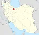 | ||||||||||||
|---|---|---|---|---|---|---|---|---|---|---|---|---|---|
| Counties and cities |
| ||||||||||||
| Sights |
| ||||||||||||
| Populated places | |||||||||||||
| Capital | |||||||||||||||||||||||||
|---|---|---|---|---|---|---|---|---|---|---|---|---|---|---|---|---|---|---|---|---|---|---|---|---|---|
| Districts |
| ||||||||||||||||||||||||
This article is issued from Wikipedia. The text is licensed under Creative Commons - Attribution - Sharealike. Additional terms may apply for the media files.