Asmat Regency
Asmat Regency is a regency (kabupaten) in the northwestern portion of the Indonesian province of South Papua. It is bounded to the southwest by the Arafura Sea, to the southeast and east by Mappi Regency, to the north by Highland Papua Province and to the northwest by Central Papua Province. It was split off from Merauke Regency (of which it had been a part) on 12 November 2002.
Asmat Regency
Kabupaten Asmat | |
|---|---|
Icon of Asmat Regency | |
 Coat of arms | |
| Motto(s): Ja Asamanam Apcamar (Onward with Balance) | |
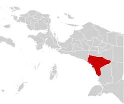 | |
 Asmat Regency Location in Western New Guinea and Indonesia  Asmat Regency Asmat Regency (Indonesia) | |
| Coordinates: 5.3795°S 138.4634°E | |
| Country | |
| Province | South Papua |
| Regency seat | Agats |
| Government | |
| • Regent | Elisa Kambu |
| • Vice Regent | Thomas E. Safanpo |
| Area | |
| • Total | 31,983.44 km2 (12,348.88 sq mi) |
| Population (mid 2022 estimate)[1] | |
| • Total | 113,524 |
| • Density | 3.5/km2 (9.2/sq mi) |
| Demographics | |
| • Religion | Christianism 93,67% –Catholicism 57,70% –Protestantism 35,97% Islam 6,29% Hinduism 0,03% Buddhism 0,01% |
| • Language | Indonesian (official) Asmat, Kamoro (native) Papuan Malay (lingua franca) |
| Time zone | UTC+9 (Indonesia Eastern Time) |
| Area code | (+62) 902 |
| Website | asmatkab.go.id |
Asmat Regency consists of an area of 31,983.44 km2, and had a population of 76,577 at the 2010 Census,[3] 88,373 at the 2015 Intermediate Census,[4] and 110,105 at the 2020 Census,[5] while the official estimate as at mid 2022 was 113,524,[1] mostly from the Asmat ethnic group. The administrative centre of the regency is the town of Agats.
A measles outbreak and famine killed at least 72 people in Asmat regency in early 2018,[6][7] during which 652 children were affected by measles and 223 suffered from malnutrition.[8][9]
Administrative districts
Asmat Regency in 2010 comprised eight districts (distrik), listed below with their areas and their populations at the 2010 Census.[3]
| Name of District (distrik) | Area in km2 | Pop'n 2010 Census |
|---|---|---|
| Pantai Kasuari | 2,297 | 16,026 |
| Fayit | 968 | 7,025 |
| Atsy | 4,282 | 13,838 |
| Suator | 3,205 | 6,453 |
| Akat | 3,057 | 5,375 |
| Agats | 2,963 | 12,905 |
| Sawa Erma | 5,424 | 13,549 |
| Suru-Suru | 1,559 | 1,406 |
However, by 2012 the number of districts had increased to nineteen; the eleven additional districts created in 2011 and 2012 were Kopay, Der Koumur, Safan, Sirets, Ayip, Betcbamu, Kolf Braza, Jetsy, Unir Sirau, Joerat, and Pulau Tiga. In 2016 another four districts were created (Awyu, Aswi, Joutu and Koroway Buluanop), bringing the total to twenty-three districts, comprising 221 administrative villages. The districts are listed below with their areas and their populations at the 2020 Census,[5] together with their official estimates as at mid 2022.[1] The table also includes the locations of the district administrative centres, the number of administrative villages (kampung) in each district, and its post code.
| Name of District (distrik) | Area in km2 | Pop'n 2020 Census | Pop'n mid 2022 Estimate | Admin centre | No. of villages | Post code |
|---|---|---|---|---|---|---|
| Pantai Kasuari | 238.49 | 5,103 | 5,281 | Kamur | 9 | 99773 |
| Kopay | 719.71 | 3,725 | 3,822 | Kawem | 10 | 99772 |
| Der Koumur | 392.83 | 4,089 | 4,136 | Yankap | 6 | 99771 |
| Safan | 685.94 | 6,976 | 7,042 | Primapun | 12 | 99774 |
| Awyu (b) | 729.16 | 2,807 | 2,939 | Wagi | 6 | |
| Fayit | 383.29 | 5,611 | 5,713 | Basim | 13 | 99782 |
| Aswi (a) | 360.54 | 3,782 | 3,979 | Piramat | 10 | |
| Atsy | 1,260.99 | 7,065 | 7,190 | Atsy | 9 | 99775 |
| Sirets | 1,362.07 | 4,365 | 4,459 | Yaosakor | 8 | 99787 |
| Ayip | 872.33 | 2,088 | 2,131 | Comoro | 3 | 99776 |
| Bectbamu | 475.27 | 2,816 | 2,860 | Youw | 7 | 99786 |
| Suator | 949.27 | 3,209 | 3,355 | Binam | 10 | 99792 |
| Kolf Braza | 2,660.19 | 2,779 | 2,868 | Binamzain | 4 | 99791 |
| Joutu (c) | 736.90 | 2,149 | 2,199 | Daikot | 7 | |
| Koroway Buluanop (d) | 773.71 | 1,307 | 1,369 | Mabul | 7 | |
| Akat | 3,488.42 | 5,603 | 5,885 | Ayam | 11 | 99779 |
| Jetsy | 690.49 | 2,611 | 2,688 | Warse | 8 | 99785 |
| Agats | 701.99 | 23,869 | 24,861 | Bis Agats | 12 | 99777 |
| Sawa Erma (e) | 3,084.51 | 6,084 | 6,167 | Sauti | 10 | 99783 |
| Suru-Suru | 2,942.23 | 4,171 | 4,488 | Suru-suru | 23 | 99781 |
| Unir Sirau | 1,093.77 | 3,328 | 3,386 | Komor | 9 | 99780 |
| Joerat | 1,313.71 | 2,990 | 3,051 | Yamas | 6 | 99784 |
| Pulau Tiga | 6,067.63 | 3,579 | 3,655 | Nakai | 11 | 99778 |
| Totals | 31,983.44 | 110,105 | 113,524 | Agats | 221 |
Notes: (a) created in 2016 from part of Ayip District. (b) created in 2016 from part of Fayit District. (c) created in 2016 from part of Suator District. (d) created in 2016 from part of Kolf Braza District. (e) includes 4 offshore islands.
See also
References
- Badan Pusat Statistik, Jakarta, 2023, Kabupaten Asmat Dalam Angka 2023 (Katalog-BPS 1102001.9304)
- "Visualisasi Data Kependudukan-Kementerian Dalam Negeri 2020". www.dukcapil.kemendagri.go.id. Retrieved 9 March 2021.
- Biro Pusat Statistik, Jakarta, 2011.
- Badan Pusat Statistik, Jakarta, 2018.
- Badan Pusat Statistik, Jakarta, 2021.
- News, BBC (13 February 2018). "Indonesia's Papua province children starving in a land of gold". British Broadcasting Corporation. Retrieved 18 March 2019.
{{cite news}}:|last1=has generic name (help) - Salim, Hanz Jimenez (13 April 2018). "Jokowi Mengaku Kesulitan Pindahkan Penduduk Asmat dari Distrik Terpencil". liputan6.com (in Indonesian). Retrieved 7 March 2019.
- Rakhmat, Muhammad Zulfikar; Tarahita, Dikanaya (February 28, 2018). "An Indonesian District Isolated From Development". Asia Sentinel. Retrieved 18 March 2019.
- TEMPO.CO, Jakarta (February 14, 2018). "Tragedy in Asmat". Tempo.co English Edition. Retrieved 18 March 2019.
External links
Regencies and cities of South Papua | ||
|---|---|---|
Capital: Merauke | ||
| Regencies |  | |