Athlone South
Athlone South (Irish: Baile Átha Luain Theas[1]), also called South Athlone,[2] is a barony in County Roscommon, Ireland.[3][4] Baronies were mainly cadastral rather than administrative units.[5] They acquired modest local taxation and spending functions in the 19th century before being superseded by the Local Government (Ireland) Act 1898.[6][7]
Athlone South
Baile Átha Luain Theas (Irish) | |
|---|---|
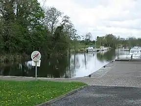
 Lecarrow | |
.jpg.webp) Barony map of County Roscommon, 1900; Athlone barony is in the south, coloured purple, undivided. | |
| Sovereign state | Ireland |
| Province | Connacht |
| County | Roscommon |
| Area | |
| • Total | 322.37 km2 (124.47 sq mi) |
Etymology
Athlone South is named after Athlone town; it contains the western portion of the town, west of the River Shannon, although part of it (seven townlands) has been transferred to County Westmeath.[8]
Geography
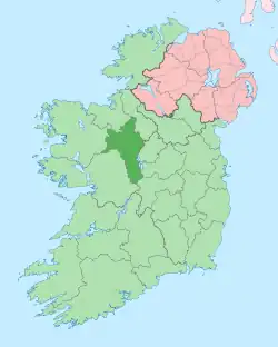
Athlone South is located in the south of County Roscommon, bounded by the River Shannon and Lough Ree to the east and the River Suck to the west.[9]
History
It was originally a single barony with Athlone North; they were separated by 1868.[10][11]
Athlone barony was anciently ruled by the Ó Ceallaigh (O'Kellys), princes of Uí Maine. The Ó Fallúin (O'Fallons) were also a powerful family.[12] It was created from the early medieval cantred of Tyrmany (Tír Maine), and by 1585 it was known as O'Kelly's Country.[13] By the 18th and 19th centuries, it was the seat of the Kellys, Mitchells and Cootes.[14][15][16]
List of settlements
Below is a list of settlements in Athlone South:
- Athlone (western part)
- Bellanamullia
- Brideswell
- Cornafulla
- Curraghboy
- Dysart
- Kiltoom
- Lecarrow
- Taghmaconnell[17]
References
- "Baile Átha Luain Theas/Athlone South". Logainm.ie.
- "Helen Doxford Harris » Helen".
- McDonnell-Garvey, Máire (12 February 1995). Mid-Connacht: The Ancient Territory of Sliabh Lugha. Drumlin Publications. ISBN 9781873437124 – via Google Books.
- Ireland, National Library of (12 February 1965). "Manuscript Sources for the History of Irish Civilisation". G. K. Hall – via Google Books.
- "Property Price Register - Lands at Muff, Barony of Athlone North, Castlecoote, Co. Roscommon". www.myhome.ie.
- General Register Office of Ireland (1904). "Alphabetical index to the baronies of Ireland". Census of Ireland 1901: General topographical index. Command papers. Vol. Cd. 2071. HMSO. pp. 966–978.
- Office, Ireland Public Record (12 February 1891). "Report of the Deputy Keeper of the Public Records and of the Keeper of the State Papers in Ireland: Presented to Both Houses of the Oireachtas". Stationery Office. – via Google Books.
- "Baile Átha Luain Theas/Athlone South". Logainm.ie.
- Connors, Seʹan (12 February 2001). Mapping Ireland: From Kingdoms to Counties. Mercier Press. ISBN 9781856353557 – via Google Books.
- "Naas to Zouch Mill". 12 February 1868 – via Google Books.
- Johnston-Liik, E. M. (12 May 2008). History of the Irish Parliament 1692-1800: Commons, Constituencies and Statutes. Ulster Historical Foundation. ISBN 9781903688717 – via Google Books.
- "The Baronies of Ireland - Family History". sites.rootsweb.com.
- Ó hAisibéil, Liam (2018). "The place-names of Co.Roscommon" (PDF). Archived (PDF) from the original on 3 June 2021 – via ARAN (Access to Research at NUI Galway).
- "Ballinturly". landedestates.ie.
- "Ballyforan". landedestates.ie.
- "Estate Record: Mitchell (Castle Strange)". landedestates.ie.
- "Hidden Treasure". dúchas.ie.
