Aultman, Arizona
Aultman was a settlement now within the town of Camp Verde in Yavapai County, Arizona, United States.[2] It has an estimated elevation of 3,281 feet (1,000 m) above sea level.[1]
Aultman, Arizona | |
|---|---|
Former populated place | |
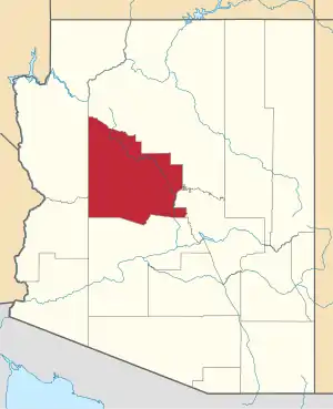
 Aultman, Arizona Location of Aultman in Arizona | |
| Coordinates: 34°36′59″N 111°54′52″W | |
| Country | United States |
| State | Arizona |
| County | Yavapai |
| Elevation | 3,281 ft (1,000 m) |
| Time zone | UTC-7 (Mountain (MST)) |
| • Summer (DST) | UTC-7 (MST) |
| Area code | 928 |
| FIPS code | 04-04675 |
| GNIS feature ID | 25847 |
History
Named after a resident, it had a post office between 1896 and 1916.[3]
In 1910, Aultman was originally planned to be the site of a territorial highway bridge spanning the Verde River. However, a petition circulated in Camp Verde, Arizona, to relocate the highway and bridge to Camp Verde; Camp Verde was selected as the bridge site.[4]
In the 1920s, the Aultman schoolhouse doubled as a polling location.[5]
Aultman's population was 20 in 1940.[6]
References
- "Feature Detail Report for: Aultman". Geographic Names Information System. United States Geological Survey, United States Department of the Interior.
- "Aultman (in Yavapai County, AZ) Populated Place Profile". AZ Hometown Locator. Archived from the original on January 31, 2016. Retrieved January 24, 2016.
- Barnes, Will Croft (1988). Arizona Place Names. Tucson: University of Arizona Press. p. 31. ISBN 0816534950. Retrieved 2020-03-03.
- "Bridge at Verde River: Territorial Highway is to Span the Verde River at Camp Verde Instead of Aultman". Flagstaff Coconino Sun. 1910-08-26. p. 3. Retrieved 2022-11-09.
- "Road Bond Election Precincts". Prescott Weekly Journal Miner. 1920-04-21. p. 2. Retrieved 2022-11-09.
- The Attorneys List. United States Fidelity and Guaranty Company, Attorney List Department. 1940. p. 85.
This article is issued from Wikipedia. The text is licensed under Creative Commons - Attribution - Sharealike. Additional terms may apply for the media files.
