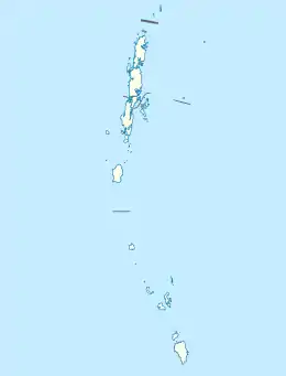
Aves Island (Andaman Islands)
Aves Island is an island of the Andaman Islands. It belongs to the North and Middle Andaman administrative district, part of the Indian union territory of Andaman and Nicobar Islands.[6] The island lies 140 km (87 mi) north from Port Blair.
 Aves Island Location of Aves Island | |
| Geography | |
|---|---|
| Location | Bay of Bengal |
| Coordinates | 12.915°N 92.935°E |
| Archipelago | Andaman Islands |
| Adjacent to | [[Pacific
|
| Area | 0.2 km2 (0.077 sq mi)[1] |
| Length | 3.9 km (2.42 mi) |
| Width | 1.2 km (0.75 mi) |
| Coastline | 2.0 km (1.24 mi) |
| Highest elevation | 63 m (207 ft)[2] |
| Administration | |
| District | North and Middle Andaman |
| Island group | Andaman Islands |
| Island sub-group | Stewart Sound Group |
| Taluk | Diglipur Taluk |
| Demographics | |
| Population | 2 (2016) |
| Pop. density | 10.00/km2 (25.9/sq mi) |
| Ethnic groups | Hindu, Andamanese |
| Additional information | |
| Time zone | |
| PIN | 744202[3] |
| Telephone code | 031927 [4] |
| ISO code | IN-AN-00[5] |
| Official website | www |
| Literacy | 84.4% |
| Avg. summer temperature | 30.2 °C (86.4 °F) |
| Avg. winter temperature | 23.0 °C (73.4 °F) |
| Sex ratio | 1.2♂/♀ |
| Census Code | 35.639.0004 |
| Official Languages | Hindi, English |
History
Aves Lighthouse, was established in 2008. [7]
Geography
The island lies 3.5 km (2 mi) east of Mayabunder. The island is small, having an area of 0.2 km2 (0.077 sq mi).
Administration
Politically, Aves Island is part of Mayabunder Taluk.[8] The island is privately owned by the Co-op Society Ltd. plantation.[9]
Transportation
Aves Island is about 20 mins ride away by Dinghy from Mayabunder jetty. [9]
Demographics
There is only 1 village. According to the 2011 census of India, the Island has 1 households. The effective literacy rate (i.e. the literacy rate of population excluding children aged 6 and below) is 100%.[10]
| Total | Male | Female | |
|---|---|---|---|
| Population | 2 | 2 | 0 |
The residents are farmers growing Paddy, vegetables, coconuts, horticultural crops, spices. [11] [12]
References
- "Islandwise Area and Population - 2011 Census" (PDF). Government of Andaman. Archived from the original (PDF) on 28 August 2017. Retrieved 26 September 2016.
- Sailing Directions (Enroute), Pub. 173: India and the Bay of Bengal (PDF). Sailing Directions. United States National Geospatial-Intelligence Agency. 2017. p. 281.
- "A&N Islands - Pincodes". 22 September 2016. Archived from the original on 23 March 2014. Retrieved 22 September 2016.
{{cite web}}: CS1 maint: bot: original URL status unknown (link) - "STD Codes of Andaman and Nicobar". allcodesindia.in. Retrieved 23 September 2016.
- Registration Plate Numbers added to ISO Code
- "Village Code Directory: Andaman & Nicobar Islands" (PDF). Census of India. Retrieved 16 January 2011.
- "Government of India, Directorate General of Lighthouses and Lightships". www.dgll.nic.in. Retrieved 18 October 2016.
- "DEMOGRAPHIC – A&N ISLANDS" (PDF). andssw1.and.nic.in. Archived from the original (PDF) on 28 August 2017. Retrieved 23 September 2016.
- http://www.knowandamans.com/2011/11/visiting-avis-island-mayabunder.html
- "District Census Handbook - Andaman & Nicobar Islands" (PDF). 2011 Census of India. Directorate of Census Operations, Andaman & Nicobar Islands. Archived from the original (PDF) on 1 August 2015. Retrieved 2015-07-21.
- "crops" (PDF). Archived from the original (PDF) on 21 December 2016. Retrieved 27 September 2016.
- guide
- Geological Survey of India
 Andaman and Nicobar Islands travel guide from Wikivoyage