Moravský Beroun
Moravský Beroun (Czech pronunciation: [ˈmorafskiː ˈbɛroun]; until 1924 Beroun, German: Bärn) is a town in Olomouc District in the Olomouc Region of the Czech Republic. It has about 2,900 inhabitants.
Moravský Beroun | |
|---|---|
.jpg.webp) Centre of Moravský Beroun | |
 Flag 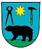 Coat of arms | |
 Moravský Beroun Location in the Czech Republic | |
| Coordinates: 49°47′37″N 17°26′32″E | |
| Country | |
| Region | Olomouc |
| District | Olomouc |
| First mentioned | 1339 |
| Government | |
| • Mayor | Jan Hicz |
| Area | |
| • Total | 51.22 km2 (19.78 sq mi) |
| Elevation | 525 m (1,722 ft) |
| Population (2023-01-01)[1] | |
| • Total | 2,872 |
| • Density | 56/km2 (150/sq mi) |
| Time zone | UTC+1 (CET) |
| • Summer (DST) | UTC+2 (CEST) |
| Postal code | 793 05 |
| Website | www |
Administrative parts
Villages of Čabová, Ondrášov, Nové Valteřice and Sedm Dvorů are administrative parts of Moravský Beroun.
Geography
Moravský Beroun is located about 25 kilometres (16 mi) northeast of Olomouc. It lies in the Nízký Jeseník range. The highest point is at 760 m (2,490 ft) above sea level. The Bystřice River flows through the municipal territory.
History
The first written mention of Beroun is from 1339. It was already referred to as a town and most likely was founded earlier. During the German colonization in the second half of the 16th century, the town became a centre of iron ore mining and processing.[2]
Beroun suffered during the Thirty Years' War. The town did not recover until the end of the 18th century, when weaving production and textile industry were established. In 1872, the railway was built.[2]
Until 1918, Beroun was part of Austria-Hungary, in the Sternberg – Šternberk District, one of the 34 Bezirkshauptmannschaften in Moravia.[3]
In 1938, after the Munich Agreement, it was annexed by Nazi Germany and administered as part of Reichsgau Sudetenland. The German-speaking population was expelled in 1945 according to the Beneš decrees and replaced by Czech settlers.
Demographics
|
|
| ||||||||||||||||||||||||||||||||||||||||||||||||||||||
| Source: Censuses[4][5] | ||||||||||||||||||||||||||||||||||||||||||||||||||||||||
Economy
In the locality of Ondrášov, a mineral spring was discovered in 1260. The water was declared curative in 1357. A factory for bottling of the mineral water known under the name Ondrášovka was founded in the early 20th century.[2]
The successor of the textile industry was the company Granitol, which today deals mainly with the production of plastic technical and packaging foils and welded products from these foils. It is currently the largest manufacturer in its field in the Czech Republic.[2]
Notable people
- Ernst Späth (1886–1946), Austrian chemist
Twin towns – sister cities
Moravský Beroun is twinned with:[6]
 Bieruń, Poland
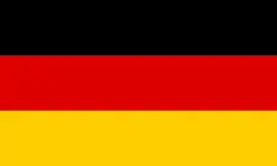 Gundelfingen, Germany
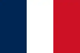 Meung-sur-Loire, France
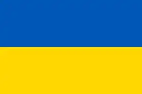 Ostroh, Ukraine
- Scheibenberg, Germany
 Teplička nad Váhom, Slovakia
Gallery
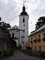 Church of the Assumption of the Virgin Mary
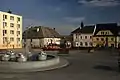 Main square
 Road
Road
References
- "Population of Municipalities – 1 January 2023". Czech Statistical Office. 2023-05-23.
- "O městě" (in Czech). Město Moravský Beroun. Retrieved 2022-01-11.
- Die postalischen Abstempelungen auf den österreichischen Postwertzeichen-Ausgaben 1867, 1883 und 1890, Wilhelm Klein, 1967
- "Historický lexikon obcí České republiky 1869–2011 – Okres Olomouc" (in Czech). Czech Statistical Office. 2015-12-21. pp. 11–12.
- "Population Census 2021: Population by sex". Public Database. Czech Statistical Office. 2021-03-27.
- "Partnerská města" (in Czech). Město Moravský Beroun. Retrieved 2020-09-14.