Baggao
Baggao, officially the Municipality of Baggao (Ibanag: Ili nat Baggao; Ilocano: Ili ti Baggao; Tagalog: Bayan ng Baggao), is a 1st class municipality in the province of Cagayan, Philippines. According to the 2020 census, it has a population of 87,753 people.[3]
Baggao | |
|---|---|
| Municipality of Baggao | |
 Flag  Seal | |
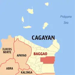 Map of Cagayan with Baggao highlighted | |
OpenStreetMap | |
.svg.png.webp) Baggao Location within the Philippines | |
| Coordinates: 17°56′05″N 121°46′24″E | |
| Country | Philippines |
| Region | Cagayan Valley |
| Province | Cagayan |
| District | 1st district |
| Barangays | 48 (see Barangays) |
| Government | |
| • Type | Sangguniang Bayan |
| • Mayor | Leonardo Pattung. |
| • Vice Mayor | Rowel B. Gazmen. |
| • Representative | Ramon C. Nolasco Jr. |
| • Municipal Council | Members |
| • Electorate | 48,060 voters (2022) |
| Area | |
| • Total | 920.60 km2 (355.45 sq mi) |
| Elevation | 51 m (167 ft) |
| Highest elevation | 172 m (564 ft) |
| Lowest elevation | 8 m (26 ft) |
| Population (2020 census)[3] | |
| • Total | 87,753 |
| • Density | 95/km2 (250/sq mi) |
| • Households | 21,486 |
| Economy | |
| • Income class | 1st municipal income class |
| • Poverty incidence | 13.47 |
| • Revenue | ₱ 395.3 million (2020) |
| • Assets | ₱ 860 million (2020) |
| • Expenditure | ₱ 302.8 million (2020) |
| • Liabilities | ₱ 166.3 million (2020) |
| Service provider | |
| • Electricity | Cagayan 1 Electric Cooperative (CAGELCO 1) |
| Time zone | UTC+8 (PST) |
| ZIP code | 3506 |
| PSGC | |
| IDD : area code | +63 (0)78 |
| Native languages | Ibanag Ilocano Cagayan Agta Dupaningan Agta Tagalog |
History
The name Baggao is derived from the Ibanag verb for washing. According to legend, a Spanish hunter came upon some natives at a brook. Asked what the name of the place was, the natives, thinking that he was asking what they were doing at the time, they responded with abbagaoan (washing place), which was later shortened into Baggao.[5] It was detached from Amulung to become a separate Spanish mission on 27 November 1896.[6]
Geography
Barangays
Baggao is politically subdivided into 48 barangays. Each barangay consists of puroks while some have sitios.
- Adaoag
- Agaman (Norte)
- Agaman (Sur)
- Agaman (Proper)
- Alba
- Annayatan
- Asassi
- Asinga-Via
- Awallan
- Bacagan
- Bagunot
- Barsat East
- Barsat West
- Bitag Grande
- Bitag Pequeño
- Bunugan
- Canagatan
- Carupian
- Catugay
- Poblacion (Centro)
- Dabbac Grande
- Dalin
- Dalla
- Hacienda Intal
- Ibulo
- Immurung
- J. Pallagao
- Lasilat
- Masical
- Mocag
- Nangalinan
- Remus
- San Antonio
- San Francisco
- San Isidro
- San Jose
- San Miguel
- San Vicente
- Santa Margarita
- Santor
- Taguing
- Taguntungan
- Tallang
- Temblique
- Taytay
- Tungel
- Mabini
- Agaman Norte
- Agaman Sur
- C. Verzosa (Valley Cove)
Climate
| Climate data for Baggao, Cagayan | |||||||||||||
|---|---|---|---|---|---|---|---|---|---|---|---|---|---|
| Month | Jan | Feb | Mar | Apr | May | Jun | Jul | Aug | Sep | Oct | Nov | Dec | Year |
| Average high °C (°F) | 24 (75) |
25 (77) |
28 (82) |
31 (88) |
31 (88) |
31 (88) |
30 (86) |
30 (86) |
29 (84) |
28 (82) |
26 (79) |
24 (75) |
28 (83) |
| Average low °C (°F) | 20 (68) |
20 (68) |
21 (70) |
23 (73) |
24 (75) |
24 (75) |
24 (75) |
24 (75) |
24 (75) |
23 (73) |
23 (73) |
21 (70) |
23 (73) |
| Average precipitation mm (inches) | 150 (5.9) |
106 (4.2) |
84 (3.3) |
48 (1.9) |
103 (4.1) |
115 (4.5) |
134 (5.3) |
156 (6.1) |
136 (5.4) |
240 (9.4) |
246 (9.7) |
300 (11.8) |
1,818 (71.6) |
| Average rainy days | 19 | 14.3 | 12.8 | 10.8 | 17.7 | 18.9 | 21.5 | 23.3 | 22.1 | 20.4 | 20.3 | 22.2 | 223.3 |
| Source: Meteoblue[7] | |||||||||||||
Demographics
|
| |||||||||||||||||||||||||||||||||||||||||||||||||||
| Source: Philippine Statistics Authority[8][9][10][11] | ||||||||||||||||||||||||||||||||||||||||||||||||||||
In the 2020 census, the population of Baggao, Cagayan, was 87,753 people,[3] with a density of 95 inhabitants per square kilometre or 250 inhabitants per square mile.
Economy
Government
Local government
Baggao, belonging to the first legislative district of the province of Cagayan, is governed by a mayor designated as its local chief executive and by a municipal council as its legislative body in accordance with the Local Government Code. The mayor, vice mayor, and the councilors are elected directly by the people through an election which is being held every three years.
Elected officials
| Position | Name |
|---|---|
| Congressman | Ramon C. Nolasco Jr. |
| Mayor | Leonardo c. Pattung |
| Vice-Mayor | Rowel B. Gazmen |
| Councilors | Mariano L. Miguel Jr. |
| Arnel R. Atalip | |
| Jaime E. Ramos Jr. | |
| Virginia Loreta T. Herrero | |
| Lilibeth C. Ulep | |
| Roy F. Dumayag | |
| Oscar D. Buraga Jr. | |
| Edmundo B. Delos Santos Jr. | |
Education
The Schools Division of Cagayan governs the town's public education system.[20] The division office is a field office of the DepEd in Cagayan Valley region.[21] The office governs the public and private elementary and public and private high schools throughout the municipality.
References
- Municipality of Baggao | (DILG)
- "2015 Census of Population, Report No. 3 – Population, Land Area, and Population Density" (PDF). Philippine Statistics Authority. Quezon City, Philippines. August 2016. ISSN 0117-1453. Archived (PDF) from the original on May 25, 2021. Retrieved July 16, 2021.
- Census of Population (2020). "Region II (Cagayan Valley)". Total Population by Province, City, Municipality and Barangay. Philippine Statistics Authority. Retrieved 8 July 2021.
- "PSA Releases the 2018 Municipal and City Level Poverty Estimates". Philippine Statistics Authority. 15 December 2021. Retrieved 22 January 2022.
- de Rivera Castillet, Ed. Cagayan Province and her People. Community Publishers.
- Salgado, Pedro. "Other Missions in Cagayan Province". Cagayan Valley and Easter Cordillera: 1581-1898, Volume I. Rex Publishing. p. 359.
- "Baggao, Cagayan: Average Temperatures and Rainfall". Meteoblue. Retrieved 27 October 2018.
- Census of Population (2015). "Region II (Cagayan Valley)". Total Population by Province, City, Municipality and Barangay. Philippine Statistics Authority. Retrieved 20 June 2016.
- Census of Population and Housing (2010). "Region II (Cagayan Valley)". Total Population by Province, City, Municipality and Barangay. National Statistics Office. Retrieved 29 June 2016.
- Censuses of Population (1903–2007). "Region II (Cagayan Valley)". Table 1. Population Enumerated in Various Censuses by Province/Highly Urbanized City: 1903 to 2007. National Statistics Office.
- "Province of Cagayan". Municipality Population Data. Local Water Utilities Administration Research Division. Retrieved 17 December 2016.
- "Poverty incidence (PI):". Philippine Statistics Authority. Retrieved December 28, 2020.
- "Estimation of Local Poverty in the Philippines" (PDF). Philippine Statistics Authority. 29 November 2005.
- "2003 City and Municipal Level Poverty Estimates" (PDF). Philippine Statistics Authority. 23 March 2009.
- "City and Municipal Level Poverty Estimates; 2006 and 2009" (PDF). Philippine Statistics Authority. 3 August 2012.
- "2012 Municipal and City Level Poverty Estimates" (PDF). Philippine Statistics Authority. 31 May 2016.
- "Municipal and City Level Small Area Poverty Estimates; 2009, 2012 and 2015". Philippine Statistics Authority. 10 July 2019.
- "PSA Releases the 2018 Municipal and City Level Poverty Estimates". Philippine Statistics Authority. 15 December 2021. Retrieved 22 January 2022.
- "2019 National and Local Elections" (PDF). Commission on Elections. Retrieved March 10, 2022.
- "History of DepED SDO Cagayan". DepED SDO Cagayan | Official Website of DepED SDO Cagayan. Retrieved March 13, 2022.
- "DEPED REGIONAL OFFICE NO. 02". DepED RO2 | The official website of DepED Regional Office No. 02. Archived from the original on 2022-04-12. Retrieved 2022-03-12.
External links
Places adjacent to Baggao | |
|---|---|
Tuguegarao (capital and largest city) | |
| Municipalities | |
| Component city | |
| Barangays | |