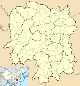
Baima, Hunan
Baima (simplified Chinese: 白马; traditional Chinese: 白馬; pinyin: Báimǎ; lit. 'white horse') is a town under the administration of Lianyuan City in central Hunan province, China,[1] situated about 13 kilometres (8.1 mi) to the south-southeast of downtown Lianyuan. As of 2020, it has two residential communities (社区) and 23 villages under its administration.[2]
Baima
白马镇 | |
|---|---|
 Baima Location in Hunan | |
| Coordinates: 27°34′30″N 111°41′55″E | |
| Country | People's Republic of China |
| Province | Hunan |
| Prefecture-level city | Loudi |
| County-level city | Lianyuan |
| Village-level divisions | 3 residential communities 22 villages |
| Elevation | 166 m (545 ft) |
| Time zone | UTC+8 (China Standard) |
| Area code | 0738 |
Administrative division
The town is divided into 22 villages and three communities, including:
- Tianxinping Community (田心坪社区)
- Baima Community (白马社区)
- Luojiaping Community (罗家坪社区)
- Zhaojia Village (赵家村)
- Sanxie Village (三协村)
- Xunan Village (徐南村)
- Yuxi Village (郁溪村)
- Niujiaoshan Village (牛角山村)
- Quantang Village (泉塘村)
- Zoujia Village (邹家村)
- Hongtian Village (洪田村)
- Geshan Village (隔山村)
- Lujiangbian Village (卢江边村)
- Santuan Village (三团村)
- Jiangxi Village (浆溪村)
- Sunjiaqiao Village (孙家桥村)
- Jianxin Village (建新村)
- Xianxiu Village (咸秀村)
- Hongquan Village (洪泉村)
- Guangyuan Village (广源村)
- Tenglong Village (腾龙村)
- Taolintang Village (桃林堂村)
- Tongbai Village (桐柏村)
- Jinbian Village (金边村)
- Wenhua Village (文化村)
References
- 2020年统计用区划代码和城乡划分代码:涟源市 (in Chinese). National Bureau of Statistics of the People's Republic of China. Retrieved 7 January 2021.
- 2020年统计用区划代码和城乡划分代码:白马镇 (in Chinese). National Bureau of Statistics of the People's Republic of China. Retrieved 7 January 2021.
This article is issued from Wikipedia. The text is licensed under Creative Commons - Attribution - Sharealike. Additional terms may apply for the media files.