Balitai
Balitai Town (simplified Chinese: 八里台镇; traditional Chinese: 八里台鎮; pinyin: Bālǐtái Zhèn) is a town in southwestern Jinnan District, Tianjin, China. It is located to the south of Haitang Subdistrict and Xinzhuang Town, west of Xiaozhan and Beizhakou Towns, north of Zhongtang Town, as well as east of Dasi and Wangwenzhuang Towns. It also contains an exclave of Beizhakou Town in the eastern portion. In 2010, the town is home to 59,177 inhabitants.[1]
Balitai Town
八里台镇 | |
|---|---|
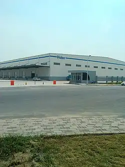
 Hai'er Logistic Center inside the town, 2012 | |
.png.webp) Location in Jinnan District | |
 Balitai Town  Balitai Town | |
| Coordinates: 38°56′40″N 117°18′36″E | |
| Country | |
| Municipality | Tianjin |
| District | Jinnan |
| Village-level Divisions | 12 communities 15 villages |
| Area | |
| • Total | 103.2 km2 (39.8 sq mi) |
| Elevation | 3 m (10 ft) |
| Population (2010) | |
| • Total | 59,177 |
| • Density | 570/km2 (1,500/sq mi) |
| Time zone | UTC+8 (CST) |
| Postal code | 300356 |
| Area code | 022 |
The name "Balitai" literally means "Eight Li Platform".
History
| Time | Status | Within |
|---|---|---|
| Qing Dynasty | Jinghai County, Hejian Prefecture | |
| 1912 - 1948 | Tianjin County | |
| 1948 - 1949 | Part of 1st District | |
| 1949 - 1953 | Part of 6th District | |
| 1953 - 1956 | Xiqing District, Tianjin | |
| 1956 - 1959 | Xi Xiaozhan Township | |
| 1959 - 1961 | Part of Xiaozhan People's Commune | Hexi District, Tianjin |
| 1961 - 1984 | Balitai People's Commune | Nanjiao District, Tianjin |
| 1984 - 1986 | Balitai Township Xi Xiaozhan Township | |
| 1986 - 1992 | Balitai Township Shuangzha Township | |
| 1992 - 1995 | Balitai Town Shuangzha Township |
Jinnan District, Tianjin |
| 1995 - 2001 | Balitai Town Shuangzha Town | |
| 2001 - present | Balitai Town |
Administrative divisions
At the end of 2022, there are 27 subdivisions within Balitai Town, consisting of 12 residential communities and 15 villages. They are listed as follows:[3]
Communities
- Xinchun (新春)
- Balifang (八里坊)
- Bigui Yuan Diyi (碧桂园第一)
- Jinjiao (金桥)
- Pinhu Yuan (品湖苑)
- Haitian (海天)
- Lanhai (澜海)
- Bigui Yuan Di'er (碧桂园第二)
- Shuanghui Yuan (双辉园)
- Huixiu Tingyuan (汇秀庭苑)
- Balitai Gongye Yuanqu
(八里台工业园区) - Taida Weidianzi Gongye Qu
(泰达微电子工业区)
Villages
- Balitai (八里台)
- Juge Zhuang (巨葛庄)
- Dasun Zhuang (大孙庄)
- Dahan Zhuang (大韩庄)
- Tuanwa (团洼)
- Xi Xiaozhan (西小站)
- Xiaohuang Zhuang (小黄庄)
- Heshundi (和顺地)
- Pan Jiawa (潘家洼)
- Shuangzha (双闸)
- Zhong Yi (中义)
- Nan Yi (南义)
- Mao Jiagou (毛家沟)
- Liu Jiagou (刘家沟)
- Bei Zhongtang (北中塘)
References
- "China: Tiānjīn Municipal Province (Districts and Townships) - Population Statistics, Charts and Map". www.citypopulation.de. Retrieved 2023-04-09.
- Zhonghua Renmin Gongheguo zheng qu da dian. Tianjin juan (Di 1 ban ed.). Beijing. 2020. ISBN 978-7-5087-6215-9. OCLC 1351675957.
{{cite book}}: CS1 maint: location missing publisher (link) - "2022年统计用区划代码和城乡划分代码" [2022 Statistical Division Codes and Urban-rural Differentiation Codes]. www.stats.gov.cn (in Chinese). Archived from the original on 2023-03-21.
This article is issued from Wikipedia. The text is licensed under Creative Commons - Attribution - Sharealike. Additional terms may apply for the media files.