Baneh
Baneh (Persian: بانه), also Romanized as Bāneh);[3] (Kurdish: بانە), also Romanized as Bane,[4][5] is a city in the Central District of Baneh County, Kurdistan province, Iran, and serves as both capital of the district and of the county. Baneh is approximately 30 km (18 miles) from Kurdistan Region in Iraq.
Baneh
Persian: بانه | |
|---|---|
City | |
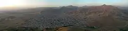 Panorama view of Baneh | |
 Baneh .svg.png.webp) Baneh | |
| Coordinates: 35°59′49″N 45°53′07″E[1] | |
| Country | |
| Province | Kurdistan |
| County | Baneh |
| District | Central |
| Area | |
| • Total | 1,584.5 km2 (611.8 sq mi) |
| Elevation | 1,554 m (5,098 ft) |
| Population (2016)[2] | |
| • Total | 110,218 |
| • Density | 70/km2 (180/sq mi) |
| Time zone | UTC+3:30 (IRST) |
| Area code | 087-342 |
| Website | www |
At the 2006 National Census, its population was 69,635 in 15,857 households.[6] The following census in 2011 counted 85,190 people in 22,149 households.[7] The latest census in 2016 showed a population of 110,218 people in 30,743 households.[2] After the cities of Sanandaj, Marivan and Saqqez.
History
Historically, Baneh had a strategic and political importance due to its close proximity to the Ottoman Empire. The city was part of the three Kurdish principalities; Ardalan, Baban and Mokryan.[8]
The old city had two citadels and was generally ruled by the Eḵtīār-al-Dīn family who held both religious and secular power of the city. The family was held in high steem during the Safavid era and received the title 'sultan'. Moreover, rulers of Baneh had the responsibility of protecting the whole area from Khoy to Kermanshah. In the 16th century, Mīrzā Beg b. Mīr Moḥammad became the first virtually independent ruler of Baneh and its surroundings.[8]
During the 18th and 19th centuries, the city was plagued with epidemics which killed a large portion of the population. In 1944, the city experienced turmoil as part of the Hama Rashid revolt and was also bombed by both parties during the Iran–Iraq War in the 1980s. Most locals fled to Iraq during the war and much of the region was destroyed.[8]
People
- Ebrahim Younesi, writer and translator
- Bahman Ghobadi, director and writer
- Ata Nahaei, novelist and translator
- Ebrahim Alipour, photographer
- Keywan Karimi, director
Gallery
 View of the city from Dokanan Park
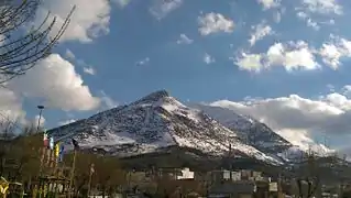 View of Arbaba on a winter's day
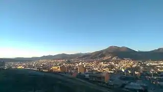
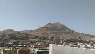 Baneh by day
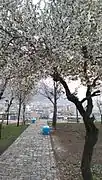 Shahr Park in spring
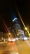 Haleh International 5-Star hotel
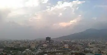 Behesht Shopping Center
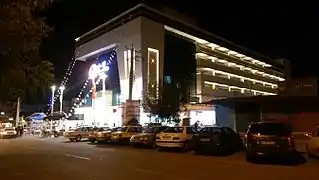 Aftab Derakhshan shopping center
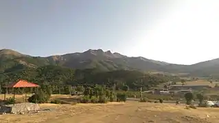 Sooren plain and forest
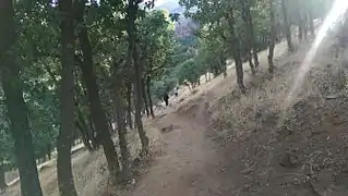 Arbaba forest
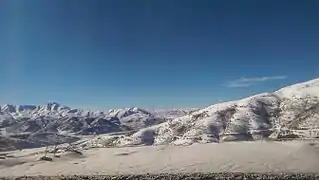 Snow covered Kali Khan
References
- OpenStreetMap contributors (16 August 2023). "Baneh, Baneh County" (Map). OpenStreetMap. Retrieved 16 August 2023.
- "Census of the Islamic Republic of Iran, 1395 (2016)". AMAR (in Persian). The Statistical Center of Iran. p. 12. Archived from the original (Excel) on 8 May 2022. Retrieved 19 December 2022.
- Baneh can be found at GEOnet Names Server, at this link, by opening the Advanced Search box, entering "-3055216" in the "Unique Feature Id" form, and clicking on "Search Database".
- "ئێوەش پشتیوانی ماڵی ڕێکخراوی مافی مرۆڤیی"هەنگاو" بن" (in Kurdish). Retrieved 21 March 2020.
- "Hengaw- Li devera Bane ya Rojhilatê Kurdistanê kolberekî kurd di encama êrişa pasdarên Îranê de hat kuştin" (in Kurdish). Retrieved 21 March 2020.
- "Census of the Islamic Republic of Iran, 1385 (2006)". AMAR (in Persian). The Statistical Center of Iran. p. 12. Archived from the original (Excel) on 20 September 2011. Retrieved 25 September 2022.
- "Census of the Islamic Republic of Iran, 1390 (2011)" (Excel). Iran Data Portal (in Persian). The Statistical Center of Iran. p. 12. Retrieved 19 December 2022.
- Marduk, A. (1988). "BĀNA". Encyclopedia Iranica.
Kurdistan Province, Iran | |||||||||||||||||||||
|---|---|---|---|---|---|---|---|---|---|---|---|---|---|---|---|---|---|---|---|---|---|
| Capital |  | ||||||||||||||||||||
| Counties and cities |
| ||||||||||||||||||||
| Sights |
| ||||||||||||||||||||
| populated places | |||||||||||||||||||||