Bapska
Bapska (Hungarian: Babafalva, German: Bapskau) is a village in Croatia.
Bapska | |
|---|---|
 | |
 Bapska 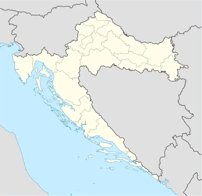 Bapska  Bapska | |
| Coordinates: 45°11′50″N 19°15′45″E | |
| Country | |
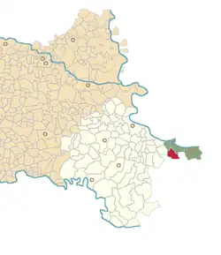
| County | |
| Municipality | Ilok |
| Area | |
| • Total | 26.5 km2 (10.2 sq mi) |
| Elevation | 147 m (482 ft) |
| Population (2021)[2] | |
| • Total | 658 |
| • Density | 25/km2 (64/sq mi) |
| Time zone | UTC+1 (CET) |
| • Summer (DST) | UTC+2 (CEST) |
| Postal code | 32235 Bapska |
| Area code | +385 0(32) |
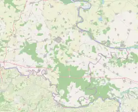
Geography
It is located south of Šarengrad (at the D2 highway) and north of Šid, Serbia.
History
In 1664 the village was raided by the Ottoman forces but was subsequently resettled.[3] The old village of Bapska was in 1730s located about two kilometres south from the contemporary village in the location know today as the Stars Bapska (Old Bapska).[3]
Demographics
According to the 2011 census, Bapska had 928 inhabitants.[4]
| Population[5] | |||||||||||||||
|---|---|---|---|---|---|---|---|---|---|---|---|---|---|---|---|
| 1857 | 1869 | 1880 | 1890 | 1900 | 1910 | 1921 | 1931 | 1948 | 1953 | 1961 | 1971 | 1981 | 1991 | 2001 | 2011 |
| 1,090 | 1,275 | 1,256 | 1,447 | 1,504 | 1,642 | 1,784 | 1,752 | 1,769 | 1,784 | 1,948 | 1,944 | 1,699 | 1,624 | 1,313 | 928 |
1991 census
| Bapska[6] |
|---|
| 1991 |
total: 1,624 others 1 (0.06%) nondeclared 3 (0.18%) regionally declared 1 (0.06%) unknown 27 (1.66%)
|
1910 census
| Bapska[7] | |
|---|---|
| Population by language | Population by religion |
total: 1,642 - (-%) - (-%)
| |
Note: Together with former settlement of Novak.
References
- Register of spatial units of the State Geodetic Administration of the Republic of Croatia. Wikidata Q119585703.
- "Population by Age and Sex, by Settlements, 2021 Census". Census of Population, Households and Dwellings in 2021. Zagreb: Croatian Bureau of Statistics. 2022.
- Mirko Marković (2003). Istočna Slavonija: Stanovništvo i naselja. Zagreb: Naklada Jesenski i Turk. p. 53. ISBN 9532221239.
- "Naslovna".
- - Republika Hrvatska - Državni zavod za statistiku: Naselja i stanovništvo Republike Hrvatske 1857.-2001.
- Book: "Ethnic and religious composition of population of Croatia, 1880-1991: by settlements", author: Jakov Gelo, publisher: Zagreb, Croatian bureau of statistics, 1998., ISBN 953-6667-07-X, ISBN 978-953-6667-07-9;
- Book: "Ethnic and religious composition of population of Croatia, 1880-1991: by settlements", author: Jakov Gelo, publisher: Zagreb, Croatian bureau of statistics, 1998., ISBN 953-6667-07-X, ISBN 978-953-6667-07-9;
External links
Wikimedia Commons has media related to Bapska.
Villages of Vukovar-Syrmia County | ||
|---|---|---|
| Villages administered as part of cities |  | |
| Villages serving as municipal seat (other villages in municipality) | ||
This article is issued from Wikipedia. The text is licensed under Creative Commons - Attribution - Sharealike. Additional terms may apply for the media files.