Barossa Council
Barossa Council is a local government area in the Barossa Valley in South Australia. The council area covers 912 square kilometres, and had a population of over 23,000 in the 2016 Census.
| Barossa District Council South Australia | |||||||||||||||
|---|---|---|---|---|---|---|---|---|---|---|---|---|---|---|---|
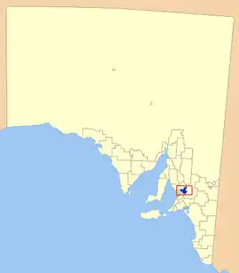 The location of the Barossa Council in blue | |||||||||||||||
| Population | 25,066 (LGA 2021)[1] | ||||||||||||||
| Established | 1996 | ||||||||||||||
| Area | 912 km2 (352.1 sq mi) | ||||||||||||||
| Mayor | Michael "Bim" Lange [2] | ||||||||||||||
| Council seat | Nuriootpa | ||||||||||||||
| Region | Barossa Light and Lower North[3] | ||||||||||||||
| State electorate(s) | Schubert | ||||||||||||||
| Federal division(s) | |||||||||||||||
| Website | Barossa District Council | ||||||||||||||
| |||||||||||||||
History
Barossa Council was created in July 1996, following the amalgamation of the District Council of Angaston, the District Council of Barossa and the District Council of Tanunda. The council gained a portion of the former District Council of Mount Pleasant in July 1997.[4]
Description
Townships in the council area include
Mayors
- Brian Hurn - 1996-2014
- Bob Sloane - 2014-2018
- Michael "Bim" Lange - 2018 - present
References
- Australian Bureau of Statistics (28 June 2022). "Barossa (Local Government Area)". Australian Census 2021 QuickStats. Retrieved 28 June 2022.
- "Your Elected Members". Barossa Council. Retrieved 30 April 2019.
- "Barossa, Light and Lower North SA Government region" (PDF). The Government of South Australia. Retrieved 10 October 2014.
- "About Council Fact Sheet" (PDF). Barossa Council. Retrieved 31 March 2016.
This article is issued from Wikipedia. The text is licensed under Creative Commons - Attribution - Sharealike. Additional terms may apply for the media files.