Basse Santa Su
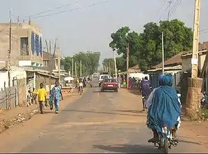
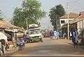
Basse Santa Su, usually known as Basse, is a town in the Gambia, lying on the south bank of the River Gambia. The easternmost major town in the nation, it known for its important market. Basse is the capital of the Upper River Division, which is coterminous with the Basse Local Government Area. As of 2009, the town has an estimated population of 18,414.[1] According to the 2013 census, the Basse LGA has 243,791 residents.[2]
Basse Santa Su | |
|---|---|
 | |
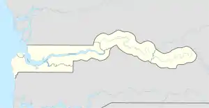 Basse Santa Su Location in the Gambia | |
| Coordinates: 13°19′N 14°13′W | |
| Country | The Gambia |
| Division | Upper River Division |
| District | Fulladu East |
| Population | |
| • Total | 18,414 |
| Time zone | UTC+0 (GMT) |
History
According to oral histories, the first Mandinka immigrants to the Gambia area, the Fati clan, settled in Tumana near Basse. They subsequently acted as hosts and/or agents for future migrants, potentially including Tiramakhan Traore. Basse was at this point a hub in regional trade networks bringing kola nuts and Guinea pepper north from what is now Guinea-Bissau and salt and salted fish up the river from the coast.[3]
A bridge over the Gambia river, funded by the Chinese government, opened in October 2021.[4]

Climate
Basse Santa Su has a tropical savanna climate (Köppen Aw), almost dry enough to be a hot semi-arid climate (BSh) with no rainfall from November to May and heavy rainfall from June to October.
| Climate data for Basse Santa Su | |||||||||||||
|---|---|---|---|---|---|---|---|---|---|---|---|---|---|
| Month | Jan | Feb | Mar | Apr | May | Jun | Jul | Aug | Sep | Oct | Nov | Dec | Year |
| Average high °C (°F) | 33.8 (92.8) |
35.7 (96.3) |
38.2 (100.8) |
39.5 (103.1) |
39.2 (102.6) |
35.3 (95.5) |
32.4 (90.3) |
31.3 (88.3) |
31.6 (88.9) |
33.8 (92.8) |
34.6 (94.3) |
33.1 (91.6) |
34.9 (94.8) |
| Daily mean °C (°F) | 24.2 (75.6) |
26.0 (78.8) |
29.2 (84.6) |
31.3 (88.3) |
31.9 (89.4) |
29.7 (85.5) |
27.8 (82.0) |
27.0 (80.6) |
27.0 (80.6) |
28.1 (82.6) |
26.2 (79.2) |
23.6 (74.5) |
27.7 (81.8) |
| Average low °C (°F) | 14.6 (58.3) |
16.4 (61.5) |
20.3 (68.5) |
23.1 (73.6) |
24.7 (76.5) |
24.2 (75.6) |
23.2 (73.8) |
22.7 (72.9) |
22.4 (72.3) |
22.4 (72.3) |
17.9 (64.2) |
14.1 (57.4) |
20.5 (68.9) |
| Average rainfall mm (inches) | 0 (0) |
0 (0) |
0 (0) |
1 (0.0) |
18 (0.7) |
106 (4.2) |
191 (7.5) |
243 (9.6) |
216 (8.5) |
62 (2.4) |
2 (0.1) |
0 (0) |
839 (33) |
| Source: Climate-Data.org[5] | |||||||||||||

References
- "Gambia: largest cities and towns and statistics of their population". World Gazetteer. Retrieved January 5, 2009.
- "Distribution of Population by Gender and LGA". GBoS. 2017-09-20. Archived from the original on 2022-03-21. Retrieved 2022-03-10.
- Brooke, George E. (August 1985). "WESTERN AFRICA TO c1860 A.D. A PROVISIONAL HISTORICAL SCHW BASED ON CLIMATE PERIODS". Indiana University African Studies Program: 91-92.
- Ma, Jianchun (13 Oct 2021). "Building the Friendship Bridges towards a Shared Future of China and The Gambia". The Point. Retrieved 3 August 2022.
- "Climate: Basse Santa Su". Climate-Data.org. Retrieved August 6, 2020.