Beşiri District
Beşiri District is a district of the Batman Province of Turkey. Its seat is the town Beşiri.[1] Its area is 809 km2,[2] and the district had a population of 30,928 in 2021.[3]
Beşiri District | |
|---|---|
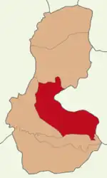
 Map showing Beşiri District in Batman Province | |
 Beşiri District Location in Turkey | |
| Coordinates: 37°55′N 41°18′E | |
| Country | Turkey |
| Province | Batman |
| Seat | Beşiri |
| Government | |
| • Kaymakam | Mahmut Şener |
| Area | 809 km2 (312 sq mi) |
| Population (2021) | 30,928 |
| • Density | 38/km2 (99/sq mi) |
| Time zone | TRT (UTC+3) |
| Website | www |
Yazidi presence
Beşiri once had large Yazidi population, in villages like Kurukavak (Hamdûna) and Uğrak (Texeriyê), only a couple of Yazidi families remain today. However, elsewhere, in Yolveren (Çinêra), Oğuz (Şimzê) and Üçkuyular (Faqîra), some families have returned from diaspora to settle again. These families, have constructed a social and traditional condolence house in Üçkuyular village, with support from the diaspora community in Europe. Villagers and the neighbouring villages use the building as a community place, where they do weddings, funerals and other occasions, as well as prayers. The diaspora Yezidis that funded the house usually have vacation there in the summer. The purpose of this house, which has four rooms, a kitchen and a prayer room, is to help preserve Yazidi presence, culture and traditions in the area.[4]
Composition
There are two municipalities in Beşiri District:[1][5]
There are 53 villages in Beşiri District:[6]
- Alaca
- Asmadere
- Atbağı
- Ayrancı
- Bahçeli
- Başarı
- Beşpınar
- Beyçayırı
- Bilek
- Çakıllı
- Çavuşbayırı
- Çığırlı
- Dağyolu
- Danalı
- Dayılar
- Değirmenüstü
- Deveboynu
- Doğankavak
- Doğanpazarı
- Durucak
- Esence
- Eskihamur
- Güvercinlik
- İkiyaka
- Ilıca
- İnpınar
- Işıkveren
- Karatepe
- Kaşüstü
- Kayatepe
- Kumçay
- Kumgeçit
- Kurukavak
- Kuşçukuru
- Kütüklü
- Oğuz
- Örmegöze
- Otluca
- Samanlı
- Tekağaç
- Tepecik
- Uğurca
- Üçkuyular
- Yakacık
- Yalınca
- Yalınkavak
- Yarımtaş
- Yazıhan
- Yenipınar
- Yeniyol
- Yeşiloba
- Yolkonak
- Yontukyazı
References
- İlçe Belediyesi, Turkey Civil Administration Departments Inventory. Retrieved 30 January 2023.
- "İl ve İlçe Yüz ölçümleri". General Directorate of Mapping. Retrieved 30 January 2023.
- "Address-based population registration system (ADNKS) results dated 31 December 2021" (XLS) (in Turkish). TÜİK. Retrieved 30 January 2023.
- Ilse., Ahmady, Kameel. Lim, Richard. Çulhaoğlu, Metin. Sturkenboom (2009). Another look at East and Southeast Turkey : a traveller's handbook. GABB. ISBN 978-605-60513-0-2. OCLC 612145076.
{{cite book}}: CS1 maint: multiple names: authors list (link) - Belde Belediyesi, Turkey Civil Administration Departments Inventory. Retrieved 30 January 2023.
- Köy, Turkey Civil Administration Departments Inventory. Retrieved 30 January 2023.
- Bağlı, Turkey Civil Administration Departments Inventory. Retrieved 3 February 2023.
