Beans Ferry, Mississippi
Beans Ferry (also Boatrights Ferry) is an unincorporated community in Itawamba County, Mississippi, United States. It is located on Mississippi Highway 25, 4.5 mi (7.2 km) south of Fulton. The Mississippian Railway passes through Beans Ferry.
Beans Ferry, Mississippi | |
|---|---|
 Beans Ferry  Beans Ferry | |
| Coordinates: 34°12′35″N 88°23′06″W | |
| Country | United States |
| State | Mississippi |
| County | Itawamba |
| Elevation | 272 ft (83 m) |
| Time zone | UTC-6 (Central (CST)) |
| • Summer (DST) | UTC-5 (CDT) |
| GNIS feature ID | 666629[1] |
The hamlet is located at a site on the east bank of the Tennessee–Tombigbee Waterway (formerly the Tombigbee River), where in the 1800s, Robert Beene operated a ferry. His father, John Beene, born in 1788, helped survey the area before Itawamba County was formed, and was a member of the county's first Board of Police (elected council).[2]
The ferry was replaced by a bridge in 1923, which was replaced by a new bridge in 1948. That bridge lasted until the construction of the Tennessee–Tombigbee Waterway in the 1970s.[3]
A large recreation area is located at Beans Ferry, with a boat launch, viewing area, dock, parking, and picnic area.[4]
There is an active natural gas field at Beans Ferry.[5]
Notes
- "Beans Ferry". Geographic Names Information System. United States Geological Survey, United States Department of the Interior.
- Franks, Bob (June 14, 2008). "Early Pioneer Families: Bailey Duvall and Wife, Minerva P. Beene". Itawamba History Review.
- Robinson Mills, Mona (2013). Itawamba County. Arcadia. p. 41.
- "Beans Ferry". Mississippi Wildlife, Fisheries and Parks. Archived from the original on March 4, 2016. Retrieved April 23, 2014.
- Elkins, Chris. "Bean's Ferry gas field is one of most active in Mississippi; but not yet profitable – Itawamba County as the scene of natural gas wells has been emphasized by the latest oil and gas exploration report for the state". The Daily Journal. Retrieved April 28, 2008.
Municipalities and communities of Itawamba County, Mississippi, United States | ||
|---|---|---|
| City | 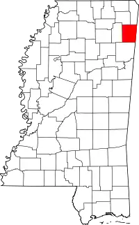 Map of Mississippi highlighting Itawamba County | |
| Towns | ||
| CDP | ||
| Other communities | ||
| Ghost towns | ||