Bega, New South Wales
Bega (/biːɡə/) is a town in the south-east of New South Wales, Australia, in the Bega Valley Shire. It is the economic centre for the Bega Valley.
| Bega New South Wales | |||||||||
|---|---|---|---|---|---|---|---|---|---|
 Panorama of Bega and the Bega Valley | |||||||||
 Bega | |||||||||
| Coordinates | 36°40′S 149°50′E | ||||||||
| Population | 4,141 (2016 census)[1] | ||||||||
| Established | 1851 [2] | ||||||||
| Postcode(s) | 2550 | ||||||||
| Elevation | 51 m (167 ft) | ||||||||
| Location | |||||||||
| LGA(s) | Bega Valley Shire | ||||||||
| County | Auckland | ||||||||
| State electorate(s) | Bega | ||||||||
| Federal division(s) | Eden-Monaro | ||||||||
| |||||||||
Place name
One claim is that place name Bega is derived from the local Aboriginal word meaning "big camping ground".[3] Another claim is that it is a corruption of the word "bika" in the local Aboriginal language (one of the Yuin languages) meaning "beautiful".[4] The local Aboriginal name for Bega before colonisation was Worerker.[5]
History and description
The Bega region was used by the Yuin-Monaro Aboriginal people for thousands of years before Europeans arrived in the area. The clan whose country occupied the Bega vicinity were called the Worerkerbrim mitte.[5]
Bega lies at the foot of Mumbulla Mountain, named after a Yuin elder King Jack Mumbulla, whose traditional Aboriginal name is Biamanga. The surrounding National Park is named after him as Biamanga National Park. [6]
The first European to come near the area was George Bass, who explored the region's coastline in December 1797 as part of his broader explorations of the Australian coast.[7] William Tarlinton was the first European to explore the area on foot, arriving in 1829. He returned in the early 1830s and settled there, starting a cattle farm. Others who arrived in the area around the same time were the Imlay brothers, who also began farming there. Their name has since been preserved in the form of Mount Imlay National Park. Live cattle were transported to Sydney for a time, to be supplemented by tallow and hides in the early 1840s. Beef and dairy farming were carried on in the area through the 1840s, and many towns were surveyed in the 1850s.
The town of Bega itself was laid out and gazetted in December 1851.[2] Located to the north of its present location, repeated flooding later resulted in its relocation to the higher ground south of the river.[8] Dairy farming expanded in the region quickly throughout the 1860s, overtaking cattle farming as the predominant industry. In 1858, Tathra was used as a port for the transport of products to Sydney, and the Illawarra Steam Company was established. In 1861–62, Tathra Wharf was constructed, which allowed for the further growth and expansion of the dairy industry.[9]
The region received a further boost in the late 1870s when gold was discovered in the Bermagui area. The Bermagui gold rush followed quickly in 1880. Two years later, in 1882, the Municipality of Bega was created. The Bega Dairy Cooperative Limited was set up in the late 1890s.[10]
Bega is now well known for its cheese. Bega Cheese is manufactured by The Bega Co-operative Society Limited which is one of the larger Australian cheese companies. Their products are exported around the world and distributed across Australia and are available in most supermarkets and general stores.
Notable local landmarks are Bega Court House and Rosevear Jeweller's shopfront, which are both listed on the Register of the National Estate.[11] The courthouse was built in 1881 and consists of rendered brick and iron roofs. The Rosevear shop is in Carp Street and was established circa 1899. It is listed as a notable example of Victorian commercial designers.
After years of planning, the shopping mall in Bega was built. The Sapphire Marketplace was opened on 2 December 2011.[12]
Heritage listings
Bega has a number of heritage-listed sites, including:
- 21 Auckland Street: CBC Bank Building[13]
Population
According to the 2021 census, there were 5,013 people in Bega.
- Aboriginal and Torres Strait Islander people made up 6.7% of the population.
- 82.3% of people were born in Australia. The next most common country of birth was England at 2.2%.
- 87.3% of people only spoke English at home.
- The most common responses for religion were No Religion 43.8% Anglican 17% and Catholic 16.8%[1]
Climate
Bega has an oceanic climate (Cfb) with warm summers and cool winters, very closely bordering the humid subtropical climate (Cfa).[14] Its relatively dry winters are owed to foehn winds, which originate from the Great Dividing Range. Frost occurs occasionally in the winter. Diurnal range is particularly high in late winter and early spring. The town features 85.3 clear days and 139 overcast days annually.[15]
| Climate data for Bega AWS (1992–2022) 36.67° S, 149.82° E | |||||||||||||
|---|---|---|---|---|---|---|---|---|---|---|---|---|---|
| Month | Jan | Feb | Mar | Apr | May | Jun | Jul | Aug | Sep | Oct | Nov | Dec | Year |
| Record high °C (°F) | 44.6 (112.3) |
44.4 (111.9) |
40.4 (104.7) |
36.5 (97.7) |
29.7 (85.5) |
24.5 (76.1) |
26.3 (79.3) |
28.2 (82.8) |
35.4 (95.7) |
36.8 (98.2) |
42.6 (108.7) |
42.4 (108.3) |
44.6 (112.3) |
| Average high °C (°F) | 27.2 (81.0) |
26.5 (79.7) |
24.8 (76.6) |
22.4 (72.3) |
19.5 (67.1) |
16.8 (62.2) |
16.6 (61.9) |
17.9 (64.2) |
20.2 (68.4) |
22.0 (71.6) |
23.6 (74.5) |
25.1 (77.2) |
21.9 (71.4) |
| Average low °C (°F) | 15.1 (59.2) |
15.0 (59.0) |
12.9 (55.2) |
9.5 (49.1) |
5.7 (42.3) |
3.6 (38.5) |
2.3 (36.1) |
3.2 (37.8) |
6.0 (42.8) |
8.5 (47.3) |
11.4 (52.5) |
13.4 (56.1) |
8.9 (48.0) |
| Record low °C (°F) | 4.5 (40.1) |
6.0 (42.8) |
2.9 (37.2) |
−0.1 (31.8) |
−2.4 (27.7) |
−4.3 (24.3) |
−4.3 (24.3) |
−4.7 (23.5) |
−3.0 (26.6) |
0.0 (32.0) |
0.7 (33.3) |
1.9 (35.4) |
−4.7 (23.5) |
| Average rainfall mm (inches) | 54.9 (2.16) |
83.5 (3.29) |
78.7 (3.10) |
34.8 (1.37) |
50.4 (1.98) |
64.5 (2.54) |
43.0 (1.69) |
33.9 (1.33) |
34.4 (1.35) |
51.3 (2.02) |
64.8 (2.55) |
65.8 (2.59) |
687.4 (27.06) |
| Average rainy days (≥ 1.0 mm) | 6.6 | 5.8 | 6.5 | 4.6 | 3.6 | 4.5 | 3.4 | 3.5 | 4.3 | 5.9 | 7.0 | 6.6 | 62.3 |
| Average afternoon relative humidity (%) | 60 | 60 | 59 | 59 | 59 | 58 | 54 | 51 | 53 | 57 | 60 | 60 | 58 |
| Average dew point °C (°F) | 15.5 (59.9) |
15.5 (59.9) |
13.6 (56.5) |
11.2 (52.2) |
8.4 (47.1) |
5.8 (42.4) |
4.2 (39.6) |
4.8 (40.6) |
7.4 (45.3) |
9.6 (49.3) |
12.1 (53.8) |
13.6 (56.5) |
10.1 (50.3) |
| Source: Australian Bureau of Meteorology (1992–2022)[16] | |||||||||||||
Gallery
Bega_Court_House.jpg.webp) Bega Court House
Bega Court House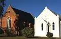 Uniting Church
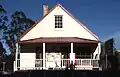 Old Bega Information Centre
Bega_Anglican_Church.jpg.webp) Anglican Church
Anglican Church
Notable people
- Kezie Apps – Female Rugby League Player
- Chris Atkinson – WRC driver
- David Boyle – Rugby League Player
- Morgan Boyle – Rugby League Player
- Adam Elliott – Rugby League Player
- Dale Finucane – Rugby League Player
- Deborah Glass OBE – Victorian Ombudsman
- Thomas Jack – DJ
- Lenka – singer and songwriter
- Ky Rodwell – Rugby League Player
See also
References
- Australian Bureau of Statistics (27 June 2017). "Bega (Urban Centre and Locality)". 2016 Census QuickStats. Retrieved 23 April 2019.
- "BEGA". New South Wales Government Gazette. No. 147. New South Wales, Australia. 30 December 1851. p. 2149. Retrieved 23 April 2019 – via National Library of Australia.
- "Bega". Geographical Names Register (GNR) of NSW. Geographical Names Board of New South Wales. Retrieved 13 June 2009.
- "PLACE NAMES". The Australian Women's Weekly. National Library of Australia. 13 May 1964. p. 61. Retrieved 22 February 2011.
- Robinson, G.A.; Clark, I.D. (2014). Travels of George Augustus Robinson, Chief Protector Port Phillip Aboriginal Protectorate.
- Mumbulla spiritual contact. 1980.
- "History of the Shire". Bega Valley Shire Council. May 2015. Retrieved 23 April 2019.
- "Travel: Bega". The Sydney Morning Herald. Sydney. 26 June 2008. Retrieved 25 February 2015.
- "Tathra Wharf and building". State Heritage Register. Office of Environment & Heritage. Retrieved 23 April 2019.
- "Bega History – Human Settlement". Bega Valley Shire Council. Archived from the original on 18 May 2009. Retrieved 8 April 2009.
- The Heritage of Australia, Macmillan Company, 1981, p.2/144
- sapphiremarketplace.com.au
- "CBC Bank (former)". New South Wales State Heritage Register. Department of Planning & Environment. H00588. Retrieved 18 May 2018.
 Text is licensed by State of New South Wales (Department of Planning and Environment) under CC-BY 4.0 licence.
 - "Bega climate: Average Temperature, weather by month, Bega weather averages – Climate-Data.org". en.climate-data.org. Retrieved 7 May 2022.
- Summary statistics BEGA (NEWTOWN ROAD) Bureau of Meteorology
- "Bega AWS, NSW Climate (1992-present normals and extremes)". Australian Bureau of Meteorology. Retrieved 7 May 2022.
External links
| Cities | |
|---|---|
| Towns & Townships |
|
| Local government areas | |
| National parks | |
| Rivers and other waterbodies | |