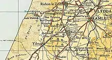
Beit Hanan
Beit Hanan (Hebrew: בֵּית חָנָן) is a moshav in central Israel. Located around two kilometers west of Ness Ziona, it falls under the jurisdiction of Gan Raveh Regional Council. In 2021 its population was 523.[1]
Beit Hanan
בֵּית חָנָן بيت حنان | |
|---|---|
 | |
 Beit Hanan  Beit Hanan | |
| Coordinates: 31°56′4″N 34°46′22″E | |
| Country | |
| District | Central |
| Council | Gan Raveh |
| Affiliation | Moshavim Movement |
| Founded | 1929 |
| Founded by | Bulgarian Jews |
| Population (2021)[1] | 523 |
History

Beit Hanan founded during the Hanukkah holiday of 1929 by Jewish immigrants from Bulgaria, Beit Hanan was the first Jewish agricultural community to be established after the 1929 Palestine riots. The name is taken from the Bible, specifically (1 Kings 4:9).[2] According to a census conducted in 1931 by the British Mandate authorities, Beit Hanan had a population of 178 inhabitants, in 50 houses.[3]


In 2007, Beit Hanan had 750 acres (3.0 km2) of farmland. The main economic branches are eggs, orchards (pecan, citrus, avocado, mango, anona and olives) and greenhouses (flowers, vegetables and seedlings). The moshav also has banquet facilities on the grounds of a historic home.
A Greek-inscribed mosaic floor was discovered within the boundaries of the moshav. A rare species of red iris grows west of the moshav, in a wild flower reserve stretching over 8 acres (32,000 m2).
Gallery
Beginning
 Surveying Kubeiba land intended for settling Beit Hanan, 1928
 A document dealing with the name of Beit Hanan Yishuv, 25 February 1930
 Drilling of the first well, 1929-30
 Planting the first orchard, 1929-30
 Early 1930s first citrus nursery
 Water tower ladder of the Beit Hanan school, 1935
 Beit Hanan 1935
 Orchards, 1934
 Settlement Hill in Beit Hanan, 1934-36
 Planting the first orange grove of the family farm under the direction of Papa Avraham Menda, 1935-36
.-JNF044486.jpeg.webp) Panorama, 1935
Panorama, 1935 Isaac Menda working at the cowshed, 1935
 Construction of the first permanent homes, 1935
 A Gadna group (semi military youth brigades) in training, 1940-45
 Germain Manda in the family laying coop in the 1940s
 Beit-Hanan youth group at Gan Rave gate, 1940-43
 Family goat shed, 1946
 Using donkey for plowing, 1947
 Beit Hanan girls during first harvest celebrations, 1951-52
 Beit Hanan drama group, 1952
 Harvest competition during the first harvest celebrations in the early 1950s
_Mayer_%D7%A9%D7%9E%D7%95%D7%90%D7%9C_(%D7%A1%D7%9E%D7%99)_%D7%9E%D7%90%D7%99%D7%A8.jpg.webp) Sami Shmuel Mayer on his Holder tractor, 1957-58
Sami Shmuel Mayer on his Holder tractor, 1957-58
Now
 Aerial View, 2012
 Beit-Hanan then (1933) and now (2007)
 Founders Memorial at the entrance to Moshav
 Founders Square
References
- "Regional Statistics". Israel Central Bureau of Statistics. Retrieved 22 February 2023.
- Carta's Official Guide to Israel and Complete Gazetteer to all Sites in the Holy Land. (3rd edition 1993) Jerusalem, Carta, p. 110, ISBN 965-220-186-3
- Mills, 1932, p. 18
External links
- Official website Archived 2015-09-23 at the Wayback Machine