Belgooly
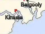
Belgooly (Irish: Béal Guala[2] is a village in County Cork, Ireland, located 4.6 kilometres to the north-east of Kinsale. In 2016 it had a population of 826.[1]
Belgooly
Béal Guala | |
|---|---|
Village | |
.jpg.webp) Belgooly village with The Huntsman Bar and Coleman's public houses | |
 Belgooly Location in Ireland | |
| Coordinates: 51°44′21″N 8°29′8″W | |
| Country | Ireland |
| Province | Munster |
| County | County Cork |
| Population | 826 |
| Time zone | UTC+0 (WET) |
| • Summer (DST) | UTC-1 (IST (WEST)) |
| Irish grid reference | W666538 |

History
The Belgooly Flour Mill, a ruinous building within the village, is entered in the initial Record of Protected Structures.[3] Other, more ancient monuments, included on the Record of Monuments and Places for County Cork, include a reputed holy well site immediately west of the village, and a standing stone to the south in Mitchelstown East townland.[4]
On 26 August 1941 a Luftwaffe Junkers Ju 88 crashed close to Belgooly, after being shot down by 615 Squadron of the RAF.[5]
Amenities and development
The village has a small shop with a post office, Belgooly GAA club facilities, Church of the Sacred Heart Roman Catholic church, and is home to the 'Huntsman' and 'Coleman's' public houses (the latter in business since at least 1914).[6]
The village is located within the study area of the Cork Area Strategic Plan and the lands that surround the village are within the designated Cork County Council "Rural Housing Control Zone". There has been an increase in residential housing development in Belgooly in the early 21st century, with (according to the 2016 census) 200 of the village's 258 private homes built between 2001 and 2010.[1]
On the Kinsale side of the town is a statue named "His Master's Voice".[7][8] Belgooly hosts an annual agricultural show and steam rally.[9][10]
Landscape and transport
The main road through the village is the R600, which links the village with the city of Cork to the north and Kinsale to the south. The R611, which links Belgooly with Carrigaline extends eastwards from the village. The village is served by a public bus service, route 226, which travels from Kinsale via Belgooly and Cork Airport to Cork city centre.
The River Stick flows on the western edge of the village and joins the Belgooly River which flows in the tidal Belgooly Estuary to the south of the village, before running to Oysterhaven Bay.
References
- "Sapmap Area: Settlements Belgooly". Census 2016. Central Statistics Office. 2016. Archived from the original on 13 February 2018. Retrieved 2 January 2019.
- "Béal Guala / Belgooly". logainm.ie. Irish Placenames Commission. Retrieved 2 January 2019.
- "Bandon Electoral Area Local Area Plan - Belgooly" (PDF). Cork County Council. Archived from the original (PDF) on 4 March 2016.
- "Record of Monuments and Places - County Cork - Volume 2" (PDF). Dúchas (National Monuments and Historic Properties Service). 1998. Retrieved 8 August 2019.
CO 112-076-- / BALLYTHOMAS / Holy well [..] CO 112-017-- / MITCHELSTOWN EAST / Standing stone
- "Fishponds Local History Society". fishponds.org.uk. Bristol Past. Retrieved 2 January 2019.
- "Guys 1914 Almanac & Directory for County Cork referencing "Coleman Bartholomew, vintner"". 1914. Retrieved 2 January 2019 – via failteromhat.com.
- "Kinsale Times - The Belgooly Statue". The Kinsale Times. Archived from the original on 5 June 2008.
- "Arts Service - Public Art - Artworks by Declan Breen". Cork County Council. Archived from the original on 17 February 2014.
- "Belgooly Show Sat 1 June 2013". Belgoolyshow.com.
- "South Cork Steam and Vintage Rally - Belgooly Events". World Events Guide. Archived from the original on 9 June 2007.
