Bengabad
Bengabad is a village in the Bengabad CD block in the Giridih Sadar subdivision of the Giridih district in the Indian state of Jharkhand.
Bengabad | |
|---|---|
Village | |
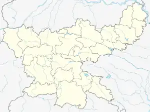
 Bengabad Location in Jharkhand, India# India  Bengabad Bengabad (India) | |
| Coordinates: 24.301667°N 86.360833°E | |
| Country | |
| State | Jharkhand |
| District | Giridih |
| Population (2011) | |
| • Total | 3,178 |
| Languages(*For language details see Bengabad block#Language and religion) | |
| • Official | Hindi, Urdu |
| Time zone | UTC+5:30 (IST) |
| PIN | 815312 (Bengabad) |
| Telephone/ STD code | 06552 |
| Vehicle registration | JH 11 |
| Lok Sabha constituency | Kodarma |
| Vidhan Sabha constituency | Gandey |
| Website | giridih |
Geography
M: municipality, CT: census town, R: rural/ urban centre, H: historical/ religious/ tourist centre
Owing to space constraints in the small map, the actual locations in a larger map may vary slightly
Location
Bengabad is located at 24.301667°N 86.360833°E.
Area overview
Giridih district is a part of the Chota Nagpur plateau, with rocky soil and extensive forests. Most of the rivers in the district flow from the west to east, except in the northern portion where the rivers flow north and north west. The Pareshnath Hill rises to a height of 4,479 feet (1,365 m). The district has coal and mica mines. It is an overwhelmingly rural district with small pockets of urbanisation. [1][2][3]
Note: The map alongside presents some of the notable locations in the district. All places marked in the map are linked in the larger full screen map.
Demographics
According to the 2011 Census of India, Bengabad had a total population of 3,178, of which 1,520 (48%) were males and 1,658 (52%) were females. Population in the age range 0-6 years was 459. The total number of literate persons in Bengabad was 2,194 (80.69% of the population over 6 years).[4]
Civic administration
Police station
Bengabad police station has jurisdiction over Bengabad CD block.[5] According to old British records, Bengabad PS was there after Giridh subdivision was formed in 1870.[6]
Transport
National Highway 114A passes through Bengabad.[9]
References
- "District Census Handbook 2011 Giridih, Series 21, Part XII A" (PDF). Natural Divisions, Forests: pages 8 and 9. Directorate of Census Operations, Jharkhand. Retrieved 15 December 2020.
- "2011 Census C.D. Block Wise Primary Census Abstract Data(PCA)". Jharkhand – District-wise CD Blocks. Registrar General and Census Commissioner, India. Retrieved 23 September 2017.
- "District Statistical Handbook, Giridih". Tables 2.1, 2.4, 2.6. Directorate of Economics and Statistics, Department of Planning and Development, Jharkhand. Retrieved 23 September 2017.
- "2011 Census C.D. Block Wise Primary Census Abstract Data(PCA)". Jharkhand – District-wise CD Blocks. Registrar General and Census Commissioner, India. Retrieved 28 November 2017.
- "District Statistical Handbook, Giridih". Tables 2.1, 2.4. Directorate of Economics and Statistics, Department of Planning and Development, Jharkhand. Retrieved 28 November 2017.
- "District Census Handbook Giridih, 2011, Series 21, Part XII A" (PDF). Pages 5-7. Directorate of Census Operations, Jharkhand. Retrieved 2 December 2017.
- "2011 District Census Handbook Giridih, Series 21, Part XII B" (PDF). Map on Page 3. Directorate of Census Operations, Jharkhand. Retrieved 23 September 2017.
- "Giridih". District Administration, Giridih. Archived from the original on 27 May 2011. Retrieved 28 November 2017.
- Google maps
