Berthier-sur-Mer
Berthier-sur-Mer is a town in the Montmagny Regional County Municipality within the Chaudière-Appalaches region of Quebec, Canada. It is located on the south shore of the Saint Lawrence River, east of Quebec City on Route 132.
Berthier-sur-Mer | |
|---|---|
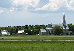 Church of Berthier-sur-Mer | |
| Motto(s): Sur terre et sur mer, Berthier toujours plus fier | |
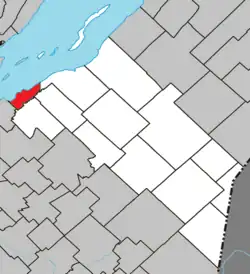 Location within Montmagny RCM. | |
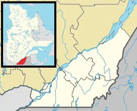 Berthier-sur-Mer Location in province of Quebec. | |
| Coordinates: 46°55′N 70°44′W[1] | |
| Country | |
| Province | |
| Region | Chaudière-Appalaches |
| RCM | Montmagny |
| Constituted | July 1, 1855 |
| Government | |
| • Mayor | Richard Gallibois |
| • Federal riding | Montmagny—L'Islet— Kamouraska—Rivière- du-Loup |
| • Prov. riding | Côte-du-Sud |
| Area | |
| • Total | 26.80 km2 (10.35 sq mi) |
| • Land | 26.85 km2 (10.37 sq mi) |
| Population | |
| • Total | 1,744 |
| • Density | 65/km2 (170/sq mi) |
| • Pop 2016-2021 | |
| • Dwellings | 939 |
| Time zone | UTC−5 (EST) |
| • Summer (DST) | UTC−4 (EDT) |
| Postal code(s) | |
| Area codes | 418 and 581 |
| Highways | |
| Website | www |
History
Berthier-sur-Mer was named after Alexandre Berthier, a captain in the Carignan-Salières Regiment, who was given title to this area in 1672, then known as the seigneury of Berthier-en-bas.
During the 19th century, Irish immigrants were quarantined at nearby Grosse Isle, now a National Historic site.
Demographics
Population
| 2021 | 2016 | 2011 | |
|---|---|---|---|
| Population | 1,744 (+12.2% from 2016) | 1,555 (11.2% from 2011) | 1,398 (12.8% from 2006) |
| Land area | 26.85 km2 (10.37 sq mi) | 26.92 km2 (10.39 sq mi) | 26.79 km2 (10.34 sq mi) |
| Population density | 65/km2 (170/sq mi) | 57.8/km2 (150/sq mi) | 52.2/km2 (135/sq mi) |
| Median age | 49.6 (M: 48.4, F: 50.4) | 50.3 (M: 50.3, F: 50.4) | 49.7 (M: 49.8, F: 49.6) |
| Private dwellings | 939 (total) 789 (occupied) | 892 (total) | 791 (total) |
| Median household income | $82,000 | $70.336 | $57,955 |
Geology
A strip of rather interesting underlying sedimentary bedrock maintains a relatively straight shoreline through which a natural harbour, quite round in shape, has been eroded. The bedrock is set at about a 60 to 80° angle and is composed of hundreds of very thin layers of red shale interspersed every meter or so with 5 to 10 cm layers of what appears to be limestone. It is quite dramatic in places where it hasn't been worn down by human activities.
See also
References
- "Reference number 381986 in Banque de noms de lieux du Québec". toponymie.gouv.qc.ca (in French). Commission de toponymie du Québec.
- "Geographic code 18065 in the official Répertoire des municipalités". www.mamh.gouv.qc.ca (in French). Ministère des Affaires municipales et de l'Habitation.
- "2021 Community Profiles". 2021 Canadian Census. Statistics Canada. February 4, 2022. Retrieved 2023-10-19.
- "2016 Community Profiles". 2016 Canadian Census. Statistics Canada. August 12, 2021. Retrieved 2022-08-24.
- "2011 Community Profiles". 2011 Canadian Census. Statistics Canada. March 21, 2019. Retrieved 2022-08-24.
- "2006 Community Profiles". 2006 Canadian Census. Statistics Canada. August 20, 2019.
- "2001 Community Profiles". 2001 Canadian Census. Statistics Canada. July 18, 2021.
Adjacent Municipal Subdivisions | |
|---|---|
| Cities & Towns | |
|---|---|
| Municipalities | |
| Parishes | |
| |