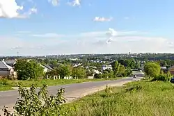
Bila, Ternopil Raion, Ternopil Oblast
Bila (Ukrainian: Біла) is a village in Ternopil Raion, Ternopil Oblast of Western Ukraine.
Bila
Біла | |
|---|---|
Village | |
 | |
 Bila  Bila | |
| Coordinates: 49°35′03″N 25°34′41″E | |
| Country | |
| Province | |
| District | Ternopil Raion |
| Area | |
| • Total | 1.570 km2 (0.606 sq mi) |
| Elevation | 314 m (1,030 ft) |
| Population (2001) | |
| • Total | 3,627 |
| • Density | 2,300/km2 (6,000/sq mi) |
| Time zone | UTC+2 (EET) |
| • Summer (DST) | UTC+3 (EEST) |
| Postal code | 47707 |
| Area code | +380 352 |
History
The existence of the village became known in the second half of the 16th century, in a document of the Polish magnate Konstanty Wasyl Ostrogski, where the fields that at that time belonged to Tarnopol were registered. In 1884, Oleksander Barvinsky launched one of the main cultural centers in the area here. In 1912, the first Ternopil airfield was established in Bila, where some of the first flight demonstrations in present-day Ukraine were made. Until the creation of the current municipality in 2018, the town formed a rural council on its own.[2][3]
Geography
Bila is located on the northern outskirts of the regional capital Ternopil, at the exit of the city from the P39 road leading to Brody. The village is separated from the capital by the Ternopil-Vantazhnyi railway station and the adjoining industrial estate.[4]
Religion
- St. Nicholas Church (1601, restored in 1910; restored in 1989, UGCC),
- Church of St. Kniahynia Olha (1997, brick; architect Y. Viunov, OCU),
- Church of the Intercession (2004, brick, UGCC),
- Spiritual youth center and Sunday school (1927, former Roman Catholic church, UGCC)
Demographics
In 2007, 2,927 people lived in the village.[5]
Languages
Native language as of the Ukrainian Census of 2001:[6]
| Language | Percentage |
|---|---|
| Ukrainian | 99.15 % |
| Russian | 0.61 % |
| Belarusian | 0.10 % |
| Armenian | 0.03 % |
References
- "Bila (Ternopil Raion, Ternopil Oblast)". weather.in.ua. Retrieved 19 March 2023.
- В. Уніят. Біла. // Тернопільський енциклопедичний словник : у 4 т. / редкол.: Г. Яворський та ін. — Тернопіль : Видавничо-поліграфічний комбінат «Збруч», 2004. — Т. 1 : А — Й. — С. 126. — ISBN 966-528-197-6.
- "Biała (5), wś, pow. tarnopolski". // Słownik geograficzny Królestwa Polskiego. — Warszawa : Druk «Wieku», 1880. — Т. I. — S. 171. (пол.) — S. 171–172. (пол.)
- "Mapa de Bila". Google Maps.
- Viktor Uniyat Біла. // (in Ukrainian) Ternopil Encyclopedic Dictionary: in 4 v. / editorial board: H. Yavorskyi and other, Ternopil: "Zbruch", 2004, V. 1: А—Й, 696 s. — ISBN 966-528-197-6. — С. 126.
- "Розподіл населення за рідною мовою, Херсонська область (у % до загальної чисельності населення) - Регіон, Рік , Вказали у якості рідної мову (2001(05.12))". Archived from the original on 2014-07-31. Retrieved 2023-03-19.
Sources
- (in Ukrainian) В. Уніят, Біла // Ternopil Encyclopedic Dictionary: in 4 v. / editorial board: H. Yavorskyi and other, Ternopil: "Zbruch", 2004, V. 1: А—Й, S. 126. — ISBN 966-528-197-6.
- (in Ukrainian) В. Уніят-Карпович, Біла // Ternopil region. History of cities and villages: in 3 v. / Ternopil: "Terno-graph", 2014, V. 3: М—Ш, S. 352—354. — ISBN 978-966-457-246-7.
- "Biała (5), wś, pow. tarnopolski". Geographical Dictionary of the Kingdom of Poland (in Polish). 1. Warszawa: Kasa im. Józefa Mianowskiego. 1880. p. 171.