Blaine, Tennessee
Blaine, formerly known as Blaine's Crossroads,[7] is a city in Grainger County, Tennessee, United States,[4] and a suburb of neighboring Knoxville.[8] It is part of both the Knoxville Metropolitan Statistical Area and the Morristown Metropolitan Statistical Area. The population was 2,084 at the 2020 census.[9]
Blaine, Tennessee
formerly Blaine's Crossroads | |
|---|---|
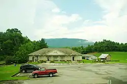
 Blaine City Hall and Library | |
| Motto: "The City With Determination" | |
 Location of Blaine in Grainger County, Tennessee. | |
| Coordinates: 36°9′3″N 83°42′2″W | |
| Country | United States |
| State | Tennessee |
| County | Grainger |
| Incorporated | 1978[1] |
| Named for | Robert Blaine[2] |
| Government | |
| • Type | Mayor-council |
| • Mayor | Marvin Braden |
| • Vice Mayor | Darrell Williams |
| • City Council | List of Councilmen |
| Area | |
| • Total | 9.53 sq mi (24.69 km2) |
| • Land | 9.52 sq mi (24.65 km2) |
| • Water | 0.02 sq mi (0.05 km2) |
| Elevation | 1,037 ft (316 m) |
| Population | |
| • Total | 2,084 |
| • Density | 219.00/sq mi (84.55/km2) |
| Time zone | UTC-5 (Eastern (EST)) |
| • Summer (DST) | UTC-4 (EDT) |
| ZIP code | 37709 |
| Area code | 865 |
| FIPS code | 47-06340[6] |
| GNIS feature ID | 2403874[4] |
| U.S. Route | |
| Website | https://www.blainetn.gov/ |
History
Blaine was originally known as Blaine's Crossroads (sometimes spelled "Blain"). During the early 19th century, it was located at the intersection of several important roads,[7] including the eastern terminus of the Emory Road (present day SR 61), which traversed northern Knox County,[10] the northern terminus of Indian Ridge Road, and the Great Indian Warpath, present-day U.S. Route 11W.[7] Shields' Station, a popular tavern and store, had been built in Blaine by the early 1830s. Blaine later served as a stop along the Knoxville and Bristol Railroad, also known as the Peavine Railroad, in the late 19th and early 20th centuries.[11]
During the American Civil War, Blaine's Crossroads served as the site of retreat of Confederate forces following General James Longstreet's victory in the Battle of Bean's Station.[12] Longstreet and his forces attempted to siege westward into Blaine's Crossroads, as part of the Knoxville campaign to capture the city of Knoxville.[12] Union army forces retreating from Bean's Station moved into Blaine's Crossroads, making a stronger defense at the community for Union military forces.[12] Overmatched by the strength of the Union Army, Longstreet and his forces retreated at Blaine's Crossroads, ending the Confederacy's attempt at controlling Knoxville.[12]
Around 1890, a Pennsylvania native named Robert Blaine opened and operated a general store in the community. As the community grew, Blaine was chosen as the namesake of the city.[2]
In the late 19th to the early 20th century, Blaine was a stop on the Knoxville and Bristol Railroad, commonly known by locals as the "Peavine Railroad."[13] The line ran from the City of Morristown in Hamblen County, through the Richland Valley to the bedroom community of Corryton, north of Blaine in unincorporated Knox County.[13] With the creation of the railroad, Blaine saw a significant change from a small turnpike town, to a bustling railroad town.[13]
On December 31, 1952, country music singer Hank Williams was spotted during his last ride in Blaine following his departure from the Andrew Johnson Hotel in downtown Knoxville.[14] Falling severely ill after a dinner at the hotel, Williams asked his driver, Charles Carr, drive him from Knoxville to Charleston, West Virginia for a concert in the same day.[14] Arriving in Blaine, Williams' car was stopped by a Tennessee Highway Patrol trooper for speeding.[14] The state trooper had seen Williams lying motionless in the back of the car during the stop and assumed that he was dead.[14] Carr insisted that Williams was sedated from a Knoxville doctor's order. The trooper fined Carr $25 for speeding, and later paid this fine at the Grainger County Courthouse in Rutledge.[14]
In 1978, waste management company Browning-Ferris Industries announced plans for a large sanitary landfill to service the needs of Knoxville in Blaine. The proposal would prompt community members to petition and vote to incorporate Blaine into a city in the same year. Blaine residents would also use acts of vandalism (notably arson) and violence against Browning-Ferris and construction companies contracted to build the landfill to oppose the project. The largest of these acts resulted in the destruction of the Knoxville office of Browning-Ferris via bomb, costing the company $50,000.[15]
In 2007, the city received $520,560 in funding from the Economic Development Administration, and $867,600 towards developing the city's sewage treatment system for proposed commercial and industrial sites.[16] The project created nearly 175 jobs in the city and the potential of $12.525 million in private investment.[16] In 2010, the Blaine City Council moved forward with the sewer project despite previous hurdles with local opposition.[17]
Geography
Blaine is located in the southwest corner of Grainger County at 36°9′3″N 83°42′2″W (36.150854, -83.700443).[18] It is situated around the intersection of U.S. Route 11W (Rutledge Pike), Tennessee State Route 61, and Indian Ridge Road. The city is southeast of the point where Grainger, Knox, and Union counties meet. Clinch Mountain and adjacent ridges rise prominently to the north and northeast, and House Mountain is visible to the southwest.
It is 14 miles (23 km) southwest of Rutledge, the county seat, 12 miles (19 km) southeast of Maynardville, and 19 miles (31 km) northeast of Knoxville. Blaine is connected to Knoxville and Rutledge via U.S. Route 11W and Maynardville via TN-61.
According to the United States Census Bureau, the city has a total area of 9.4 square miles (24.3 km2), all of it land.[9]
Demographics
| Census | Pop. | Note | %± |
|---|---|---|---|
| 1980 | 1,147 | — | |
| 1990 | 1,326 | 15.6% | |
| 2000 | 1,585 | 19.5% | |
| 2010 | 1,856 | 17.1% | |
| 2020 | 2,084 | 12.3% | |
| Sources:[19][20][5] | |||
2020 census
| Race | Number | Percentage |
|---|---|---|
| White (non-Hispanic) | 1,942 | 93.19% |
| Black or African American (non-Hispanic) | 20 | 0.96% |
| Native American | 2 | 0.1% |
| Asian | 7 | 0.34% |
| Pacific Islander | 1 | 0.05% |
| Other/Mixed | 69 | 3.31% |
| Hispanic or Latino | 43 | 2.06% |
As of the 2020 United States census, there were 2,084 people, 815 households, and 613 families residing in the city.
2000 census
As of the census[6] of 2000, there were 1,585 people, 636 households, and 478 families residing in the town. The population density was 179.6 inhabitants per square mile (69.3/km2). There were 680 housing units at an average density of 77.1 per square mile (29.8/km2). The racial makeup of the town was 96.91% White, 1.07% African American, 0.32% Native American, 0.13% Asian, 0.63% from other races, and 0.95% from two or more races. Hispanic or Latino of any race were 1.01% of the population.
There were 636 households, out of which 31.4% had children under the age of 18 living with them, 60.2% were married couples living together, 10.4% had a female householder with no husband present, and 24.7% were non-families. 20.4% of all households were made up of individuals, and 5.2% had someone living alone who was 65 years of age or older. The average household size was 2.49 and the average family size was 2.87.
In the town, the population was spread out, with 22.5% under the age of 18, 9.5% from 18 to 24, 30.8% from 25 to 44, 26.4% from 45 to 64, and 10.8% who were 65 years of age or older. The median age was 37 years. For every 100 females, there were 95.2 males. For every 100 females age 18 and over, there were 95.2 males.
The median income for a household in the city was $30,677, and the median income for a family was $35,417. Males had a median income of $26,213 versus $20,707 for females. The per capita income for the city was $16,587. About 11.7% of families and 14.9% of the population were below the poverty line, including 19.9% of those under age 18 and 27.1% of those age 65 or over.
Economy
In its retail and commercial markets, Blaine has a small amount of restaurants, stores and professional services. A Food City supermarket that opened in 2015,[22] is the only grocery store in Blaine.[23]
Economic growth and development has appeared to make significant gains in the city after the construction of sewage treatment plant on the easternmost part of the city near the unincorporated community of Lea Springs.[24][25] Since the wastewater system project's completion in the early 2010s, Blaine has seen a massive boost in commercial development and population growth, both of which were contributed to the project, the planning of a business park site,[26] and the city's proximity to Knoxville appealing to commuters.[27][28]
Arts and culture
Historic sites
- Lea Springs (located east of town in ZIP code)
- Richland
- Shields' Station
- Janeway Cabin[29]
- Emory Road[30]
Government
Blaine uses the mayor-council system, which was established in 1978 when the city was incorporated. It is governed locally by a nine-member city council.[1]
The citizens elect the mayor and eight council members to four-year terms. The board elects a vice mayor from among the eight council members.
List of mayors
- J.W. Speegle, 1978-1980
- Eddie Earl, 1980-1982
- William Newman, 1982-1984
- Billy Freeman, 1984-1987
- W. Adrian Cameron, 1987-1989
- Eddie Hamilton, 1989-1993
- Vickie Vineyard, 1993-2005
- Patsy McElhaney, 2005–2018
- Marvin Braden, 2018–present
Blaine is represented in the 35th District of the Tennessee House of Representatives by Jerry Sexton, a Republican.[32]
It is represented in the 8th District of the Tennessee Senate by Frank Niceley, also a Republican.[33]
Blaine is represented in the United States House of Representatives by Republican Tim Burchett of the 2nd congressional district.[34]
Infrastructure
Utilities
Knoxville Utilities Board provides electricity to Blaine and parts of its outskirts inside the Blaine zip code, 37709.[35]
Luttrell-Blaine-Corryton Utility District (LBCUD) provides municipal water services to Blaine.[36]
The City of Blaine operates and owns its wastewater treatment system and plant, with the LBCUD contracted to perform the billing and collection for sewer services and its fees.[37]
Transportation
All U.S. routes and state routes in Blaine are maintained by the Tennessee Department of Transportation (TDOT) in TDOT Region 1, which consists of 24 counties in East Tennessee.[38] Streets, sidewalks, and greenways in the Blaine city limits are the City of Blaine Public Works Department.[39]
Major surface routes
- Emory Road (Old SR 61)
- Indian Ridge Road
- Little Valley Road
- Old Rutledge Pike
- Richland Road
- Stoutown Road
References
- University of Tennessee, Municipal Technical Advisory Service. "Blaine". Municipal Technical Advisory Service. Retrieved July 28, 2020.
- Miller, Larry (2001). Tennessee Place Names. Indiana University Press. p. 22. ISBN 0-253-33984-7. Retrieved June 25, 2020.
- "ArcGIS REST Services Directory". United States Census Bureau. Retrieved October 15, 2022.
- "City of Blaine". Geographic Names Information System. United States Geological Survey, United States Department of the Interior.
- "Census Population API". United States Census Bureau. Retrieved October 15, 2022.
- "U.S. Census website". United States Census Bureau. Retrieved January 31, 2008.
- David H. Burr, "Map of Kentucky and Tennessee Exhibiting the Post Offices, Post Roads, Canals, Rail Roads, etc.," The American Atlas (J. Arrowsmith: 1839). Accessed at the Library of Congress American Memory Collection, 2015.
- Collins, Kevin. "Grainger County". Tennessee Encyclopedia. Retrieved February 9, 2020.
- "Geographic Identifiers: 2010 Demographic Profile Data (G001): Blaine town, Tennessee". American Factfinder. U.S. Census Bureau. Retrieved February 23, 2017.
- Tennessee Historical Commission marker 1B8, "Emory Road." Accessed: 18 July 2015.
- Carroll Van West, Tennessee's Historic Landscapes (University of Tennessee Press, 1995), p. 168.
- Bosse, Tom (December 7, 2016). "Blaine's Crossroads". The Historical Marker Database. Retrieved December 28, 2020.
- West, Carroll Van (1995). Tennessee's Historic Landscapes: A Traveler's Guide. University of Tennessee Press. pp. 166–167. ISBN 9780870498817.
- Goodson, Steve; Anderson, David (January 31, 2014). "Mystery Shrouds Death of Singer Hank Williams". In Anderson, David; Huber, Patrick; Goodson, Steve (eds.). The Hank Williams Reader. Oxford University Press. ISBN 9780199349890. Retrieved January 5, 2021.
- "Blast Ends Landfill Plans". Kingsport Times-News. May 30, 1978. Retrieved April 4, 2021 – via Newspapers.com.
- "Summary of EDA Investments". Economic Development Administration. Archived from the original on October 3, 2007. Retrieved August 11, 2020.
- Womack, Barbara (October 20, 2010). "Blaine crosses sewer hurdle". Grainger Today. Retrieved August 11, 2020.
- "US Gazetteer files: 2010, 2000, and 1990". United States Census Bureau. February 12, 2011. Retrieved April 23, 2011.
- "Census of Population and Housing: Decennial Censuses". United States Census Bureau. Retrieved March 4, 2012.
- "Incorporated Places and Minor Civil Divisions Datasets: Subcounty Resident Population Estimates: April 1, 2010 to July 1, 2012". Population Estimates. U.S. Census Bureau. Archived from the original on June 11, 2013. Retrieved December 11, 2013.
- "Explore Census Data". data.census.gov. Retrieved December 27, 2021.
- Culver, Annie (March 31, 2015). "Food City breaks ground on new location in Blaine". WATE-TV. Retrieved September 8, 2020.
- City of Blaine, Tennessee. "City Businesses". blainetn.gov. Retrieved June 18, 2020.
- "Blaine to apply for sewer grant". Grainger Today. February 25, 2018. Retrieved June 18, 2020.
- City of Blaine, Tennessee. "AGREEMENT FOR OPERATIONS, MAINTENANCE AND MANAGEMENT SERVICES OF WASTEWATER SYSTEM" (PDF). mtas.tennessee.edu. Retrieved June 18, 2020.
- Flory, Josh (September 22, 2008). "Industrial sites under preparation". Knoxville News Sentinel.
- East Tennessee Economic Development Agency. "Blaine Business Park" (PDF). eteda.org. Retrieved June 18, 2020.
- Womack, Barbara (May 20, 2020). "Blaine FY 2020-21 budget passes first reading". Grainger Today. Retrieved June 18, 2020.
- Bosse, Tom (December 7, 2016). "Janeway Cabin". The Historical Marker Database. Retrieved December 28, 2020.
- Raby, Donald. "Emory Road". The Historical Marker Database. Retrieved December 28, 2020.
- "History". City of Blaine. Retrieved November 9, 2020.
- "Representative Jerry Sexton". capitol.tn.gov. Retrieved June 25, 2020.
- "Senator Frank S. Niceley". capitol.tn.gov. Retrieved June 25, 2020.
- "Our District". Conrgessman Tim Burchett. Retrieved June 30, 2020.
- "Service Areas". Knoxville Utilities Board. Retrieved December 28, 2020.
- "About". Luttrell-Blaine-Corryton Utility District. Retrieved December 28, 2020.
- "Blaine Sewer Rates". Luttrell-Blaine-Corryton Utility District. Retrieved December 28, 2020.
- "Find Information". Tennessee Department of Transportation. Retrieved July 22, 2020.
- "Blaine" (PDF). Tennessee Department of Transportation. Federal Highway Administration. Retrieved December 28, 2020.
External links
- Official website
- Municipal Technical Advisory Service entry for Blaine — information on local government, elections, and link to charter


