Blue Jay, Ohio
Blue Jay is a census-designated place (CDP) in Whitewater Township, Hamilton County, Ohio, United States. The population was 1,427 at the 2020 census.
Blue Jay, Ohio | |
|---|---|
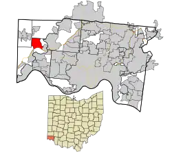 Location in Hamilton County and the state of Ohio. | |
| Coordinates: 39°13′37″N 84°44′13″W | |
| Country | United States |
| State | Ohio |
| County | Hamilton |
| Area | |
| • Total | 4.41 sq mi (11.42 km2) |
| • Land | 4.37 sq mi (11.33 km2) |
| • Water | 0.04 sq mi (0.09 km2) |
| Elevation | 782 ft (238 m) |
| Population (2020) | |
| • Total | 1,427[3] |
| • Density | 326.25/sq mi (125.95/km2) |
| Time zone | UTC-5 (Eastern (EST)) |
| • Summer (DST) | UTC-4 (EDT) |
| FIPS code | 39-07377[4] |
| GNIS feature ID | 1064459[2] |
Geography
Blue Jay is located at 39°13′37″N 84°44′13″W,[5] along Harrison Pike, 18 miles (29 km) northwest of Cincinnati. An interchange between Interstate 74 and Interstate 275 is south of the center of the CDP. Harrison, Ohio is located just west of Blue Jay.
According to the United States Census Bureau, the CDP has a total area of 4.4 square miles (11.4 km2), of which 4.4 square miles (11.3 km2) is land and 0.04 square miles (0.1 km2), or 0.79%, is water.[6]
References
- "ArcGIS REST Services Directory". United States Census Bureau. Retrieved September 20, 2022.
- "US Board on Geographic Names". United States Geological Survey. October 25, 2007. Retrieved January 31, 2008.
- "Census of Population and Housing". Census.gov. Retrieved June 4, 2016.
- "U.S. Census website". United States Census Bureau. Retrieved January 31, 2008.
- "US Gazetteer files: 2010, 2000, and 1990". United States Census Bureau. February 12, 2011. Retrieved April 23, 2011.
- "Geographic Identifiers: 2010 Demographic Profile Data (G001): Blue Jay CDP, Ohio". U.S. Census Bureau, American Factfinder. Archived from the original on February 12, 2020. Retrieved November 13, 2012.
Municipalities and communities of Hamilton County, Ohio, United States | ||
|---|---|---|
| Cities |  Map of Ohio highlighting Hamilton County | |
| Villages | ||
| Townships | ||
| CDPs |
| |
| Other communities | ||
| Footnotes | ‡This populated place also has portions in an adjacent county or counties | |
This article is issued from Wikipedia. The text is licensed under Creative Commons - Attribution - Sharealike. Additional terms may apply for the media files.