Booragoon, Western Australia
Booragoon is a southern suburb of Perth, Western Australia, located within the City of Melville.
| Booragoon Perth, Western Australia | |||||||||||||||
|---|---|---|---|---|---|---|---|---|---|---|---|---|---|---|---|
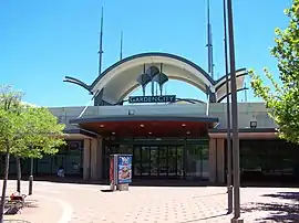 Garden City, Booragoon | |||||||||||||||
| Coordinates | 32°02′22″S 115°50′01″E | ||||||||||||||
| Population | 5,684 (SAL 2021)[1] | ||||||||||||||
| Established | 1950s | ||||||||||||||
| Postcode(s) | 6154 | ||||||||||||||
| Location | 12 km (7 mi) from the Perth CBD | ||||||||||||||
| LGA(s) | City of Melville | ||||||||||||||
| State electorate(s) | Alfred Cove, Bateman | ||||||||||||||
| Federal division(s) | Tangney | ||||||||||||||
| |||||||||||||||
Booragoon is the indigenous name for the lower reaches of the Canning River.[2]
It is home to Westfield Booragoon (formerly the Garden City Shopping Centre) and the council offices for the City of Melville. Transport is provided by the nearby Booragoon bus station.
Mount Pleasant Baptist Church is in Booragoon.
References
- Australian Bureau of Statistics (28 June 2022). "Booragoon (Suburb and Locality)". Australian Census 2021 QuickStats. Retrieved 28 June 2022.
- "Perth suburb names". Landgate. 25 January 2017. Retrieved 20 May 2017.
This article is issued from Wikipedia. The text is licensed under Creative Commons - Attribution - Sharealike. Additional terms may apply for the media files.