Boston, Revere Beach and Lynn Railroad
The Boston, Revere Beach and Lynn Railroad was a 3 ft (914 mm) narrow-gauge passenger-carrying shortline railroad between East Boston and Lynn, Massachusetts, from 1875 to 1940. Part of the railroad's right of way now forms the outer section of the Massachusetts Bay Transportation Authority's Blue Line rapid transit service.
 | |
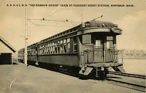 A BRB&L train at Pleasant Street station | |
| Overview | |
|---|---|
| Locale | North Shore, Massachusetts |
| Dates of operation | 1875–1940 |
| Technical | |
| Track gauge | 3 ft (914 mm) |
Boston, Revere Beach and Lynn Railroad | ||||||||||||||||||||||||||||||||||||||||||||||||||||||||||||||||||||||||||||||||||||||||||||||||||||||||||||||||||||||||||||||||||||||||||||||||||||||||||||||||||||||||||||||||||||||||||||||||||||||||||||||||||||||||||||||||||||||||||||||||||||||||||||||||||||||||||||||||||
|---|---|---|---|---|---|---|---|---|---|---|---|---|---|---|---|---|---|---|---|---|---|---|---|---|---|---|---|---|---|---|---|---|---|---|---|---|---|---|---|---|---|---|---|---|---|---|---|---|---|---|---|---|---|---|---|---|---|---|---|---|---|---|---|---|---|---|---|---|---|---|---|---|---|---|---|---|---|---|---|---|---|---|---|---|---|---|---|---|---|---|---|---|---|---|---|---|---|---|---|---|---|---|---|---|---|---|---|---|---|---|---|---|---|---|---|---|---|---|---|---|---|---|---|---|---|---|---|---|---|---|---|---|---|---|---|---|---|---|---|---|---|---|---|---|---|---|---|---|---|---|---|---|---|---|---|---|---|---|---|---|---|---|---|---|---|---|---|---|---|---|---|---|---|---|---|---|---|---|---|---|---|---|---|---|---|---|---|---|---|---|---|---|---|---|---|---|---|---|---|---|---|---|---|---|---|---|---|---|---|---|---|---|---|---|---|---|---|---|---|---|---|---|---|---|---|---|---|---|---|---|---|---|---|---|---|---|---|---|---|---|---|---|---|---|---|---|---|---|---|---|---|---|---|---|---|---|---|---|---|---|---|---|---|---|---|---|---|---|---|---|---|---|---|---|
| ||||||||||||||||||||||||||||||||||||||||||||||||||||||||||||||||||||||||||||||||||||||||||||||||||||||||||||||||||||||||||||||||||||||||||||||||||||||||||||||||||||||||||||||||||||||||||||||||||||||||||||||||||||||||||||||||||||||||||||||||||||||||||||||||||||||||||||||||||
History

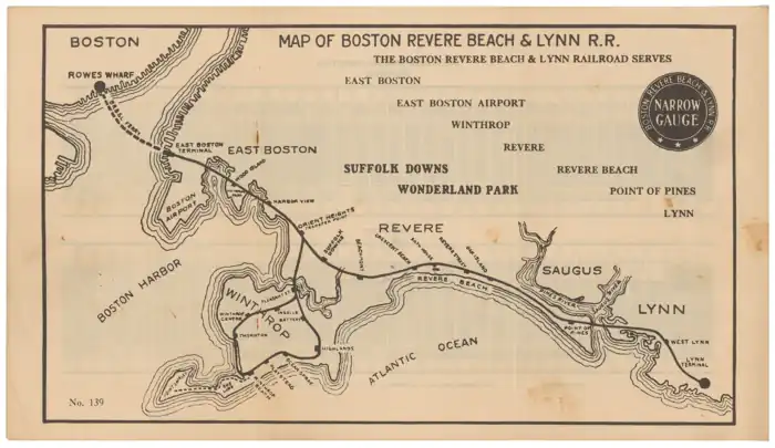
The railroad was chartered May 23, 1874, and opened July 29, 1875.[1]: 114 A ferry connection from its southern terminus at East Boston connected to Rowes Wharf in the city of Boston proper, with a connection to the Atlantic Avenue Elevated (from 1901 to 1938). The railroad followed the coastline north-eastward through the resort of Revere Beach to the far terminus at Lynn. A branch split at Orient Heights to a loop through Winthrop.
The rail laid was light, 30-pound per yard (15 kg/m) rail being installed at first, increased to 50 lb/yd (25 kg/m) in 1885 and 60 lb/yd (30 kg/m) in 1904. It was, however, laid from the beginning on standard gauge-sized ties. Given the lightweight rail, the locomotives were small and of 3 ft (914 mm) narrow gauge dimensions. The vast majority of them were Mason Bogies, 11 from the Mason Machine Works and a further 21 from other builders after Mason closed. Cars were of 3 ft (914 mm) narrow gauge dimensions, seating four across.
Between 1896 and 1900, the section from Revere Beach to Point of Pines, formerly running along the beach, was relocated inland to lie next to the Eastern Railroad's abandoned Chelsea Beach Branch.[2] The stations were moved and a new one (Bath House) was built. Revere Beach Boulevard was built later along the former route.
Revere Beach became a very popular resort, and the entire line was double-tracked by 1903. The Narrow Gauge Hotel burned in 1902. The 1904 Independence Day celebration included a staged collision between two obsolete Boston and Maine locomotives, and the rowdy crowds caused the town to cancel the Pines Hotel liquor license. 1906 festivities included a large papier-mâché structure which would spew a cloud of souvenir post cards with smoke and flashing lights as the Eruption of Mount Vesuvius. Commodore Perry's flagship USS Saratoga was burned offshore as a tourist attraction in 1908. Theodore Roosevelt spoke from the Pines Hotel during his 1912 presidential campaign as a Bull Moose candidate. The Pines Hotel closed in 1913 after a police raid discovered unlicensed liquor sales. The Boston American flying exhibition of July 1914 attracted large crowds.[1]: 116 Six passenger cars were purchased by the East Broad Top Railroad in 1916; three were sold again in 1942, while three remain in use.[3]
The railroad was highly successful, carrying commuters into Boston and the Boston urban population to the seaside resorts. By 1914 over seven million passengers were carried annually, making it one of the most heavily traveled stretches of railroad in North America. With such a traffic density, the expense of electrification could be easily recouped. By 1928, all existing cars were fitted with electric motors, trolley poles, and control stands and the steam locomotives were disposed of. However, the number of riders decreased during the Great Depression and completion of the Sumner Tunnel between East Boston and downtown Boston in 1934 allowed automobiles to compete with the ferries.[1]: 117
After attempts to find a buyer fell through, the BRB&L filed for bankruptcy in 1937. A September 1938 hurricane destroyed 500 ft (150 m) of overhead wire and damaged the East Boston terminal. Further losses of ridership followed, and in 1939 the management petitioned for abandonment. After a railfan excursion train on 15 October the abandonment petition was granted, and the railroad ceased operations on January 27, 1940.[1]: 117
Winthrop sections
On July 1, 1891, the BRB&L merged with the 3 ft (914 mm) narrow gauge Boston, Winthrop and Shore Railroad. The BW&S was itself a consolidation on December 12, 1883 of the Boston, Winthrop and Point Shirley Railroad and Eastern Junction, Broad Sound Pier and Point Shirley Railroad.
Boston, Winthrop and Point Shirley Railroad
The BW&PS was organized on July 3, 1876 and opened a 3 ft (914 mm) narrow gauge line on June 7, 1877. This line split from the BRB&L at Winthrop Junction and headed east and south for 1.8 miles (2.9 km) to Winthrop Center and extended in stages during the following years. In 1881, the part heading south was closed and a new line was built east to Ocean Spray and south to Short Beach.[4]: 32–39
Eastern Junction, Broad Sound Pier and Point Shirley Railroad
The EJBSP&PS was chartered in 1880 and built a standard gauge railway line from the Eastern Railroad near Crescent Beach southeast via Beachmont and Winthrop Beach to Point Shirley. South of Ocean Spray, this was just east of the BW&PS. Much of this shared section of right-of-way used a three-rail, dual-gauge track.[4]: 102 A branch of the EJBSP&PS was also constructed in Revere, from the junction with the Eastern Railroad north to Point of Pines, parallel with the Eastern's Chelsea Beach line. The EJBSP&PS was not operated until 1884, by which time it had been absorbed into the Boston, Winthrop & Shore RR. It operated for only two summers before being abandoned due to damage from storms.
Post-merger
The BW&PS and the EJBSP&PS, along with the Boston & Winthrop (a "paper railroad" proposed but never built) were merged late in 1883 and operated thereafter as the Boston, Winthrop & Shore RR. In 1885, after a storm, sections of line were abandoned, and the management of the BRB&L stepped in. A circuit or loop line was constructed in 1888 and existed until the 1940 demise of the BRB&L. It used parts of the original alignment of the BW&PS. Most of the line, however, was built brand new, serving Winthrop Highlands, Winthrop Center and Winthrop Beach. The loop was double-tracked in 1903.
Point Shirley Street Railway
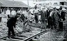
The Point Shirley Street Railway was built from Winthrop Beach station to Point Shirley beginning in August 1910 and opened later that year.[5] The 1.2-mile (1.9 km) single-track line ran along Shirley Street and Tafts Avenue.[6][7] The BRB&L acquired the entire line with legislative approval in October 1912.[8] By 1914, the line operated 30,594 car miles (an average of 35 daily round trips), carried 165,037 passengers (an average of 452 daily), and employed seven people.[7]
Unusually, the Point Shirley Street Railway did not operate with electric power from overhead lines.[5] It first used a gasoline-powered electric streetcar, then a battery-powered streetcar owned by the BRB&L, but these did not prove adequate for reliable service and by early 1919 buses were used instead. This prompted a public outcry with demands for conventional overhead-powered cars; instead, the BRB&L introduced two lighter battery-powered streetcars with better performance to the line in May 1919.[8]
Even the 1919-built cars proved to be too expensive to operate on a marginal low-traffic line. In 1928, they were permanently replaced by buses.[5]
After closure

Worth $2 million immediately after electrification, the railroad was sold to a scrap dealer for $118,756. The tracks were removed and the catenary structures cut down for scrap value. The passenger cars failed to be sold at auction and were burnt in mid-1940 to retrieve their metal components. The motorized trucks were sold to the Eastern Mass.[9] Most former stations were demolished shortly after abandonment or during rapid transit conversion. Thornton, moved and converted to a house when the line was double-tracked in 1903, is reportedly still extant.[4]: 182 In addition, Harbor View, closed earlier than the rest of the line and moved slightly from its original location, remains as a private residence.[10]
Bus service
Upon abandonment of the BRB&L, Lynn–Boston passengers were served by existing Eastern Massachusetts Street Railway (Eastern Mass) bus service and Boston and Maine Railroad rail service. Revere–Boston passengers were served by Boston Elevated Railway (BERy) streetcars connecting to the East Boston Tunnel; the company also operated a Revere Beach–Point of Pines bus service for two months.[11]: 61 Winthrop–Boston bus service was operated by Saugus Transit (later Rapid Transit Inc.). Saugus Transit initially operated Winthrop–Lynn bus service under a temporary permit. On April 2, 1940, this service was split in two with a forced transfer at Point of Pines: Revere-based Service Bus Lines continued to operate Winthrop–Point of Pines, while the Lynn-based Eastern Mass operated Lynn–Point of Pines as part of a new Lynn–Boston route.[11]: 79, 104 [12]
In January 1941, the Eastern Mass bought the Lynn terminal and a section of right of way for use as a busway.[1]: 118 After the Eastern Mass relocated its bus terminal to Central Square, the company no longer needed the land and it was fragmented into commercial properties.[13][14]
Blue Line
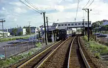
In 1941, the BERy bought the BRB&L right of way from Day Square to Revere Beach for use as a high-speed trolley line similar to the Ashmont-Mattapan High Speed Line; these plans were delayed by the onset of World War II.[10] However, the 1926 Report on Improved Transportation Facilities and 1945–47 Coolidge Commission Report recommended that the East Boston Tunnel line, which had been converted to rapid transit from streetcars in 1924, be extended to Lynn via the BBRB&L route rather than using it for a trolley line.[15][16]
In 1947, the newly formed Metropolitan Transit Authority (M.T.A.) decided to build to Lynn as a rapid transit line, and construction began in October 1948.[10] The first part of the Revere Extension opened to Orient Heights on January 5, 1952, with intermediate stations at Airport and Day Square, and to Suffolk Downs on April 21, 1952.[14] The second phase (cut short due to limited funds, and possibly due to the Eastern Massachusetts wielding its influence to protect its business in Lynn) opened to Wonderland on January 19, 1954 with intermediate stations at Beachmont and Revere Beach.[10][14][1]: 118 All stations from Orient Heights to Wonderland were located at the sites of former BRB&L stations. The line was renamed as the Blue Line in 1965.[14]
Although recommended and studied several times since, further Blue Line extension to Lynn has not moved past the proposal stage. The former right of way from Revere Street to Point of Pines is owned by the Massachusetts Electric Company, a National Grid subsidiary, and used as a utility corridor. Most of its length is covered in brush or wetlands, although several residential buildings and parking areas incur on the utility-owned right of way in Point of Pines.[13][17] The Alternatives Analysis / Draft Environmental Impact Statement, released in 2011, considered two potential routes: one following the Narrow Gauge right of way through Point of Pines, and one sharing the Newburyport/Rockport Line right of way.[18]
Winthrop
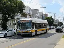
The Winthrop Loop was not preserved for transit use; some stations were destroyed within weeks. Much of the right of way is owned by the town, including the sections used for Veterans Road and Walden Street as well as a baseball field near Fort Banks and the embankment through Crystal Cove. Other sections were reused for housing and commercial developments; a short section near Argyle Street is a walking trail.[13] During the 1990s, a short section of track was installed as a memorial to the line in Winthrop Center, and portions of the Crystal Cove embankment are still extant.
Unlike the main line, the Winthrop Loop was not paralleled by mainline railroads or Boston Elevated Railway (BERy) streetcar lines. The town of Winthrop rejected plans for BERy to provide bus service.[19] Instead, Saugus Transit began operating Winthrop Beach - Maverick bus service as soon as the BRB&L was abandoned; it was granted a permanent operating certificate under the name Rapid Transit Inc in March.[9]: 117 [11]: 90 The two routes split at Winthrop Beach and roughly paralleled the two halves of the Loop; a connecting service also operated through to Point Shirley.[11]: 90
Veterans Road was paved on the former right-of-way after World War II. The inbound terminus was changed to 1952-opened Orient Heights in May 1956.[11]: 92 The MBTA, formed in 1964 to subsidize suburban commuter rail operations, began funding bus services including the Winthop service in 1968.[14]
In July 1991, Winthrop bus operations were transferred to Paul Revere Transportation. In September 1999, the two halves of the loop service were designated as 712 Winthrop - Orient Heights via Highlands and 713 Winthrop - Orient Heights via Center and added to MBTA maps and signage.[14] Outbound route 712 trips are through-routed to inbound route 713 trips and vice versa; some service continues to operate to Point Shirley.
Other sections
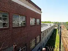
The Orient Heights carhouse was repurposed as a casket factory.[9] It was destroyed by a fire on March 15, 2019.[20] The right of way from Byron Street to Tomahawk Drive was acquired by the Massachusetts Port Authority for the expansion of Logan Airport. The right of way through Jeffries Point is privately owned; the tunnels are intact, though their north ends are buried.[9][21] Part of the right-of-way between Logan Airport and the Blue Line section was used for a U.S. Navy oil pipeline in the 1950s.[10]: 90
General Electric acquired most of the right of way through Lynn for expansion of the River Works plant during World War II, likely as settlement for debt still owed on the electrification project.[22] GE later sold off its sections: one piece to a private developer in 1989, the piece near Commercial Street to the MBTA in 1991 (part of which was later sold to the same developer), and the western section to a different developer in 2014.[23][24] New England Power Company (also a National Grid subsidiary) maintains an easement through the western section for electrical transmission lines.[25]
Station listing
Winthrop Loop

This is going clockwise around the loop. The loop tracks split from the main line just north of Orient Heights, turned east and then split with one direction heading east and the other south. Much of the rail's path was converted to roads when the line was removed, but you can still see some of the existing railbed that curved out into Crystal Cove at Winthrop Beach Station, and the remnants of the rail bridges as it crossed Belle Isle March to connect at Orient Heights. Today, one can drive along Veteran's Road (current path of the old line) to experience the course of the commuter train as it ran parallel to Shirley Street. The location of the various railway stations in Winthrop had a tremendous influence on the pattern of Winthrop's suburban growth; business and commerce grew up naturally around these stations and ultimately into what would become today's neighborhoods.
| Station | Notes |
|---|---|
| Pleasant Street | This station was located at the very north end of Pleasant Street as it meets Belle Isle Terrace, on the site of what is now part of a boat storage yard. |
| Battery | Station, originally Cherry St. Station, was located at the intersection of Banks Street and Wilshire Street, on the site of what is now a gravel parking lot for a warehouse. |
| Highlands | Station was located at the current location of Crest Avenue Playground; the depot was approximately where the jungle gym is today. |
| Ocean Spray | Was located on the corner of Shirley St. and what is today Veteran's Road, approximately on the site of the used car dealership. |
| Playstead | Station existed off of Shirley street across from its intersection with Pearl St. |
| Winthrop Beach | Station existed at the corner of Shirley and what is now Washington St., approximately where DiParma's restaurant currently is. |
| Thornton | Station existed at the very southern end of Winthrop Street on the beach side of Pleasant, all the way down the hill, just past and to the right of the road. If you walk down into the brush there, you can see remnants of the rail bed next to the waters edge, heading towards Crystal Cove. |
| Winthrop Centre | Station was approximately where the Winthrop Center circle is today. A 12-foot portion of the old track was installed as a memorial in the 1990s and can be seen embedded in the asphalt of Hagman Road (which follows the track line today). In addition, one of the steel electric power supports remains as well; it can be located protruding from the sidewalk at the corner near the track remnant. An historical marker mounted next to the steel support provides some information about Winthrop's train history, as does a sign in the nearby park. |
| Ingalls | This station was located on the south corner of Walden street at Short Street. The line at this point ran alongside Walden Street on the west side of the road. |
Equipment
Steam locomotives
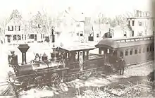
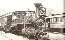
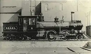
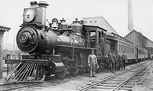
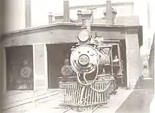
| Number | Name | Builder | Type | Date | Works number | Notes[1]: 111–112 |
|---|---|---|---|---|---|---|
| 1st # 1 | Orion | Mason Machine Works | 0-4-4T | 1873 | 508 | Built as North and South of Georgia - Sold to Nantucket Railroad #1 Sconset 1888 |
| 2nd # 1 | Hinkley Locomotive Works | 4-4-0 | 1879 | Sold to Nantucket Railroad #1 1901 | ||
| 3rd # 1 | ALCO Manchester | 2-4-4T | 1903 | 27801 | Scrapped 1929 | |
| 1st # 2 | Pegasus | Mason Machine Works | 0-4-6T | 1875 | 549 | Burned at Winthrop Junction (Orient Heights) and scrapped 1896 |
| 2nd # 2 | Manchester Locomotive Works | 2-4-4T | 1899 | 1707 | Scrapped 1929 | |
| 1st # 3 | Jupiter | Mason Machine Works | 0-4-4T | 1875 | 550 | Leased to the Boston, Winthrop & Point Shirley Railroad in 1883, burned at Winthrop Junction (Orient Heights) and scrapped 1896 |
| 2nd # 3 | Manchester Locomotive Works | 2-4-4T | 1899 | 1708 | Scrapped 1929 | |
| 1st # 4 | Mercury | Porter Bell & Company | 2-4-0 | 1876 | Leased to the Boston, Winthrop & Shirley Railroad in 1878, burned at Winthrop Junction (Orient Heights) and scrapped 1896 | |
| 2nd # 4 | Mason Machine Works | 2-4-6T | 1882 | 683 | Burned at Winthrop Junction (Orient Heights) 1896 and scrapped 1904 | |
| 3rd # 4 | ALCO Manchester | 2-4-4T | 1904 | 30125 | Scrapped 1929 | |
| 1st # 5 | Leo | Hinkley Locomotive Works | 4-4-0 | 1876 | 1240 | Sold to Brown Company of Florida |
| 2nd # 5 | Mason Machine Works | 2-4-4T | 1885 | 720 | Rebuilt 1917 - Scrapped 1929 | |
| 1st # 6 | Draco | Mason Machine Works | 0-4-4T | 1876 | 559 | Scrapped 1885 |
| 2nd # 6 | Mason Machine Works | 2-4-4T | 1886 | 727 | Rebuilt in ALCO Manchester shops 1920 - scrapped 1929 | |
| 7 | Mason Machine Works | 2-4-6T | 1882 | 684 | Rebuilt in ALCO Manchester shops 1920 - scrapped 1929 | |
| 1st # 8 | Mason Machine Works | 2-4-4T | 1883 | 692 | Scrapped 1900 | |
| 2nd # 8 | Manchester Locomotive Works | 2-4-4T | 1900 | 1741 | Scrapped 1929 | |
| 9 | Mason Machine Works | 2-4-4T | 1887 | 740 | Scrapped 1929 | |
| 10 | Mason Machine Works | 2-4-4T | 1887 | 741 | Scrapped 1929 | |
| 11 | Taunton Locomotive Manufacturing Company | 2-4-4T | 1890 | 981 | Rebuilt 1917 - Scrapped 1929 | |
| 12 | Taunton Locomotive Manufacturing Company | 2-4-4T | 1890 | 982 | Rebuilt in ALCO Manchester shops 1920 - scrapped 1929 | |
| 13 | Manchester Locomotive Works | 2-4-4T | 1900 | 1742 | Scrapped 1929 | |
| 14 | ALCO Manchester | 2-4-4T | 1902 | 25872 | Scrapped 1940 | |
| 15 | ALCO Manchester | 2-4-4T | 1903 | 27802 | Scrapped 1929 | |
| 16 | ALCO Manchester | 2-4-4T | 1905 | Scrapped 1929 | ||
| 17 | ALCO Manchester | 2-4-4T | 1906 | 39054 | Scrapped 1929 | |
| 18 | ALCO Manchester | 2-4-4T | 1907 | 42268 | Ran through the East Boston bumper block into Boston Harbor and scrapped 1928 | |
| 19 | ALCO Manchester | 2-4-4T | 1907 | 42741 | Rebuilt 1917 - Scrapped 1929 | |
| 20 | ALCO Manchester | 2-4-4T | 1907 | 42742 | Scrapped 1929 | |
| 21 | ALCO Manchester | 2-4-4T | 1907 | 42743 | Scrapped 1929 | |
| 22 | ALCO Manchester | 2-4-4T | 1912 | 50830 | Scrapped 1929 | |
| 23 | ALCO Manchester | 2-4-4T | 1912 | 50831 | Scrapped 1929 | |
| 24 | ALCO Schenectady | 2-4-4T | 1914 | 54590 | Scrapped 1929 | |
| 25 | ALCO Schenectady | 2-4-4T | 1914 | 54591 | Scrapped 1929 | |
| 26 | ALCO Schenectady | 2-4-4T | 1914 | 54592 | Scrapped 1929 |
Ferryboats

| Name | Date | Origin | Disposal[1]: 113 |
|---|---|---|---|
| Union | 1875 | purchased from New Bedford-Taunton Railroad | Scrapped 1889 |
| Oriole | 1876 | purchased from Providence, Warren & Fall River Railroad | Sold to Washington Railroad of Lunder, North Carolina 1878 |
| City of Lynn | 1878 | Built by Bath Iron Works | Converted to a sand barge in 1918 |
| Swampscott | 1882 | Built by D. D. Kelly & Son of Boston | Sold for Portland to Peaks Island ferry service in Casco Bay 1908 |
| Dartmouth | 1889 | Built in East Boston | Retired 1939 |
| Ashburnham | 1905 | Built in Boston | Sold 1940 |
| Brewster | 1906 | Built in Boston | Sold 1940 |
| Newtown | 1908 | Built in Boston | Towed to Portland, Maine in 1940 |
Notes
- Stanley, Robert C. (1980). Narrow Gauge - The Story of the Boston, Revere Beach & Lynn Railroad. Boston Street Railway Association.
- Walker Lithograph & Publishing Co. (1891). "Boston & Hull & Nahant & Revere & Swampscott & Winthrop 1891 Plate 05". WardMaps LLC. Retrieved 1 July 2012.
- Greenwood, Richard E. (November 5, 1974). "Inventory – Nomination Form: East Broad Top Railroad". National Register of Historic Places. National Park Service. pp. 7.3, 7.4.
- Lieberman, William (2017). The Train on the Beach. ISBN 9781634921831.
- Desaulniers, George; Simonini, Donald (2002). Images of America: Winthrop. Arcadia Publishing. pp. 41–45. ISBN 9780738509525.
- Whitman & Howard (1913). "Map of Winthrop" – via WardMaps.
- Public Service Commission (1915). Second Annual Report of the Public Service Commission. Vol. 2. Wright and Potter Printing Company. pp. 871–875 – via Google Books.
- Public Service Commission (1920). Annual Report of the Public Service Commission. Vol. 1. Wright and Potter Printing Company. p. 129 – via Google Books.
- Kyper, Frank (2010). Narrow Gauge to Boston: A Nostalgic Window on the Boston, Revere Beach & Lynn Railroad. South Platte Press, Bruggeggenjohann/Reese, and Outer Station Project. p. 99. ISBN 9780942035872.
- Cheney, Frank (2003). Boston's Blue Line. Arcadia Publishing. pp. 8, 64, 83. ISBN 9780738535760.
- Humphrey, Thomas J. (August 2020). "Origin and Development of the Fixed-Route Local Bus Transportation Network in the Cities and Towns of the Massachusetts Bay Transportation Authority District as of December 31, 1973: Revised Edition" (PDF). NETransit.
- "Two Companies Take Over Lynn–Revere Bus Service". Boston Globe. April 2, 1940. p. 6 – via Newspapers.com.
- "OLIVER: MassGIS's Online Mapping Tool". Massachusetts Office of Geographic Information. Retrieved 8 May 2016.
- Belcher, Jonathan. "Changes to Transit Service in the MBTA district" (PDF). Boston Street Railway Association.
- Central Transportation Planning Staff (15 November 1993). "The Transportation Plan for the Boston Region - Volume 2". National Transportation Library. Archived from the original on 21 October 2008. Retrieved 3 July 2012.
- Boston Elevated Railway and Boston Department of Public Utilities (1945), Boston Rapid Transit System & Proposed Extensions 1945 - Metropolitan Transit Recess Commission Air View – via Wikimedia Commons
- Liscio, David (November 19, 2009). "Blue Line Trains Attach Sixth Car". Lynn Daily Item – via MBTA.
- "Blue Line Extension to Lynn: P3 Project Suitability Assessment Report" (PDF). Massachusetts Department of Transportation. 11 September 2013.
- Annual Report of the Board of Public Trustees of the Boston Elevated Railway Company for the Year Ended December 31, 1939. Boston Elevated Railway. 1940. p. 13 – via Internet Archive.
- McDonald, Danny; Serrano, Alejandro; Stanton, Andrew (March 15, 2019). "9-alarm fire at East Boston casket company continues to roar". Boston Globe.
- "Boston Tax Parcel Viewer". City of Boston. Retrieved 8 May 2016.
- Liljestrand, Robert A.; Sweetland, David R. (2002). Boston, Revere Beach & Lynn Railroad. Ansonia, Connecticut: Bob's Photo. p. 32. ISBN 0934088411. LCCN 2002117786.
- "Salem Deeds Online: Search". Southern Essex District Registry of Deeds. Retrieved 8 May 2016.
- "City of Lynn, Massachusetts: Property Assessment Data". Patriot Properties. Retrieved 8 May 2016.
- CAI Technologies (January 2015). "City of Lynn Assessor's Map: 17" (PDF). City of Lynn.
References
- Hilton, George W. (1990). American Narrow Gauge Railroads. Stanford, California: Stanford University Press. ISBN 0-8047-2369-9.
- Karr, Ronald Dale (1994). The Rail Lines of Southern New England: A Handbook of Railroad History. Branch Line Press. ISBN 0-942147-02-2.
External links
- Plan showing location of Boston, Revere Beach & Lynn Rail Road, May 1875
- "The Coffee Roasters" of New England, about the BRB&L