Bowman, Tennessee
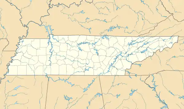
Bowman is a census-designated place and unincorporated community in Cumberland County, Tennessee, United States. It is located off U.S. Route 127 north of Crossville, south of Clarkrange, and west of the Catoosa Wildlife Management Area. Its population was 302 as of the 2010 census.[5]
Bowman, Tennessee | |
|---|---|
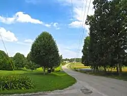 Bowman Loop Road in Bowman | |
 Bowman | |
| Coordinates: 36°03′40″N 85°01′42″W | |
| Country | United States |
| State | Tennessee |
| County | Cumberland |
| Area | |
| • Total | 2.29 sq mi (5.93 km2) |
| • Land | 2.29 sq mi (5.93 km2) |
| • Water | 0.00 sq mi (0.00 km2) |
| Elevation | 1,811 ft (552 m) |
| Population | |
| • Total | 297 |
| • Density | 129.81/sq mi (50.11/km2) |
| Time zone | UTC-6 (Central (CST)) |
| • Summer (DST) | UTC-5 (CDT) |
| ZIP code | 38571[4] |
| Area code | 931 |
| GNIS feature ID | 1646854[2] |
The community was named for Nathaniel Bowman, a pioneer settler.[6]
References
- "ArcGIS REST Services Directory". United States Census Bureau. Retrieved October 15, 2022.
- U.S. Geological Survey Geographic Names Information System: Bowman
- "Census Population API". United States Census Bureau. Retrieved October 15, 2022.
- "Bowman TN ZIP Code". zipdatamaps.com. 2023. Retrieved February 17, 2023.
- "U.S. Census website". United States Census Bureau. Retrieved May 14, 2011.
- Miller, Larry L. (2001). Tennessee Place-names. Indiana University Press. p. 27. ISBN 0-253-21478-5.
- "Census of Population and Housing". Census.gov. Retrieved June 4, 2016.
Municipalities and communities of Cumberland County, Tennessee, United States | ||
|---|---|---|
| Cities | ||
| Town | ||
| CDPs | ||
| Other communities | ||
This article is issued from Wikipedia. The text is licensed under Creative Commons - Attribution - Sharealike. Additional terms may apply for the media files.