Bridger–Teton National Forest
Bridger–Teton National Forest is located in western Wyoming, United States. The forest consists of 3.4 million acres (14,000 square kilometers), making it the third largest National Forest outside Alaska. The forest stretches from Yellowstone National Park, along the eastern boundary of Grand Teton National Park and from there rides along the western slope of the Continental Divide to the southern end of the Wind River Range. The forest also extends southward encompassing the Salt River Range and Wyoming Range mountains near the Idaho border.
| Bridger–Teton National Forest | |
|---|---|
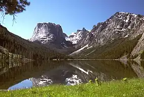 Green Lakes region of Bridger–Teton National Forest | |
 | |
| Location | Wyoming, United States |
| Nearest city | Jackson, Wyoming |
| Coordinates | 43°25′48″N 110°43′30″W |
| Area | 3,402,684 acres (13,770.17 km2)[1] |
| Established | July 1, 1908 |
| Governing body | U.S. Forest Service |
| Website | www |
Geography
Located within the forest are the Gros Ventre, Bridger and Teton Wildernesses, totaling 1.2 million acres (4,900 square kilometers). Other points of interest contained in the forest include Gannett Peak at 13,804 feet (4,207 m), the tallest mountain in Wyoming, and the Gros Ventre landslide, which is one of the largest readily visible landslides on earth. All of the forest is in turn a part of the 20-million-acre (81,000-square-kilometer) Greater Yellowstone Ecosystem.
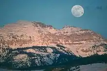
While Gannett Peak is the highest summit in the forest, another 40 named mountains rise above 12,000 ft (3,660 m). The high altitudes and abundant snowfall, exceeding 600 inches (15 m) at some locations, provides a constant supply of water for streams and rivers. 1,500 lakes also help provide water for the Yellowstone, Snake and Green rivers, which all have their headwaters in the forest. Seven of the largest glaciers outside of Alaska are located within the forest boundaries.
U.S. Route 26 and U.S. Route 287 cross over the continental divide at Togwotee Pass and enter the forest from the north, and U.S. Highways 89 and 191 provide access to the forest in the vicinity of Jackson, Wyoming and forest lands to the south.
Ecology
The primary tree species include lodgepole pine, Engelmann spruce, Douglas fir, subalpine fir, aspen and whitebark pine. Willows, grasses and sagebrush are found on the lower altitudes, while above the timberline alpine meadows are common. Threatened and endangered species found within the forest boundaries include grizzly bear,[2] gray wolf, black-footed ferret and peregrine falcon. Most of the mammals that existed in the region prior to European settlement can still be found here. Elk, moose, mule deer, bighorn sheep, bison, coyote, marmot, pronghorn, and cougar are but a few of the 75 species of mammals known to exist in the forest. Four subspecies of cutthroat trout also are found here including the Snake River cutthroat trout. 355 species of birds have been sighted including bald eagles, trumpeter swans, sandhill cranes, hawks, and Clark's nutcrackers.
Recreation
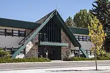
Over 2,000 mi (3,200 km) of hiking trails are located in the forest providing access into wilderness areas and interlinking with trails in Yellowstone National Park. There are several dozen vehicle accessible campgrounds that have picnic tables and tent sites as well as room in some circumstances for recreational vehicles. Nighttime temperatures can be below freezing any time of the year and mosquitos in the late spring and early summer are common. Summertime high temperatures average at 70 to 79 °F (21 to 26 °C) and the wintertime lows can drop below −50 °F (−46 °C).
Administration
Bridger–Teton National Forest is an administrative combination of Bridger and Teton National Forests, amalgamated in 1973. The Bridger National Forest itself absorbed Wyoming National Forest in 1923. The Wyoming National Forest had been created as the Yellowstone Forest Reserve in 1904, then renamed in 1908.[3] The Teton Forest Reserve was created at the same time, destined to become Teton National Forest.
Ranger district offices are located in Pinedale, Kemmerer, Big Piney, Moran, Afton and Jackson. The forest headquarters is located in Jackson. In descending order of land area the forest is located in parts of Sublette, Teton, Lincoln, Park, and Fremont counties.
Hazards
Encountering bears is a concern in the Wind River Range.[4] There are other concerns as well, including bugs, wildfires, adverse snow conditions and nighttime cold temperatures.[5]
Importantly, there have been notable incidents, including accidental deaths, due to falls from steep cliffs (a misstep could be fatal in this class 4/5 terrain) and due to falling rocks, over the years, including 1993,[6] 2007 (involving an experienced NOLS leader),[7] 2015[8] and 2018.[9] Other incidents include a seriously injured backpacker being airlifted near SquareTop Mountain[10] in 2005,[11] and a fatal hiker incident (from an apparent accidental fall) in 2006 that involved state search and rescue.[12] The U.S. Forest Service does not offer updated aggregated records on the official number of fatalities in the Wind River Range.
Gallery
 Bridger–Teton National Forest Map
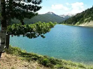
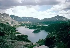 Cook Lake
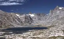
 Middle Piney Lake
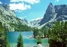
 Titcomb Lakes
 Slide Lake
See also
References
- "Land Areas of the National Forest System" (PDF). U.S. Forest Service. January 2012. Retrieved June 30, 2012.
- Koshmrl, Mike (June 9, 2023). "Grizzlies, environmentalists win toothless victory in court of appeals". Oil City News. Wyofile. Retrieved June 12, 2023.
- "Kemmerer Ranger District". Bridger–Teton National Forest. U.S. Forest Service. August 14, 2008.
- Staff (April 24, 2017). "Bear Safety in Wyoming's Wind River Country". WindRiver.org. Archived from the original on July 26, 2021. Retrieved May 31, 2022.
- Ballou, Dawn (July 27, 2005). "Wind River Range condition update - Fires, trails, bears, Continental Divide". PineDaleOnline News. Archived from the original on April 21, 2021. Retrieved May 31, 2022.
- Staff (1993). "Falling Rock, Loose Rock, Failure to Test Holds, Wyoming, Wind River Range, Seneca Lake". American Alpine Club. Archived from the original on July 26, 2021. Retrieved May 31, 2022.
- MacDonald, Dougald (August 14, 2007). "Trundled Rock Kills NOLS Leader". Climbing. Archived from the original on July 26, 2021. Retrieved May 31, 2022.
- Staff (December 9, 2015). "Officials rule Wind River Range climbing deaths accidental". Casper Star-Tribune. Archived from the original on July 26, 2021. Retrieved May 31, 2022.
- Dayton, Kelsey (August 24, 2018). "Deadly underestimation". WyoFile News. Archived from the original on July 26, 2021. Retrieved May 31, 2022.
- Funk, Jason (2009). "Squaretop Mountain Rock Climbing". Mountain Project. Archived from the original on July 26, 2021. Retrieved May 31, 2022.
- Staff (July 22, 2005). "Injured man rescued from Square Top Mtn - Tip-Top Search & Rescue helps 2 injured on the mountain". PineDaleOnline News. Archived from the original on July 26, 2021. Retrieved May 31, 2022.
- Staff (September 1, 2006). "Incident Reports - September, 2006 - Wind River Search". WildernessDoc.com. Archived from the original on January 27, 2020. Retrieved May 31, 2022.