Brown Valley
Brown Valley is a rectangular ice-covered valley between Mount Kauffman and Mount Kosciusko in the northeast end of the Ames Range, Marie Byrd Land. It was mapped by the United States Geological Survey from surveys and from U.S. Navy air photos, 1959–65, and named by the Advisory Committee on Antarctic Names after Thomas I. Brown, United States Antarctic Research Program meteorologist at Byrd Station in 1963.
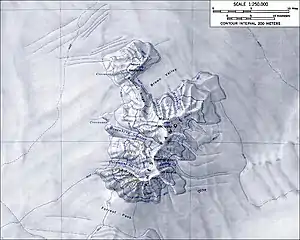
Topographic map of the Ames Range (1:250,000 scale) from USGS Mount Kosciusko
| Brown Valley | |
|---|---|
 Brown Valley Position in Antarctica | |
| Geography | |
| Location | Ames Range, Marie Byrd Land, Antarctica |
| Borders on | Mount Kauffman (northwest), Gardiner Ridge (west), Mount Kosciusko (south) |
| Coordinates | 75°38′S 132°12′W |
References
 This article incorporates public domain material from "Brown Valley". Geographic Names Information System. United States Geological Survey.
This article is issued from Wikipedia. The text is licensed under Creative Commons - Attribution - Sharealike. Additional terms may apply for the media files.