Burg, Dithmarschen
Burg is a municipality in the district of Dithmarschen, in Schleswig-Holstein, Germany. It lies at the rim of the Heide-Itzehoe Geest with parts of the village in the marshland below. It was named after a fortress "Bökelnburg" of which a 9th-century earth wall ring remains. According to legend Burg was the site of a farmer's revolt. They burned down the castle and killed the count who had asked for a "tenth" tribute despite it being a time of drought.
_-_Apotheke.jpg.webp) kgl. priv. Apotheke am Markt
kgl. priv. Apotheke am Markt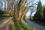 Auffahrt zur Bökelnburg
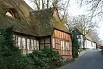 Krenzerstraße
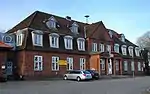 Bahnhof Burg
Burg, Dithmarschen | |
|---|---|
.png.webp) Flag  Coat of arms | |
Location of Burg, Dithmarschen within Dithmarschen district 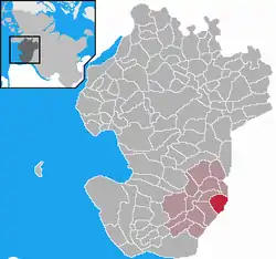 | |
 Burg, Dithmarschen 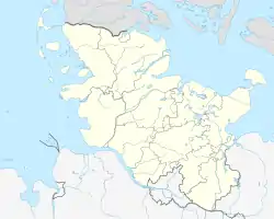 Burg, Dithmarschen | |
| Coordinates: 54°0′N 9°16′E | |
| Country | Germany |
| State | Schleswig-Holstein |
| District | Dithmarschen |
| Municipal assoc. | Burg-Sankt Michaelisdonn |
| Government | |
| • Mayor | Werner Hill |
| Area | |
| • Total | 11.23 km2 (4.34 sq mi) |
| Highest elevation | 65 m (213 ft) |
| Lowest elevation | 1 m (3 ft) |
| Population (2021-12-31)[1] | |
| • Total | 4,184 |
| • Density | 370/km2 (960/sq mi) |
| Time zone | UTC+01:00 (CET) |
| • Summer (DST) | UTC+02:00 (CEST) |
| Postal codes | 25712 |
| Dialling codes | 04825 |
| Vehicle registration | HEI |
| Website | www.burg-dithmarschen.de |
References
Wikimedia Commons has media related to Burg.
This article is issued from Wikipedia. The text is licensed under Creative Commons - Attribution - Sharealike. Additional terms may apply for the media files.