Burj Bhalaike
Burj Bhalaike, sometimes spelled Buraj Bhalaike, or Burj Bhalai (Gurmukhi: ਬੁਰਜ ਭਲਾਈਕੇ), is a village in the Sardulgarh tehsil of Mansa district in Punjab, India.[1]
Burj Bhalaike
Burj Bhalai | |
|---|---|
Village | |
 Burj Bhalaike Location in Punjab, India  Burj Bhalaike Burj Bhalaike (India) | |
| Coordinates: 29.842356°N 75.274630°E | |
| Country | |
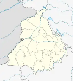
| State | Punjab |
| District | Mansa |
| Talukas | Sardulgarh |
| Area | |
| • Total | 6.32 km2 (2.44 sq mi) |
| Elevation | 214 m (702 ft) |
| Population (2019) | |
| • Total | 1,885 |
| • Density | 300/km2 (770/sq mi) |
| Languages | |
| • Official | Punjabi (Gurmukhi) |
| • Regional | Punjabi |
| Time zone | UTC+5:30 (IST) |
| PIN | 151505 |
| Telephone code | 01659-26***** |
| Vehicle registration | PB51 |
| Nearest city | Mansa |
Geography
Burj Bhalaike is located at 29.842356°N 75.274630°E[2] in the Mansa district of Indian Punjab. Mansa is the nearest railway station, lying 28 kilometres (17 mi) to its north, Sardulgarh (22 km) to the southwest, the city and district of Bathinda to the northwest and the city and district of Sangrur to the northeast.[2]
Education
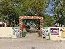
Government Primary School Burj Bhalaike Main Gate

Government High School Burj Bhalaike Main Gate
There is a Govt. Primary School and a Govt. High School in Burj Bhalaike.[3]
References
- "Village & Panchayats | District Mansa, Government of Punjab | India". Retrieved 12 September 2022.
- Google maps
- ":: ePunjab Schools ::". www.epunjabschool.gov.in. Retrieved 12 September 2022.
External links
Wikimedia Commons has media related to Burj Bhalaike.
This article is issued from Wikipedia. The text is licensed under Creative Commons - Attribution - Sharealike. Additional terms may apply for the media files.