Burns, Texas
Burns is an unincorporated community in Bowie County, in the U.S. state of Texas.[1] According to the Handbook of Texas, the community had a population of 400 in 2000. It is located within the Texarkana metropolitan area.
Burns, Texas | |
|---|---|
 Burns  Burns | |
| Coordinates: 33°31′5″N 94°17′21″W | |
| Country | United States |
| State | Texas |
| County | Bowie |
| Elevation | 331 ft (101 m) |
| Time zone | UTC-6 (Central (CST)) |
| • Summer (DST) | UTC-5 (CDT) |
| Area code(s) | 903 & 430 |
| GNIS feature ID | 1353352[1] |
History
Burns was most likely named for a family surnamed Burns and had a population of 400 in 2000.[2]
Geography
Burns is located along Farm to Market Road 560, 14 mi (23 km) northwest of Texarkana in northwestern Bowie County.[2][3]
Education
Burns had a school for black children at one point. Today, the community is served by the Hooks Independent School District.[2]
References
- U.S. Geological Survey Geographic Names Information System: Burns, Texas
- Jasinski, Laurie E.: Burns, TX from the Handbook of Texas Online (August 26, 2004). Retrieved July 6, 2023.
- Transportation Planning and Programming Division (2018). Texas County Mapbook (PDF) (Map) (2018 ed.). 1:72,224. Texas Department of Transportation. p. 467. Retrieved July 6, 2023.
Municipalities and communities of Bowie County, Texas, United States | ||
|---|---|---|
| Cities | 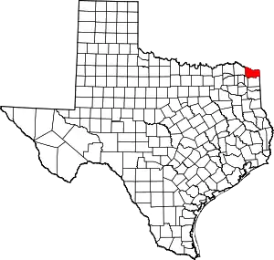 Bowie County map | |
| Unincorporated communities | ||
| Ghost towns | ||
| Footnotes | ‡This populated place also has portions in an adjacent county or counties | |
This article is issued from Wikipedia. The text is licensed under Creative Commons - Attribution - Sharealike. Additional terms may apply for the media files.