Buttermilk, Kansas
Buttermilk is an unincorporated community in Comanche County, Kansas, United States.[1]
Buttermilk, Kansas | |
|---|---|
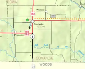 KDOT map of Comanche County (legend) | |
| Coordinates: 37°6′10″N 99°19′31″W[1] | |
| Country | United States |
| State | Kansas |
| County | Comanche |
| Elevation | 1,896 ft (578 m) |
| Time zone | UTC-6 (CST) |
| • Summer (DST) | UTC-5 (CDT) |
| Area code | 620 |
| FIPS code | 20-09750 |
| GNIS ID | 484539 [1] |

History
As of 2014, it consisted of a farmhouse and outbuildings, a church and three houses. It does not ordinarily appear on any road maps.
The nearby Big Gyp Cave Pictograph Site is on the National Register of Historic Places.
Education
The community is served by Comanche County USD 300 public school district.
References
Further reading
External links
Municipalities and communities of Comanche County, Kansas, United States | ||
|---|---|---|
| Cities | 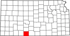 Map of Kansas highlighting Comanche County | |
| Unincorporated community | ||
| Townships | ||
This article is issued from Wikipedia. The text is licensed under Creative Commons - Attribution - Sharealike. Additional terms may apply for the media files.